Visiting the Lishan Scenic Area, including Farms and Tea Plantations
Text | Rick Charette
Photos | Chen Cheng-kuo
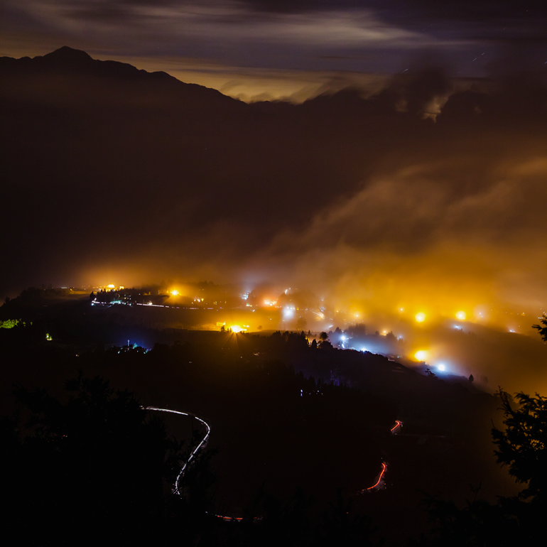
There are many locations in mountainous Taiwan where you can see clouds meander – or race – by at eye level, not above you. We here present you with the most precious delights, created by nature and man, in northeast Taichung’s high-peak Lishan region, a place where rivers are born.
Lishan’s lofty, romantic landscapes have led many to flights of word fancy, such as the bestowal of the moniker “little Switzerland.” After trekking through the words and photos that follow, you’ll maybe agree that “little Switzerland with big Taiwanese characteristics” is perhaps a characterization further along on the way to apt.
Though you’ll still see plenty of people unless you hit the mountain-to-mountain hiking trails, this place, in terms of Taiwan reality, is remote. In Taiwan there is little chance you’ll find yourself in a spot bereft of other humans if anywhere near road access, and all locals understand this area meets the most indisputably basic definition of “remote” – the nearest convenience-store chain outlets to the east are out-of-reach far down on the Yilan Plain and at the mouth of the fabulous Taroko Gorge, and hours to the west over Taiwan’s highest paved-road point near far-off Qingjing Farm.
Tell Taiwan folk you’re headed up to Lishan and a clear and consistent set of images flashes before their eyes: magnificent mountain panoramas, old veteran-settlement farms now transformed into recreational farms, slope-hugging pear, peach, and apple orchards, tea orchards perched equally dramatically, sleepy Atayal-tribe villages with cross-topped church steeples visible from great distances, and wonder-filled trail walks.
Day 1 — Wuling Farm
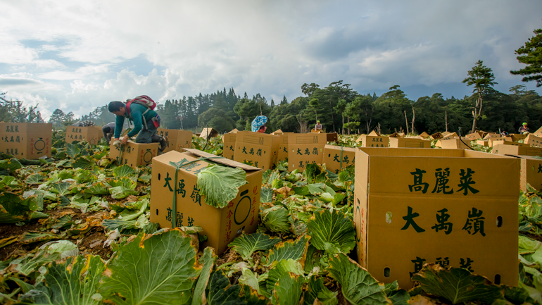
After a long yet leisurely drive up through the magisterially meandering Lanyang River valley, your Travel in Taiwan exploration crew reached the Siyuan Pass. From the lookout here you enjoy a fine eagle’s-eye field of vision back down through the serpentine valley, and notably over a couple of attractions that will prove a taste of things to come – quiet indigenous farming villages and field upon field of Chinese cabbage. Yes, you’ve entered Taiwan’s cabbage country. You’re also set to enter the Lishan Scenic Area, part of the Tri-Mountain National Scenic Area.
Over the top! The scenery – the pass is also the border point separating Yilan and Taichung – changes instantly. No more distant-view, wide-open valley sliding quickly down to the lowlands. You’re in alpine country now, surrounded by coniferous trees at the headwaters of the Dajia River, which flows west through the mountains, on to the plains, and into the Taiwan Strait. Here, the river is little more than marsh in a shallow, narrow upland vale, struggling to gather up a stream. Soon rushing, gurgling waters are flowing, and unlike most Taiwan waterways the liquid here is sparkling-clear and, despite the end-of-summer 30-degree temperature, ice-cold. Some of the area’s isolated cabbage farms appear, on the little flat land that is available. We’ll see many more in the days to come – sometimes what seems to be whole cabbage-planted mountainsides.
Ahead, the Dajia slices ever deeper into the rock of the valley, still no wider, like a jeweler’s knife on ultra-geo-slow, the highway moving up ever higher to hug the side. You meet the Wuling Farm entrance road, and down into the valley you run, to the bottom, where suddenly a wide side valley pops open at a T-intersection, carved by the symphonic crystal-clear Qijiawan River. This is the farm’s home, a true hidden-away Shangri-La setting.
Wuling Farm was settled by retired servicemen in 1963, with a focus on fruit-growing. These men had come from mainland China in the great late 1940s Nationalist exodus to Taiwan. The government set up this and other high-mountain veterans’ farms along the Central Cross-Island Highway, built 1956~1960 by many of these same servicemen, to help the decommissioned vets earn a living.
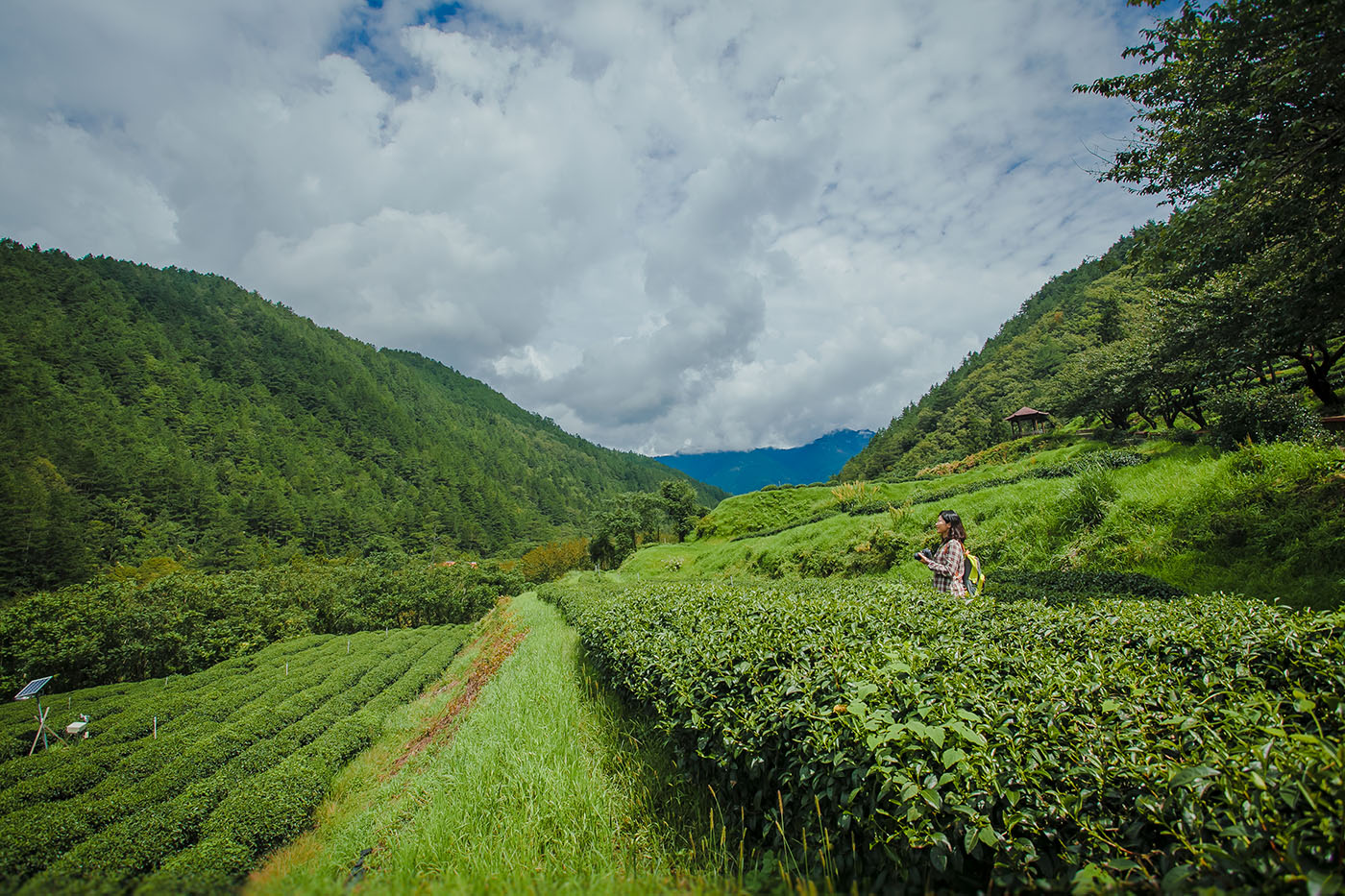
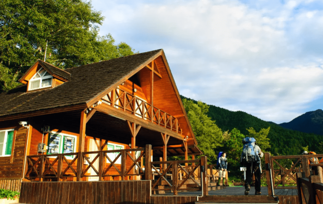
These days, only a few show orchards still exist, and most of the cultivation that still goes on is dedicated to tea. A single easy-grade road traverses the farm valley, with a side road leading up to the alpine-meadow campground and beyond up past tea orchards to the Mt. Xue Trailhead Service Station, starting point of the high-mountain hiking trail leading to the peaks of Mt. Xue (Snow Mountain), which is part of Shei-Pa National Park. The side road is a fine choice for a moderately strenuous walk (about 2 hours return).
There are numerous pleasant short walking trails branching off from the main road, and you can also rent bicycles beside the farm’s visitor center. Note that during the fabulous spring cherry-blossom season there can be comparatively heavy traffic into the recreational farm, though visitor numbers are controlled.
For my part, beyond the spirit-lifting panoramic scenery, the farm’s two highlights are the landlocked salmon and Taoshan Waterfall Hiking Trail. The critically endangered sub-species, one of the world’s rarest fish, was trapped in the Dajia River system’s upper reaches during the last Ice Age. Learn about preservation efforts at the Taiwan Salmon Eco Center, and view the fish au naturel at the roadside/riverside Fish-watching Lookout. The popular waterfall trail starts at the main road’s terminus, past Wuling Suspension Bridge, another good salmon-spotting platform. The paved, pine tree-shaded 4.3km forest walk, mildly strenuous, ends with a grand view of the 50m-high falls, cascading down like twisting white ribbons of silk. Give yourself 3 hours (return). If you return around dusk wildlife spottings may well be a bonus reward.
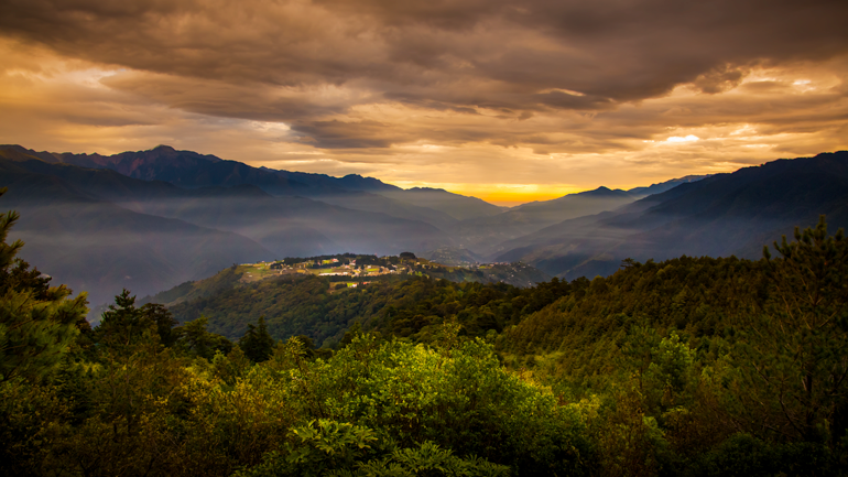
Day 2 — Huanshan, Lishan, Fushoushan
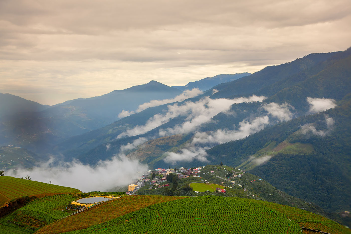
Back on the main highway, continuing southwest toward Lishan village, the Dajia River valley soon opens up dramatically, presenting long-distance views in three directions from your high-slope vantage points – back up the valley, down the valley, and across. Coming around a promontory corner, Huanshan indigenous village suddenly appears at your feet down below, laid out like a baby giant’s playset, the Dajia waters roiling below it.
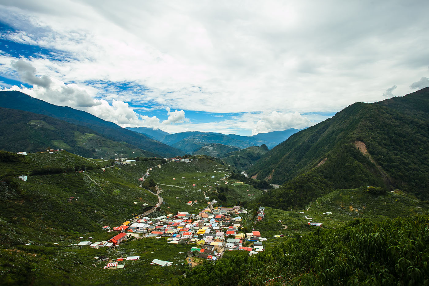
The Atayal, Taiwan’s third-largest tribal people, live in the north and north/central mountains. Three area tribal villages, Huanshan, Songmao, and Liyang, all on plateaus overlooking the river, form a special “towns in the mountains” area. In Huanshan, the largest of the three, the cultural center/historical antiques center has displays on Atayal culture, with early indigenous artifacts, decorations, traditional-design rooms, a henhouse, granary, etc. Instruction sessions on traditional Atayal weaving are also offered.
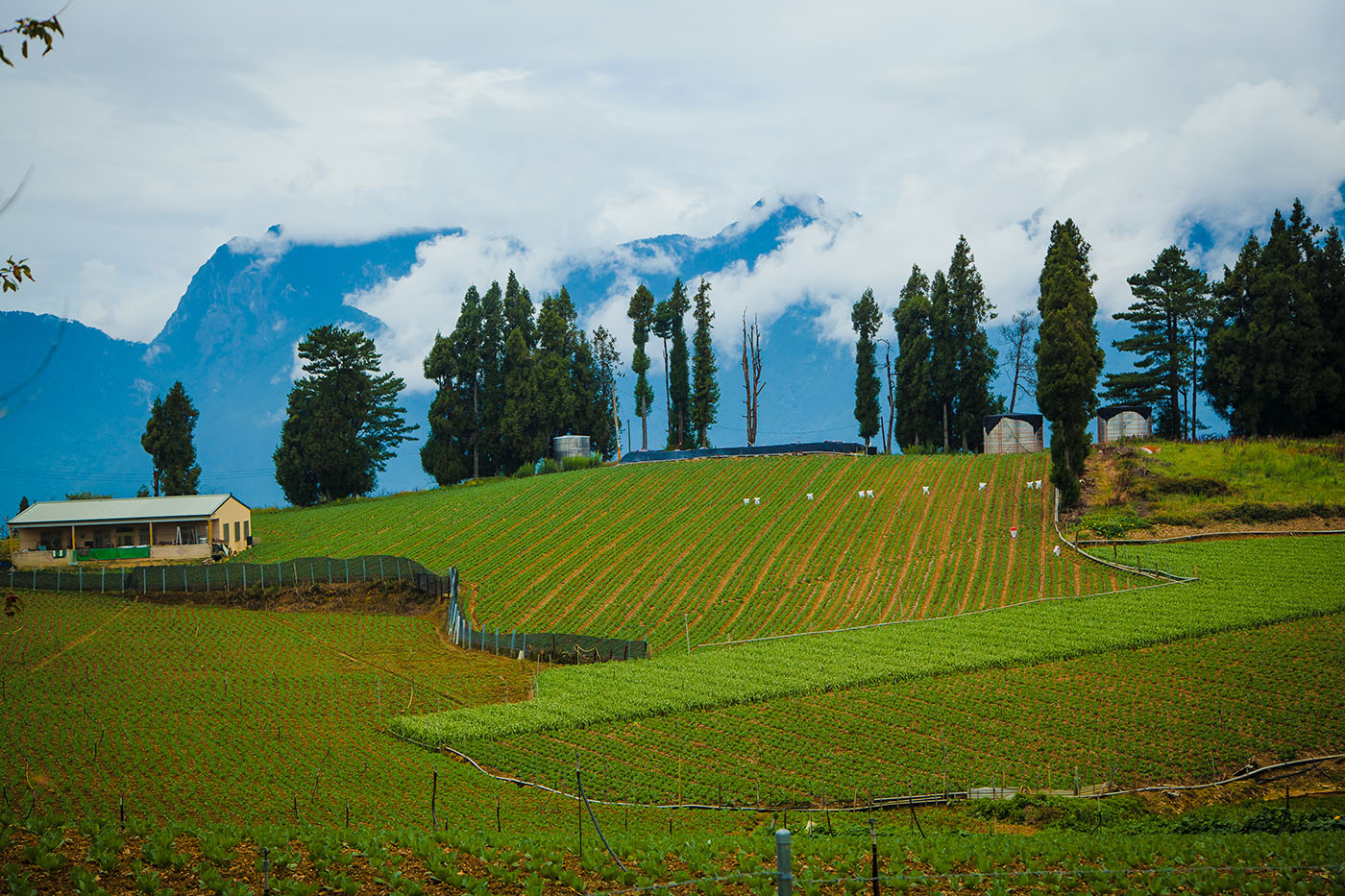
The entrance to Fushoushan Farm, another veterans’ farm, is directly above Lishan. The village is high up a mountainside; the farm, higher still, takes up the mountain mammoth’s uppermost reaches. Beside the visitor center of the farm is the Apple King, a magical, photogenic tree onto which 43 apple varieties have been grafted, all named on an information board. (Note: free guided farm tours, in Chinese, are launched daily from the center.)
One of the farm’s best-known draws, Tianchi (Heaven Pond), sits at the mountain’s very top. This is the best farm location for views of Mt. Xue’s west peak, though often blocked by cloud and mist in the afternoon. Daguan Pavilion, beside, is an airy two-story Chinese-style building once used by Chiang Kai-shek as a temporary residence. Two other farm villas built for him, Fushou Villa and Sunglu Villa (his son, Chiang Ching-kuo, spent more time at the latter), are today accommodations for visitors staying at the farm.
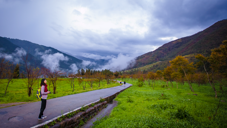
My most pleasant walk during our stay – the farm has a number of easy trails – was through the broad, fragrant orchard behind the visitor center, which has good English signboard information, leading to the immortals-amongst-the-clouds views at Guanxue (“Snow Viewing”) Pavilion and Songlin (“Pine Forest”) Trail. Among the autumn produce readying for harvest were numerous apple varieties and persimmons, along with such unexpected treats as kiwi fruit and chestnuts.
Tianchi and the campground area below it are well-liked destinations for sunrise and stargazing pleasure. Though luck was not with us on this trip, skies are generally clear. In the mornings, expect company at Tianchi – people bring picnic eats and hot tea, and many practice their tai chi, absorbing the qi-rich mountain air.
Day 3 — Lishan, Deji Reservoir
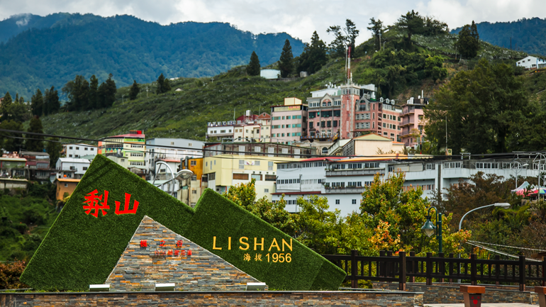
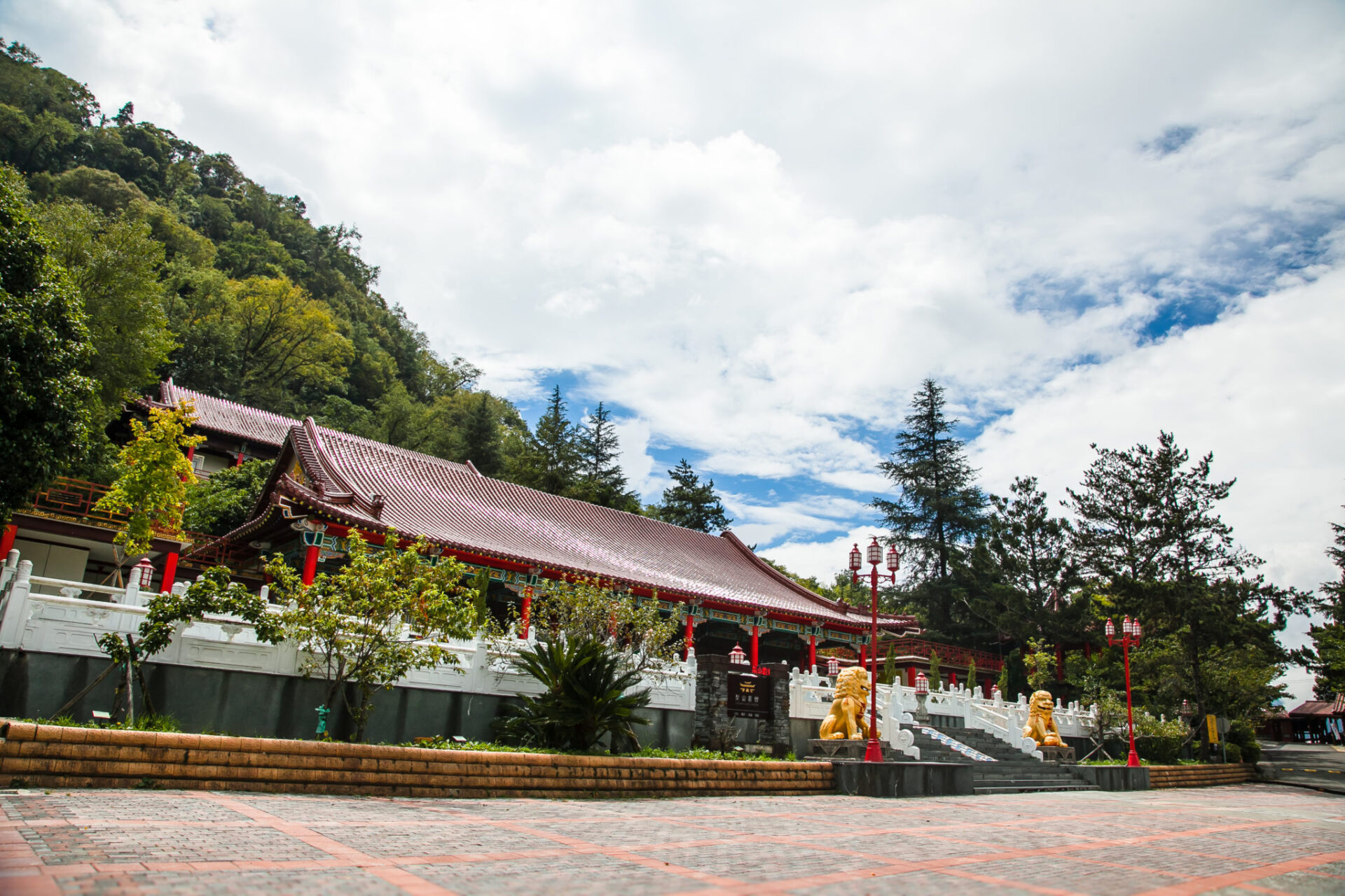
From Lishan (“Pear Mountain”) you look down on a nigh-bottomless chasm. Across, to the north, is an enchanting Cinemascope-feel Mt. Xue Range sweep. The village’s crowning glory is the radiant Lishan Guest House, one of dozens of villas built on the island for Chiang Kai-shek for inspection tours and vacations during his days of rule. Built in the Chinese imperial-palace style by the same architect responsible for the main building of Taipei’s iconic Grand Hotel, the facility was seriously damaged in Taiwan’s infamous 9-21 Earthquake of 1999, and reopened in 2013 after 10 years of renovation. Other key sites in the expanded complex are an “imperial-style” post office and a tourist information center.
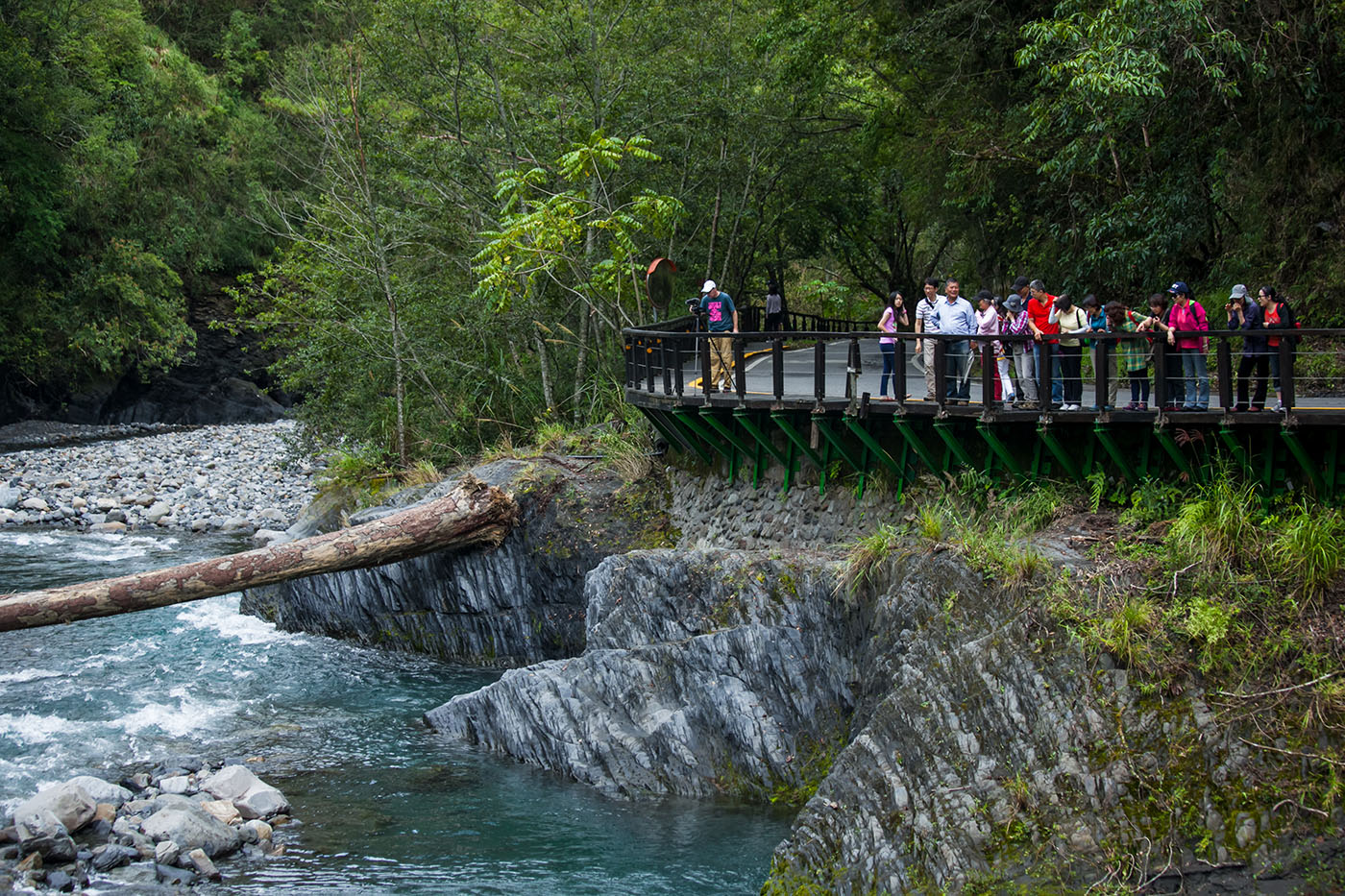
Arching the high slope behind the guest house is the Lishan Ecology Trail, which takes you along steep boardwalk stairs and viewing decks. It follows an old trail long used to reach Fushoushan Farm further up. The region is home to many bird and butterfly species, and on this day’s trail adventure I thrilled at my first-ever sightings of the Fire-breasted Flowerpecker and the Highland Red-belly Swallowtail.
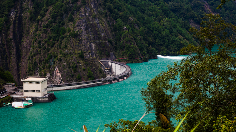
Finally we visited the Deji Reservoir. Though not on the standard Lishan-area tour itinerary, the hour-long drive (return from Lishan) is worth the effort, with extraordinary rugged scenery and striking engineering on display. The reservoir can be reached by following Provincial Highway 8 west from Lishan; this was the original Central Cross-Island Highway, but an extended section past the dam has long been closed due to typhoon and earthquake damage and is open only to locals with special permit. The reservoir, 14km long and covering 592 hectares, is framed in many spots by towering, sheer granite walls. The high (290m), thin hyperbola-shaped dam, unfortunately only visible from a distance, is Taiwan’s first arch dam, an impressive testament to man’s audacity.
Getting There & Getting Around
Self-Drive: The fastest route from Taipei to Lishan is National Freeway No. 5 into and through Yilan County, then Provincial Highway No. 7 and 7A. From the Taichung area, follow Highway No. 14 and 14A, via Qingjing Farm and Hehuanshan, and then turn onto Highway No. 8 at Dayuling. From the East Coast follow Highway No. 8 through Taroko Gorge and turn right at Dayuling.
Public Transport: Kuo-Kuang Motor Transport (www.kingbus.com.tw) operates the daily-service No. 1751 between Yilan (Yilan Bus Transfer Station) and Lishan, on the way stopping at Wuling Farm. Fengyuan Bus (www.fybus.com.tw) operates the daily-service No. 6506 between Fengyuan and Lishan and the daily-service No. 6508 between Lishan and Wuling Farm. Hualien Bus (www.hualienbus.com.tw) operates the daily-service No. 1141 between Hualien City (Hualien Railway Station) and Lishan via Taroko Gorge. A Wuling Farm tour-bus package tour (with English guide) is also offered as part of the Tourism Bureau-vetted Taiwan Tour Bus (www.taiwantourbus.com.tw) service.

KLOOK
Taichung: Wuling Farm Day Tour (From Taipei)
Nantou Qingjing Farm and Hehuan Mountain One-Day Tour from Taichung
About the author

Rick Charette
A Canadian, Rick has been resident in Taiwan almost continually since 1988. His book, article, and other writings, on Asian and North American destinations and subjects—encompassing travel, culture, history, business/economics—have been published widely overseas and in Taiwan. He has worked with National Geographic, Michelin, APA Insight Guides, and other Western groups internationally, and with many local publishers and central/city/county government bodies in Taiwan. Rick also handles a wide range of editorial and translation (from Mandarin Chinese) projects.