Great Scenery, Pristine Nature, Indigenous Culture and Much More
Text | Rick Charette
Photos | Ray Chang
I had been here before, some 15 years earlier, though dipping in for only the better part of a daytime. Unnoticed or perhaps not present on that occasion was what struck me most of all the things I saw on a recent 3-day trip into the valleys of the Maolin National Scenic Area, the seemingly ever-present gaze of eagles.
Many times I looked up from valley floor, looked across a valley from a mid-slope trail-point, or looked down from a mountain-ridge crest, there hovered a patient, slowly circling bird of prey, a few among the largest I have ever seen, including champions of North America’s Rockies and Pacific Northwest. Evidence that, though man has a long-established presence here, this region remains pristine and Nature-owned.
So, is this a place where you do not do much more than trek about on trails and watch eagles hunt? Nay. Equally popular prime attractions in the Maolin National Scenic Area (www.maolin-nsa.gov.tw) are the indigenous villages, hot-spring-soaking, butterfly-watching, and magnificent mountain scenery. Here is a highlight reel of my recent Travel in Taiwan trip, in prose and photos.
Maolin Basics
The National Scenic Area (NSA) is northeast of central Kaohsiung, in the western foothills of the Central Mountain Range and the southernmost section of Taiwan’s thick mountain spine. The area is heavily forested and three major rivers run through it. Long and comparatively slender, it has a north-south orientation. It can be divided into three main sections, centered on settlements along each river: the south section’s hubs are Sandimen and Wutai, the middle section’s Maolin and Duona, the north’s Bulao and Baolai. Even if pressed for time, don’t overplan your trip – each section deserves at least a full day. There is good – and steadily more – bilingual signage throughout the NSA.
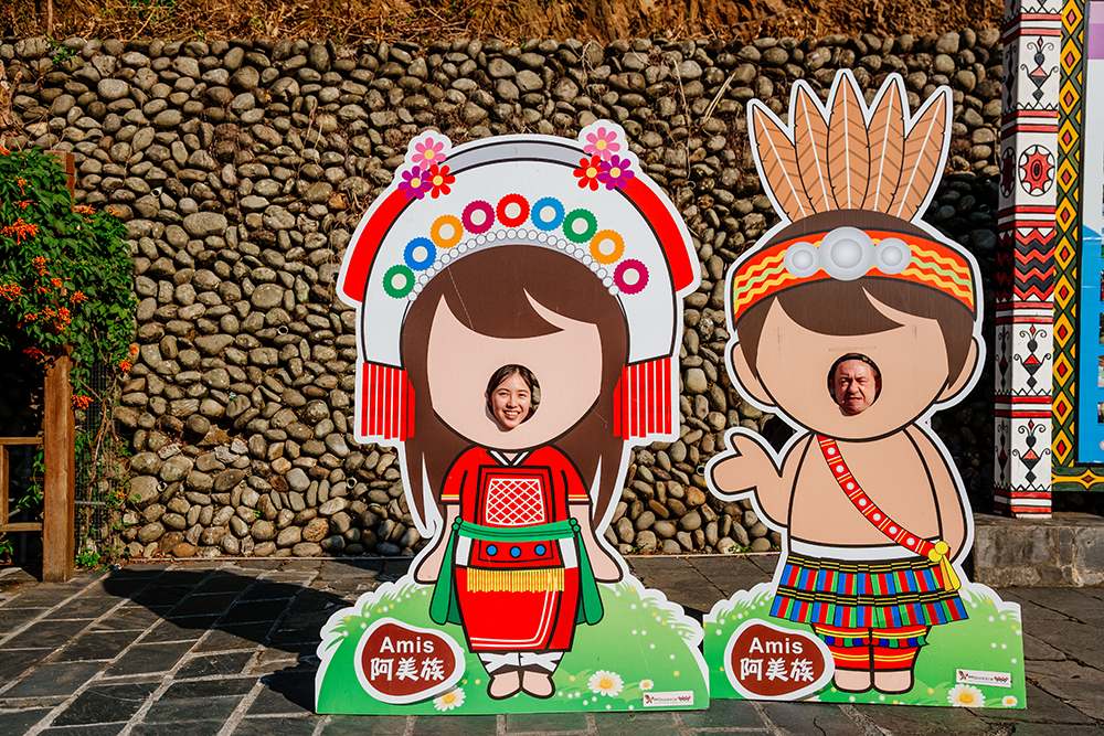
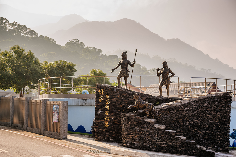
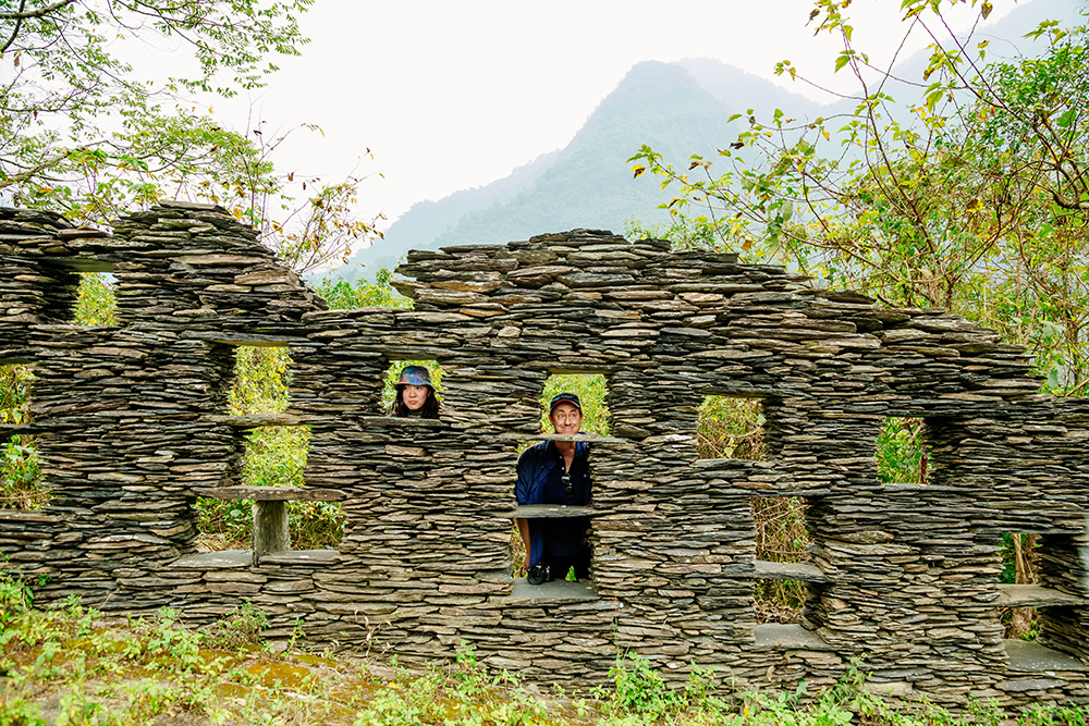
The NSA has a pronounced indigenous population. Members of the Rukai and Paiwan tribes, which share many cultural elements, live in the south, Rukai in the middle, Tsou and Bunun in the north. The Rukai tribe, which has the largest population in the NSA, and the Paiwan tribe are perhaps best-known for striking arts and crafts and traditional dwellings and communal halls made of slate. In Duona village, a cluster of 30 traditional Rukai slate houses is being preserved, the largest concentration in Taiwan. In Sandimen, a Paiwan settlement, is a renowned cluster of tourist-friendly studios where beautiful ornaments made with beads imbued with deep cultural symbolism are crafted.
Blessed with many hot-spring sources, the NSA is home to numerous commercially operated hot-spring facilities. It has the most extensive distribution of natural stream springs in Taiwan.
The Purple Crow Butterfly, an intrepid traveler that, like the Monarch Butterfly, accomplishes impossibly challenging annual migrations, winters in tremendous number in the Maolin area. In the Purple Butterfly Valley and Maolin Ecological Park you may well see thousands at a time flitting about in the woods.
Day 1 – Sandimen/Wutai
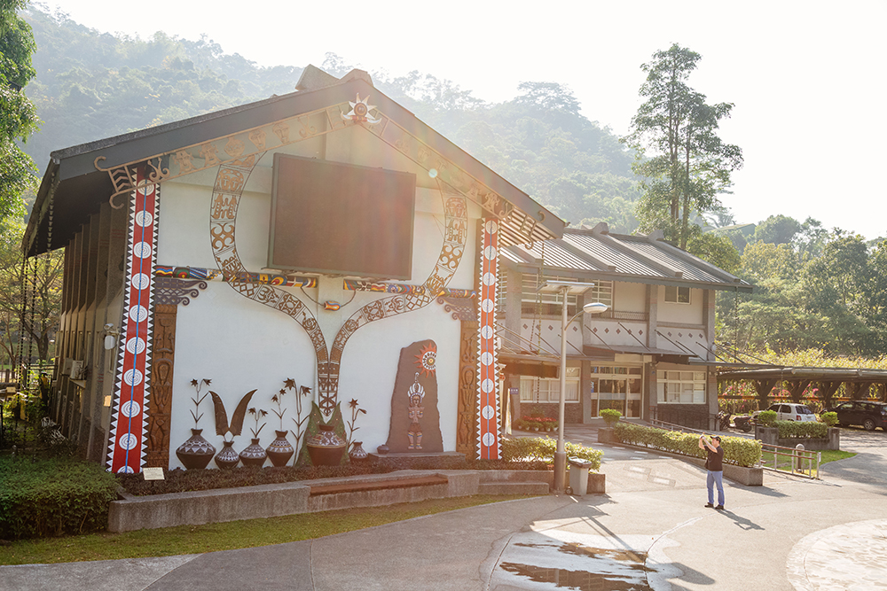
Our first stop was at the Majia Visitor Center, to get our bearings. Maolin’s visitor centers are unusually attractive, and highly individualistic in design. The exterior at Majia’s has a striking indigenous-symbol theme. Inside you’ll find English brochures, a large and well-wrought, wall-mounted NSA scale map, and small hands-on displays of intricate tribal gear and handicrafts. From the center you can also follow a trail to the majestic 3-tier Liangshan Waterfall (about 1km one-way).
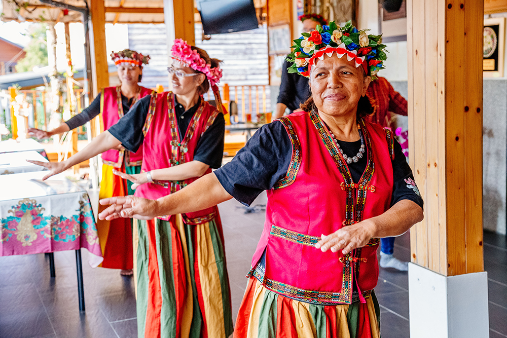
Next was the expansive and edifying Taiwan Indigenous Peoples Cultural Park, which sits on a plateau high above the Ailiao River (NT$160 adult entry, NT$50 small-vehicle parking; www.tacp.gov.tw). Sandimen is directly across the narrow river valley – this is where the Ailiao rushes out into the western lowlands – perched equally high. Further and much higher in the mountains beyond Sandimen is Wutai, perhaps Taiwan’s most attractive indigenous settlement, which has a great concentration of Rukai slate-slab edifices. The Cultural Park has scores of superb indigenous-architecture replicas, from many of Taiwan’s other tribes as well as those with a local presence. Beyond this, my favorite elements are the honest handicraft-production presentations and, next, the exuberant and earnest tourist-oriented song-and-dance shows.
Leaving the theme park, we drove over the crest of the mountain it is located on to the western lowlands-facing side. Entering the slopeland village of Rinari, we felt as though we’d somehow ended up in Europe. Laid out in a neat grid of tidy streets are copycat-design A-frame and twin homes, all two stories, all made of wood. This new settlement is a re-settlement of three Rukai/Paiwan villages that suffered severe typhoon damage. In striking yet harmonious contrast with the European-style architecture are the traditional Rukai/Paiwan slate-built patios before each home, most enclosed by low slate walls, many with built-in slate seating on the inside. Tribal members spend a good deal of time here, in what they call their “living rooms.”
After a formal song-and-dance greeting by the friendly staff of the Rinari Tribal Development Center, we were given a free village tour (advance booking required). Our guide explained that “Rinari” literally means “We walk together, to the place yonder,” interpreted the different tribal-theme flourishes at the front of each home – each family submitted its desired design before construction began – and took us into the various home-based studios to meet the artists/artisans and into the homes of a number of elders, including a Rukai chief.
Day 2 – Maolin/Duona
“The Maolin National Scenic Area is the only place in the world where traffic signs have been set up to protect butterflies!”
So said Liao Jin-shan, our deep-knowledge volunteer guide at Maolin Ecological Park, situated on a low mountaintop dramatically overlooking Maolin village. Take the free guided tour (advance registration; English available; call 0919-219-944); though the visitor center has solid displays (with English) on the region’s butterflies, the guides provide so much more and they can show you the best sites to spot the butterflies. When disturbed by visitors the butterflies, often looking just like dark leaves on branches when still, burst into flight en masse in such a dense, visually dramatic spectacle that, it struck me, if seen on a movie-theater screen I’d declare it special-effects fake.
Butterfly Watching in Maolin
The Maolin NSA is one of only two over-wintering butterfly valley areas in the world, the other Mexico’s Monarch Butterfly Valley. The southern mountains provide winter nesting grounds during Taiwan’s short but at times chilly winter season for the Purple Crow Butterfly, which at other times can be found throughout the island. When the northeastern winter winds arrive in northern Taiwan in late autumn, millions of Purple Crows – like migratory birds – move to the south and gather in the valleys. You’ll view four sub-species: Dwarf Crows, which account for almost 75% of Maolin’s population, which at times may total one million; Double-branded Black Crows, which make up much of the rest; Striped Blue Crows; and Blue-banded King Crows.

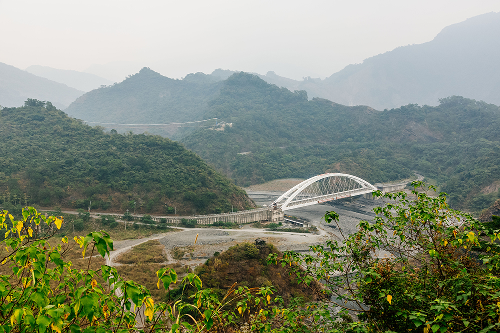
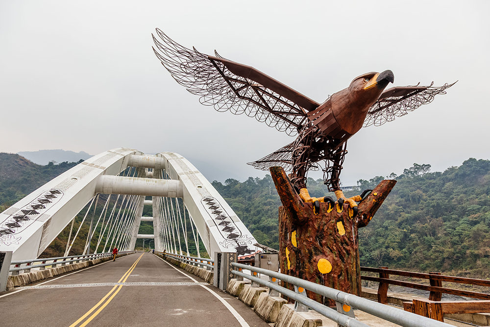
Between Maolin and Duona, as you follow the twisting highway high above the serpentine Zhuokou River, you are suddenly presented with what to me is the NSA’s single greatest visual. Far below is the sparkling-white Duona Bridge, leaping the riverbed, with a giant steel-frame eagle guarding one end. At stage-right is the “head” of Dragon Head Mountain, said to be spitting out a “pearl,” a mountain-ridge section the river has sliced its way around. High on stage-left is the soaring Duona Suspension Bridge, leaping a deep chasm. Finally, stage-rear and moving right-left atop the crouching dragon’s spine is the attractive, easy-grade Dragon Head Mountain Trail. Accessed via a highway-side parking lot, a boardwalked pathway leads to the suspension bridge and you’ve got little space left and right, the madly twisting river at your feet on both sides of the trail.
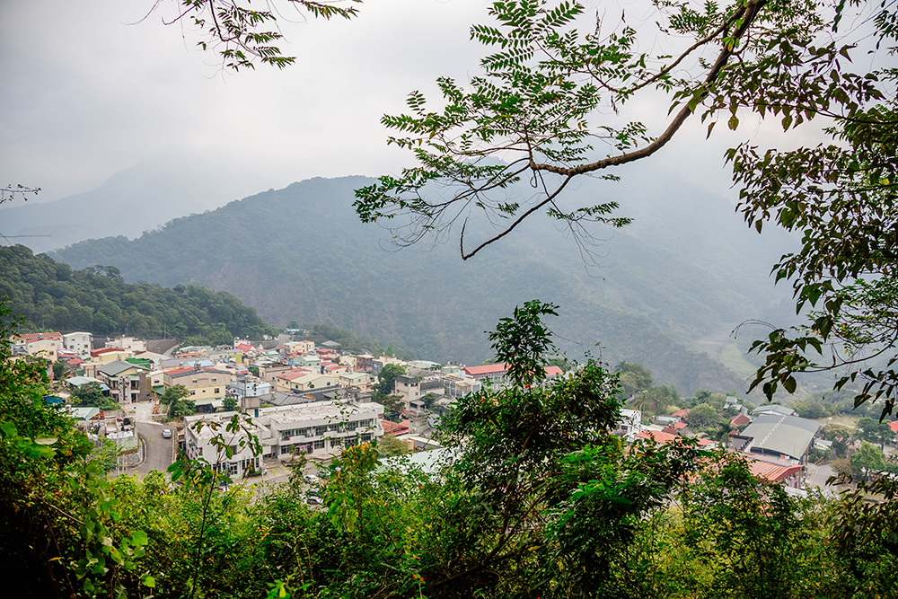
After you’ve traveled high into the mountains, you descend into Duona, nestled on a plateau between two high mountains along what is obviously, from afar, an ancient river channel, a deep-dug tributary of the Zhuokou beyond and below, out of sight. The quiet, tourist-friendly village is not much more than a single street with offshoots. Buy delicious indigenous-style stone-grilled meats and sausages at two joints just as you enter. The first building on your right is the Yishanmu Duona Café, in a splendid extra-large slate building, offering indigenous handicrafts, coffee, partly made with beans grown in the area, and a beloved Taiwan cold treat called aiyu jelly, made from the gel surrounding aiyu fig seeds, the fruit commonly gathered by brave young indigenous men climbing tall trees.

Beyond the village entry-point, signs lead you to the initially steep yet pleasant Duona Warriors’ Trail, from which high-on views of village life are presented. Along the short, wide trail are replicas of traditional structures where, long ago, warriors placed their status-enhancing hunted heads, stored hunted meats, and called out their illustrious deeds.
Day 3 – Bulao/Baolai
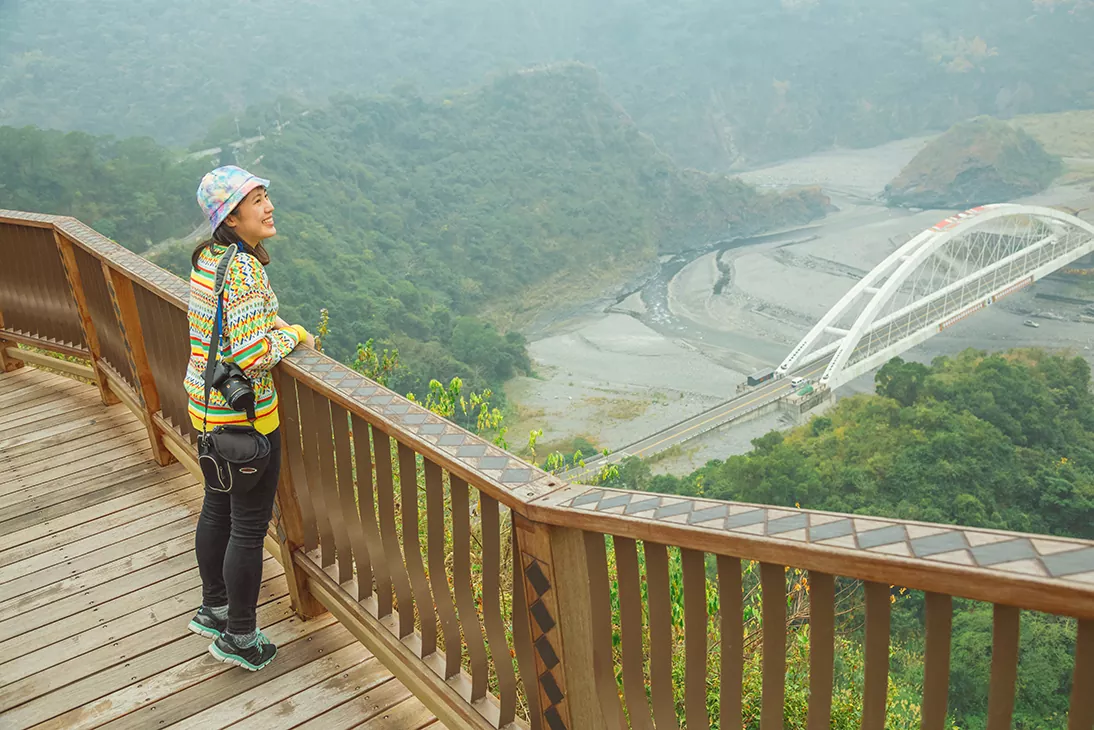
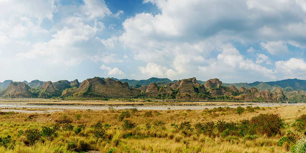
On the drive up the Laonong River valley from the Maolin to the Bulao/Baolai area, take Provincial Highway 27 (on the right bank of the river) instead of 27A. (We actually did this on the way back, on the recommendation of Baolai Visitor Center staff.) Though narrower, it’s much more scenic, with more shade trees, temples, and farm-hamlet attractions. Though this puts you across from the 18 Arhats Mountains, running parallel to Highway 27A, a renowned nature reserve with 72 cone-shaped peaks sometimes called Taiwan’s “Little Guilin,” the views are better from this side of the river.
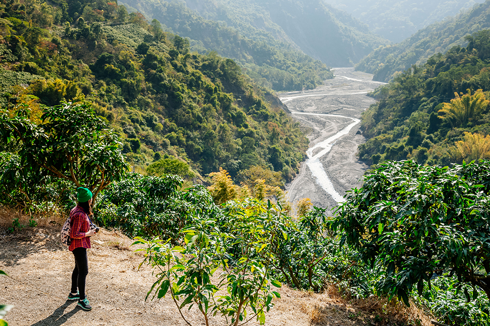
The valley narrows where the 27 crosses the Laonong to link with the 20, becoming more picturesque. Unlike the rugged Maolin/Duona and Sandimen/Wutai valley areas, there is a long, gently undulating riverside-plateau strip here, nicely quilted with compact, well-tended farm fields and orchards.
The Pulaixitou Tribe Historic Battle Trail is just outside Baolai. About 1.5km long one-way it brought us past a plum-tree orchard in snow-white bloom, thick-cluster bamboo forest, and into a clearing atop a mountain-spur ridge with picture-perfect river-valley views – and face-to-beak with the largest eagle I’ve ever seen, not 10 meters away, riding the updraft.
I was deeply impressed. His Majesty turned his back on me, a mere mortal, equally unimpressed.
Getting There & Getting Around
If you do not have your own wheels, the Pingtung Bus Co. (www.ptbus.com.tw; Chinese) offers services between Pingtung City and various NSA locations on four lines: two to Sandimen via different routes, one to Sandimen and then Wutai, and one to Maolin and then Duona. For additional details on the lines, on getting to central Kaohsiung and Pingtung City, and on getting around, notably about the NSA’s bicycle routes and rentals, visit the NSA website (www.maolin-nsa.gov.tw).
Kaohsiung Tours on KLOOK.COM
Kaohsiung: Classic Kaohsiung Day Tour
Kaohsiung: Classic Kaohsiung Attractions Day Tour

About the author

Rick Charette
A Canadian, Rick has been resident in Taiwan almost continually since 1988. His book, article, and other writings, on Asian and North American destinations and subjects—encompassing travel, culture, history, business/economics—have been published widely overseas and in Taiwan. He has worked with National Geographic, Michelin, APA Insight Guides, and other Western groups internationally, and with many local publishers and central/city/county government bodies in Taiwan. Rick also handles a wide range of editorial and translation (from Mandarin Chinese) projects.