Last weekend we went on an easy but long hike in the Shuangxi (New Taipei City) and Toucheng (Yilan County) area in northeast Taiwan.
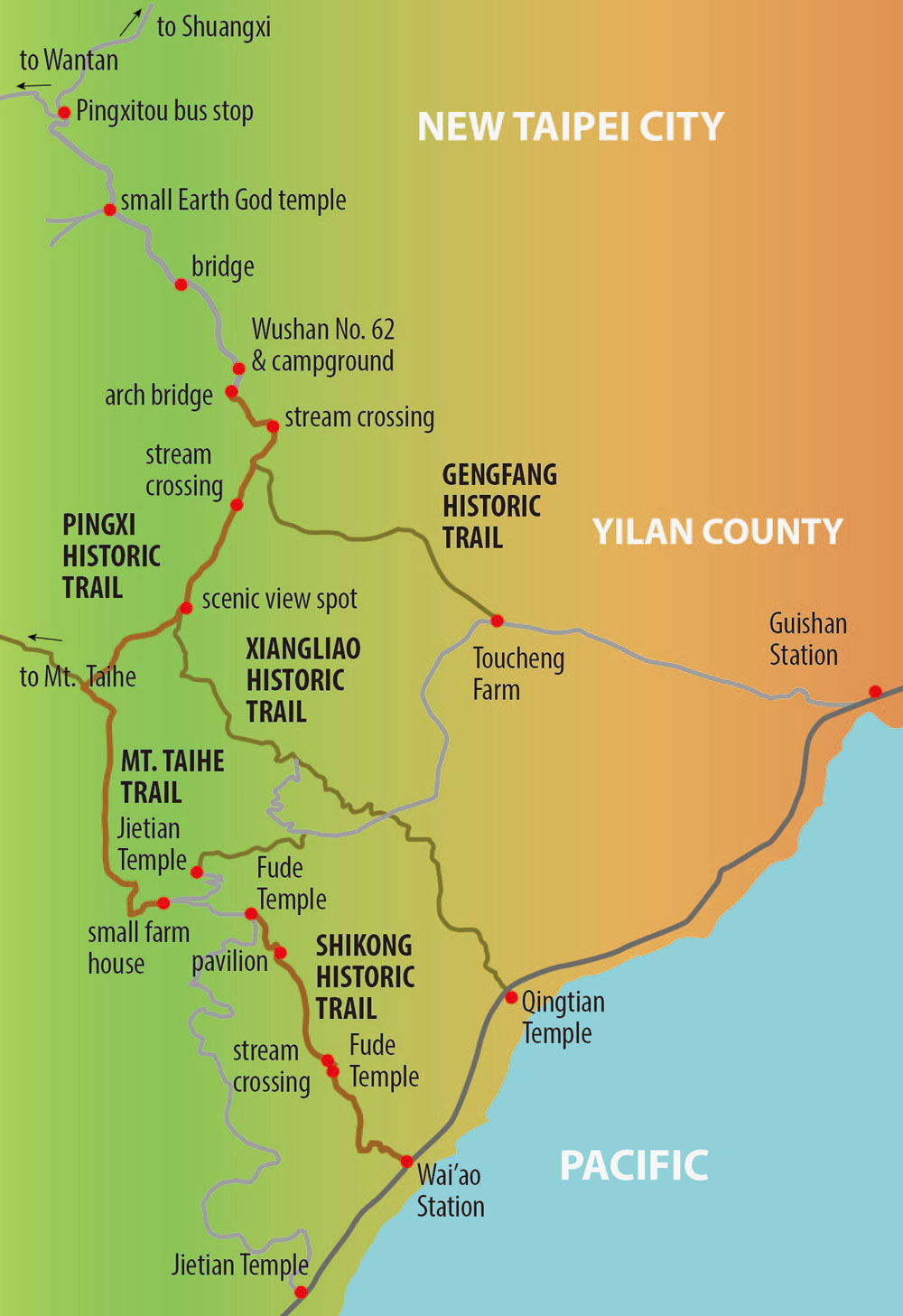
We took a train from Taipei to Shuangxi where we transferred to bus No. 815 (free community bus). This bus goes deep into the countryside passing the popular Hubaotan area and ending at the equally popular Wantan area. In between there is the Pingxitou stop where we got off. Tell the driver that you want to get off at Pingxitou.
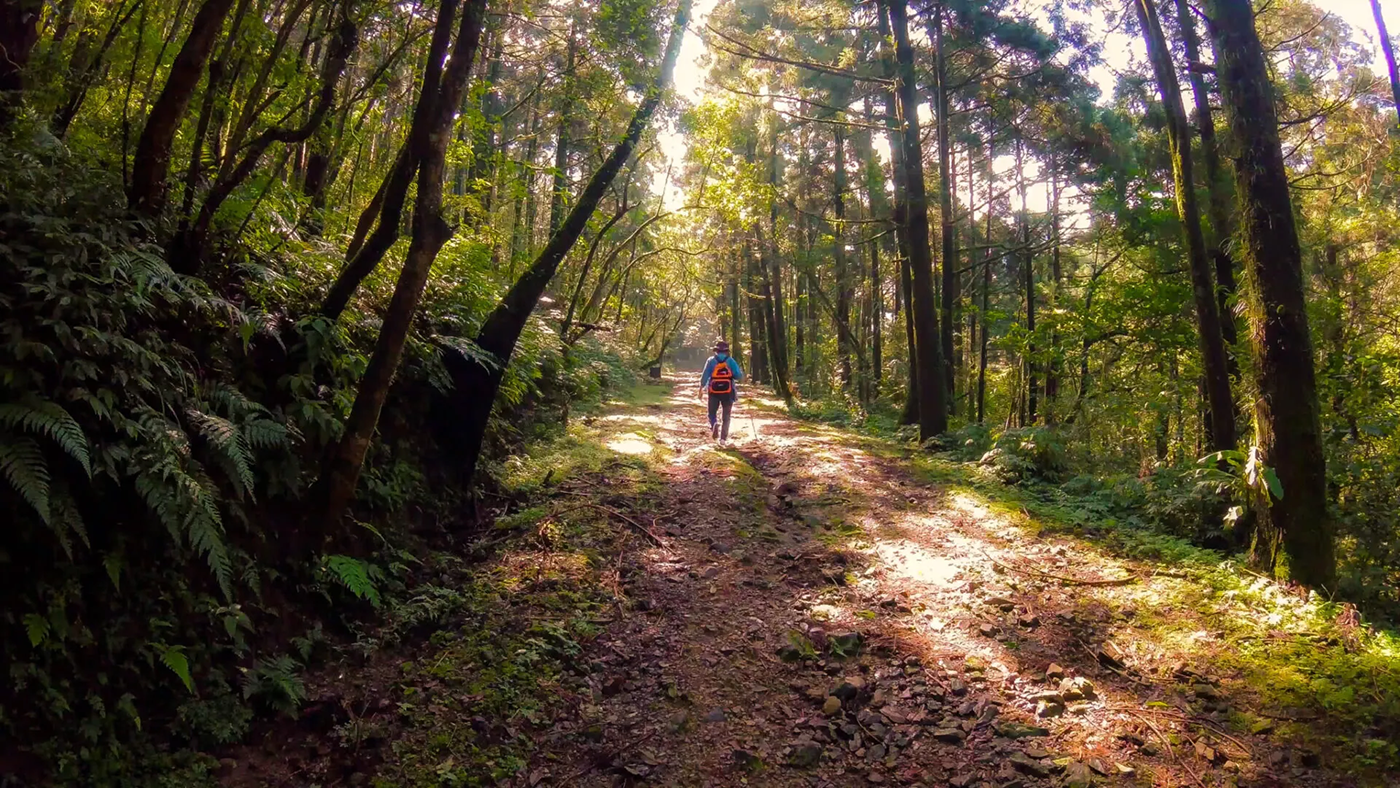
From there you first walk on a quiet minor road through a forest of coniferous trees and along a stream. The road ends at an open space (campsite) with a single building (Wushan No. 62). Follow the stream further on until you see a small arch bridge. Cross the bridge and on the other side you’ll see a map showing you the hiking trails in the area.
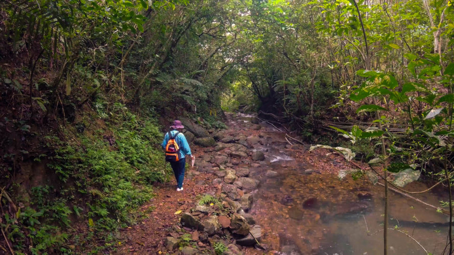
From there, a broad path (Pingxi Historic Trail) leads uphill and then down to meet the stream again. Now you have to cross the stream. Since it had been raining the days before, the water level was too high for crossing over by stepping on stones in the riverbed, so we had to take off our shoes. The current is not very strong, so crossing the stream is safe and the water is pleasantly cold.
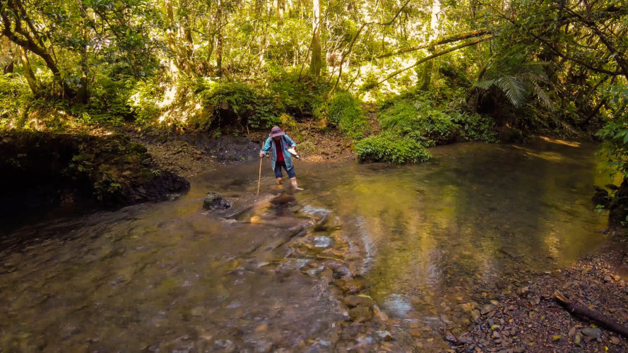
First stream crossing
The path then gently goes uphill and you are surrounded by tall trees. It’s very refreshing there and it feels a bit like walking through a forest in central Europe. You’ll pass a trail (Gengfang Historic Trail) that goes down to the stream on the left and then up the mountains on the other side. We did that trail a few weeks earlier. It connects to Toucheng and goes through thick forest.
Close to the trail head are two benches where you can rest. A few hundred meters further on you come to the second stream crossing, meaning you need to take off your shoes again. We thought it might have been a good idea to bring flip flops and walk the flat trail between the two stream crossings wearing them instead of putting on and off our shoes. The ground is wet and muddy, so you’ll likely get you feet and hands and butt dirty…
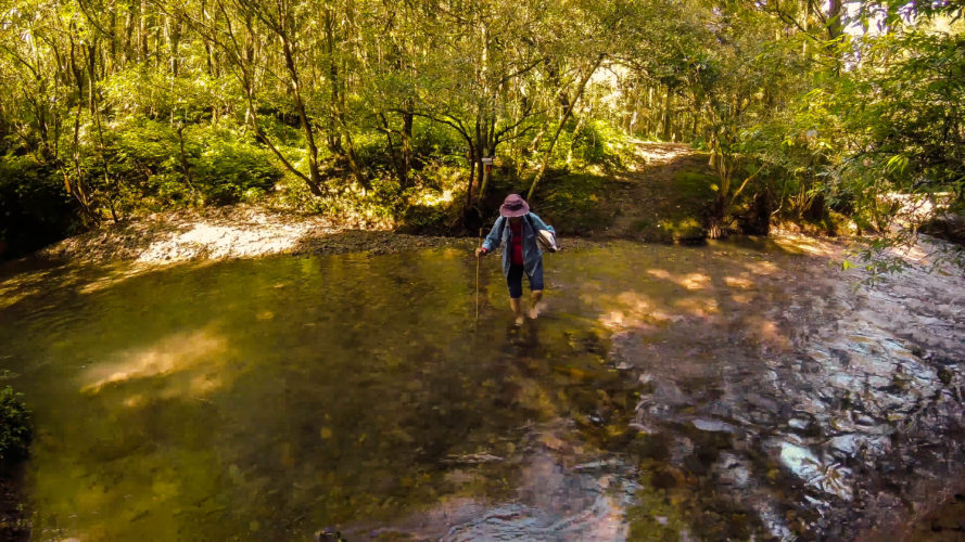
Second river crossing
After the second crossing, you walk uphill and the path becomes narrower. You come to a nice lookout spot with benches from where you can take in the great views down to the coast and Turtle Island, which sits right in the center of your view. Close to this rest spot there is a trail (Xiangliao Historic Trail) going downhill to the left. We did this trail before, it’s narrow and steep in sections, but not too technical. If you take this trail you will come to a small road (turn left) that brings you to Toucheng Farm, from where you can reach Guishan Railway Station near the coast by following the main road. Instead of heading to the farm you can also continue the trail down to the coast. You’ll end up near Qingtian Temple, which is north of Wai’ao Railway Station.
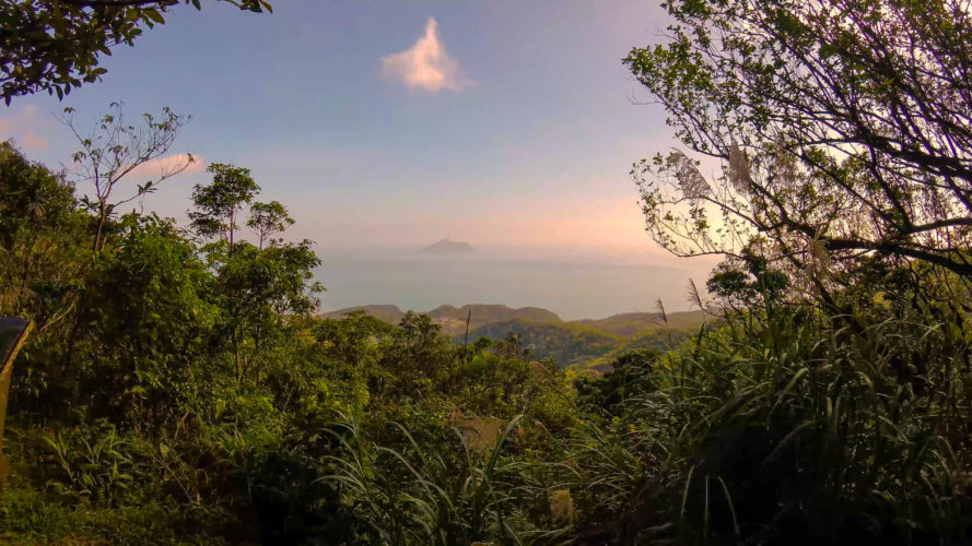
View over the coast with Turtle Island in the center
We didn’t turn left but continued on the now increasingly narrow, but still easy-to-walk trail in the direction of Mt. Taihe. After about half an hour you’ll reach a fork where you can walk up to Mt. Taihe on the right side or walk down toward the coast on the left side. This is a broad and well maintained path. There is a temple at Mt. Taihe and our guess is that the people of the temple keep the path tidy. It is quite steep in section but very easy to walk. It’s actually so even that it could make for a good path to ride a mountain bike on. The path ends at a bridge where there is a simple farm house where you can sit down for a rest.
Beyond the bridge is a minor road, if you go downhill to the left you can connect to the above mentioned Xiangliao Historic Trail (near Jietian Temple). We went to other way uphill. Look out for a small temple on the left side (there was construction work going on when we passed by). Shortly after passing the temple turn left, down a little grassy path until you see a spot where there are three choices. Take the trail on the right (Shikong Historic Trail).
It starts a bit rough, you have to walk across a lot of stones in what must be the pass of a small stream during heavy rain. Then the trail becomes a bit gentler, following a stream. You will come to a rest pavilion decorated with dozens of plastic bands left by hiking groups. Further down there is a lovely section where the trail goes right beside the stream.
Shikong Historic Trail
Then you have to take of your shoes again, unless the water level is low, for the next stream crossing. You’ll pass a little Earth God temple next and soon you’ll come to a point from where you can look down to the ocean. With the coast in sight, the sound of the waves in your ears, you’ll quickly approach the railway tracks and Wai’ao Station. There is a sign in Chinese saying that crossing the railway tracks is forbidden, but there is no other way to get to the station other than walking across. Be extra careful and watch in both directions when doing the crossing, the Puyuma Express is very fast…
On the platform, if you want to take the train, remember to swipe your EasyCard on the platform at the bottom of the pedestrian crossing. Otherwise you have to pay on the train. You cannot buy tickets at Wai’ao. From the platform you can see the ocean and if you have time you might want to check out the well-known surf beach of Wai’ao, which is close by.
![]()
Here is a video about a hiking trail project, including the Pingxi Historic Trail, which is a section of the historic Danlan Trail.