A Pick-Your-Own-Ending Adventure in the Hills North of Central Taipei
TEXT | AMI BARNES
PHOTOS | VISION
Note: This article was published in the 2025 Summer Edition of TAIPEI magazine, a publication by the Taipei City Government.
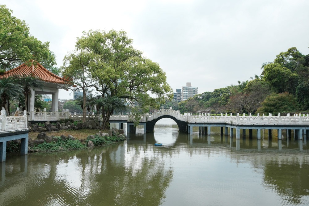
Just north of where the Keelung River cuts through Taipei, a probing finger of mountainous green juts into the city, cleaving a wedge between Neihu District’s shiny office buildings and the older district of Shilin. Among the peaks jostling for space here, Mt. Jinmian is one of the best-known, and a walk based around scaling its rocky flanks presents a multitude of options for hikers seeking somewhere to stretch their legs.
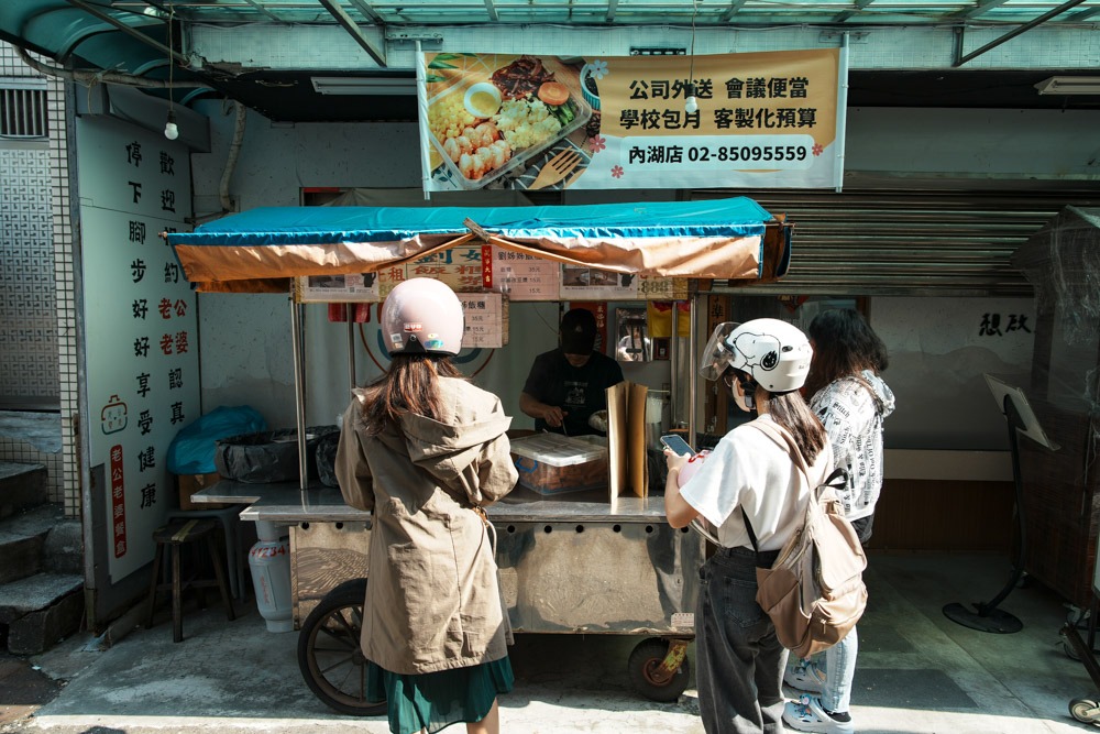
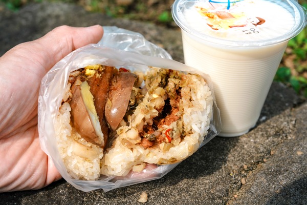
A rabbit warren of interconnecting trails threads through the hills around Mt. Jinmian, with entry and exit points secreted away in quiet lanes where trees come close to the houses. One of the easier-to-locate entrances can be found a 10min walk away from MRT Xihu Station. Turning left out of Exit 1, head up Lane 285 of Section 1, Neihu Road. The street is lined with drink shops, eateries, and convenience stores, making it ideal for pre-fueling or picking up provisions (pro tip: if you’re going for a morning walk, visit Sister Liu’s Rice Balls, inside Alley 67, and grab yourself a top-notch hiking snack). At the top of Lane 285, hook a right onto Huanshan Road, cross the street, then turn left on Huanshan Road, Lane 136 – when you run out of road, you’ll find yourself at the start of the trail.
Mt. Jinmian
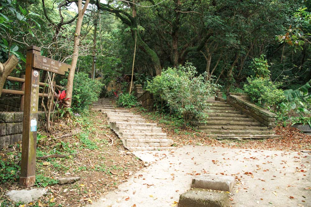
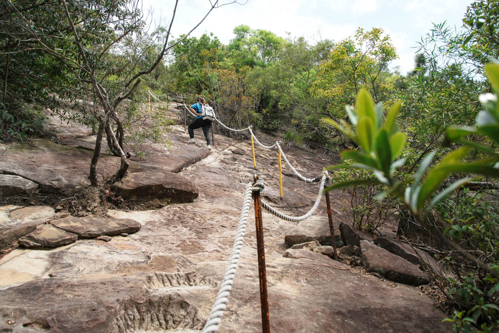
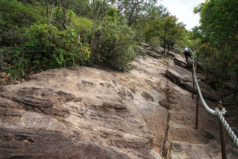
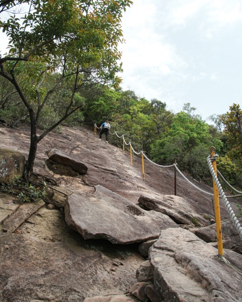
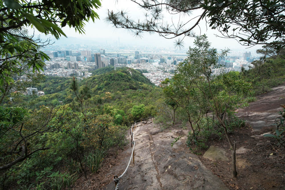
Tall camphor trees tower over a pagoda in the trailhead park, and on spring evenings, it’s not uncommon to spot giant flying squirrels picking their way through the canopy in search of fresh leaves. Heading upwards, the trail immediately splits in two beside the remains of an old Qing Dynasty-era quarry (rocks from this location were used in the construction of Taipei’s old imperial-city walls). Both options will get you to the same place, but the right-hand route does so in the most dramatic style. Steps fashioned from wooden boards and compacted earth lead gently uphill for the first 300m, then the path veers left and begins to ascend more steeply, soon arriving at a grand exposed slab of sandstone, which – when the light hits just right – shimmers golden on account of its high quartz content.
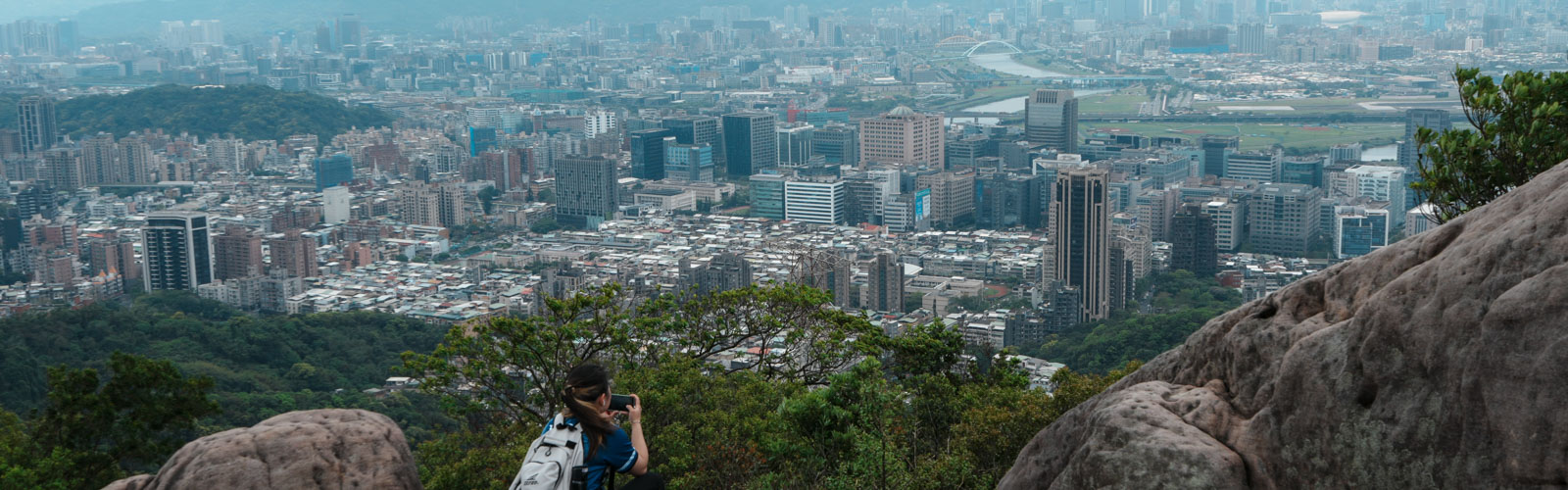
Hikers scaling the great rock face are assisted by shallow toeholds and a sturdy roped handrail, and although plenty of first-timers bring hiking gloves to help with the rope-grabbing, they are not strictly necessary. This section is tiring on account of the steep gradient, but it’s neither difficult nor dangerous – besides, the exertion involved affords you ample opportunity to pause and enjoy the view. There’s one particularly impressive vantage point that comes just at the top of the longest exposed section. If you turn to look back as you begin to dip under the trees, the steep slope fills the foreground and Taipei 101 stands out in the distance, flanked by Xinyi District’s knot of high-rises, all captured within a leafy frame. If you’re hoping to score photos of you and your hiking buddies looking intrepid, this is the spot.
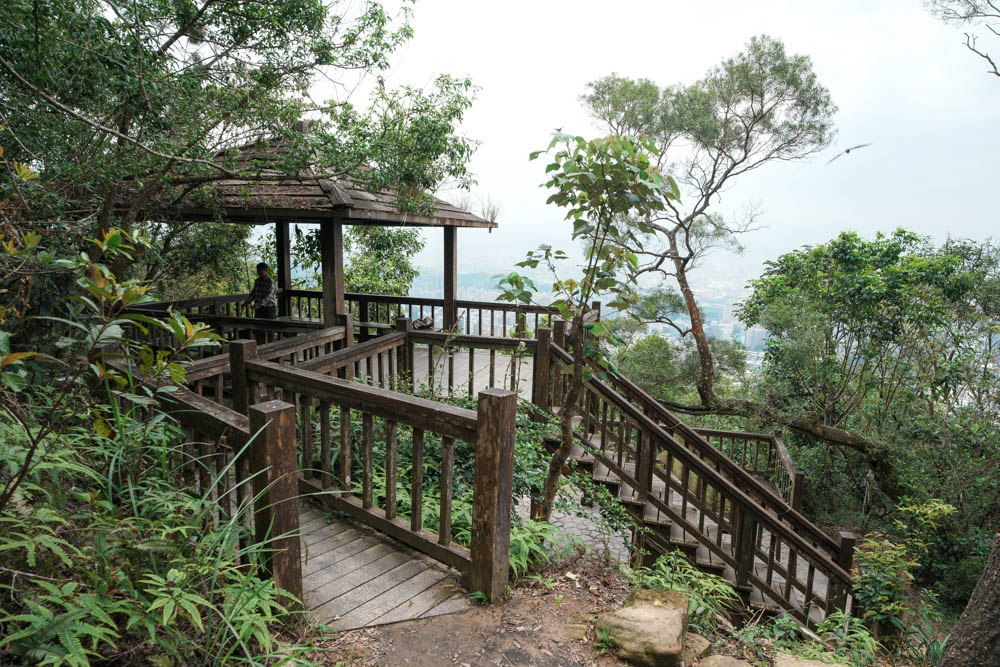
Continuing upwards, you’ll soon reconnect with the other path running up from the trailhead, and if you turn right and keep heading uphill for another five minutes, you’ll reach the wood-built Lunjian Pagoda. This two-story shelter is a popular haunt with health-conscious locals, and you’re likely to find someone here whatever time of day you visit – early risers cranking out pre-dawn pull-ups, afternoon tea-drinkers catching their breath, and as dusk falls, you might meet the trail’s resident felines impatiently awaiting supper.
Scissors Rock
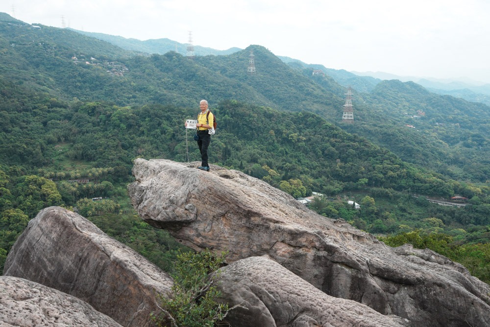
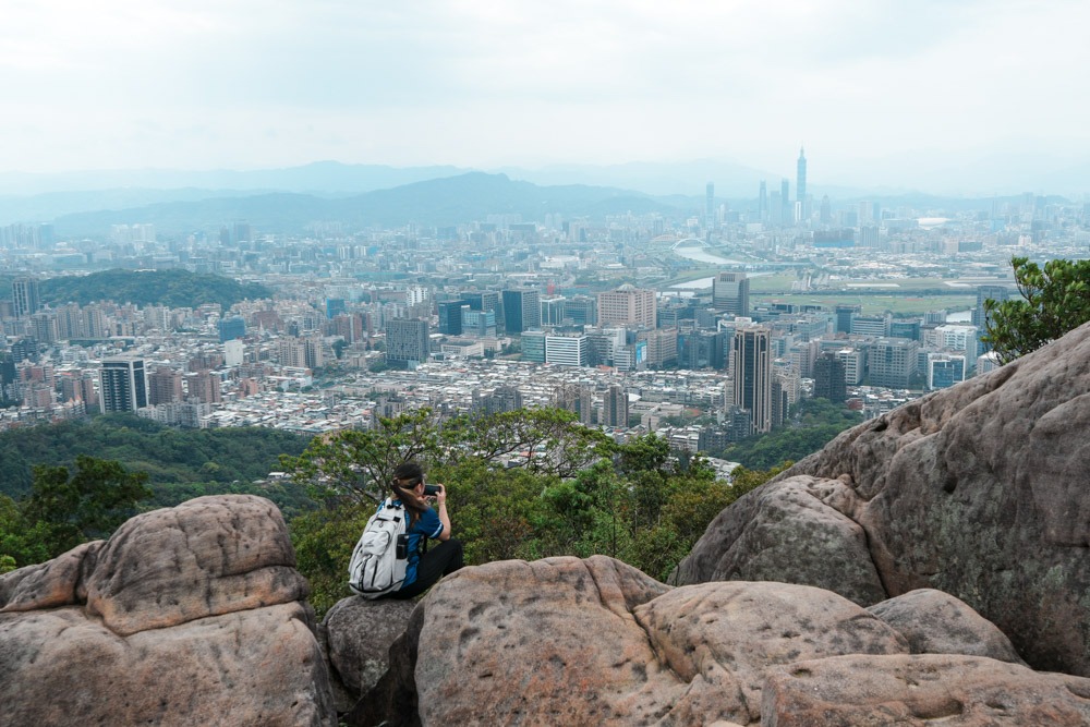
Scissors Rock – the focal point for this walk – can be found a few dozen meters beyond Lunjian Pagoda. The name comes from a pair of angled rock slabs that stab skywards as if poised to snip the clouds asunder. Atop the upper blade – if you dare scramble over to it – you’ll find a metal summit marker that reads “Mt. Jinmian,” although this low mountain’s true peak lies a couple of hundred meters further east in an unassuming clearing. It’s my humble opinion that the views from Scissors Rock are even better than those offered along the more popular Mount Elephant Trail near Taipei 101. Looking beyond Taipei Songshan Airport, Taipei’s urban sprawl spills out in all directions across the Taipei Basin, hemmed in by hills at every turn. To the south, the tall peaks in New Taipei City’s Wulai District form a green wall, Linkou District and central Taoyuan City are discernable as clusters of high-rises on the horizon to the west, if you look east you can make out the distant triangular form of Mt. Jilong, and to the north, Mt. Datun peeks out from behind a closer ridge.
I’m lucky to live within a short walk of this trail network, and after extensive research, I can say that the best times to visit are at either end of a clear day – at dawn, as the city is waking up, or in the evening when you can sit on the still-warm sunbaked rocks to watch it shimmy into its twinkling night garb. I’ve spent many a morning up here watching the sky pale from indigo through pink, orange, and yellow until it finally settles on the day’s preferred shade of blue, and it is without doubt one of my favorite ways to greet a new Taipei day.
When it comes time to head down, you have several options. The swiftest and easiest is to retrace your steps past Lunjian Pagoda and then follow the exposed rock spine down to where you started, but if your legs still have juice, there are many more kilometers to explore.
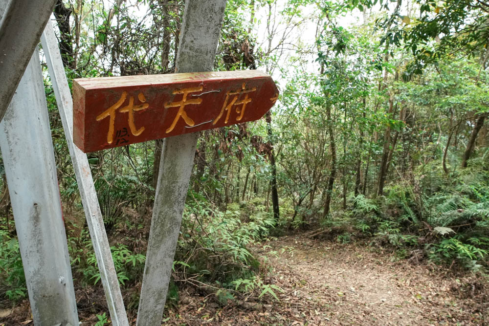
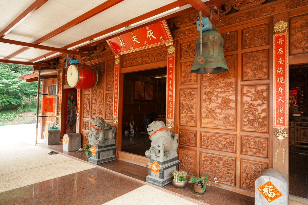
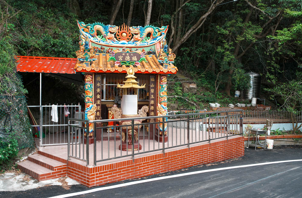
Daitian Temple
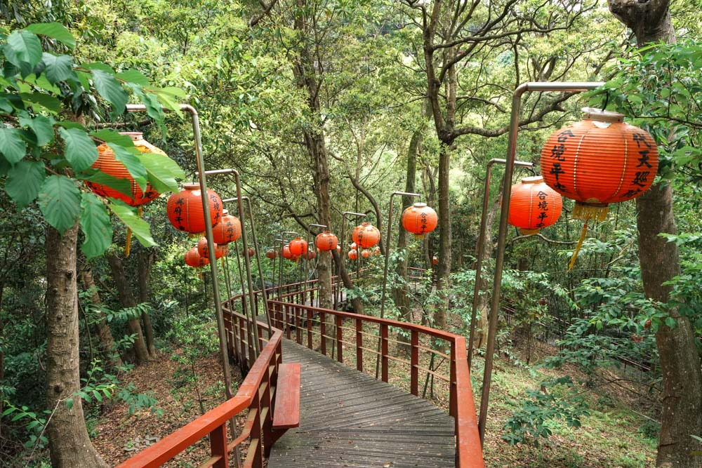
One short but interesting option involves continuing straight over Scissors Rock. If you keep heading along the crest of the ridge (east), you’ll eventually descend near Neihu’s Bihu Park, but if you take the first left (under a pylon) and follow signs for Daitian Temple, you can walk down a secluded and infrequently visited lantern-lined boardwalk that feels like something out of a Miyazaki film.
Mt. Dalunwei Hiking Trail
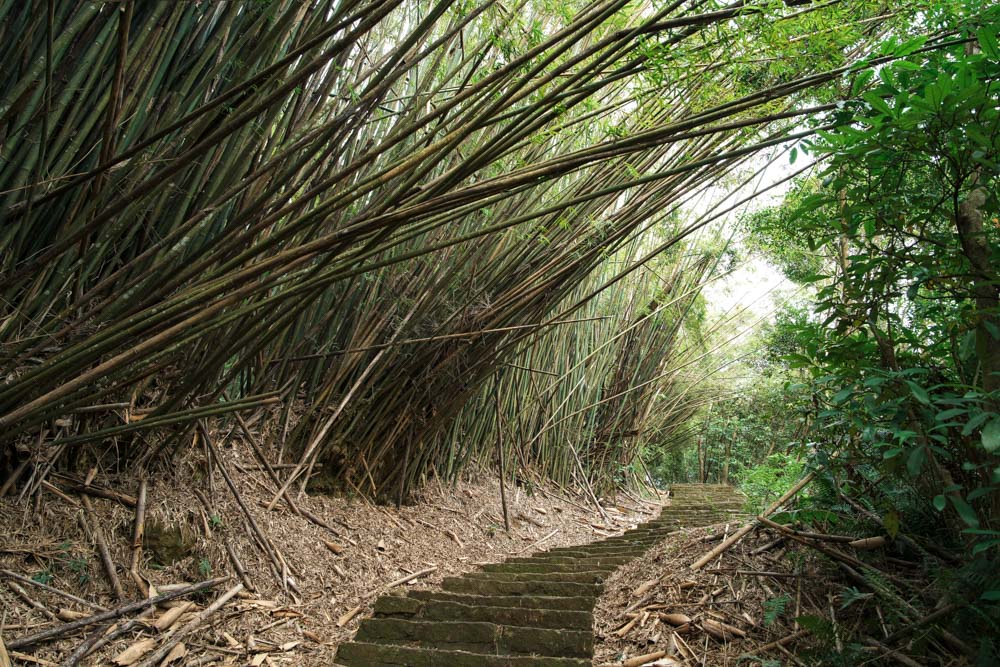
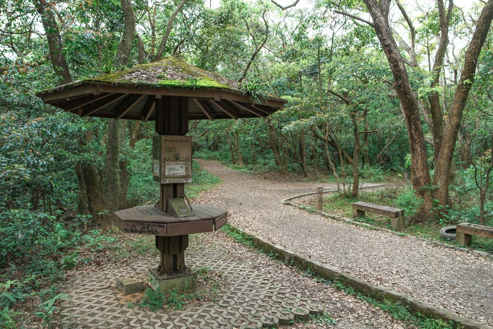
Longer routes await in the hills to the north. From just west of the Scissors Rock summit, follow signs for Mt. Dalunwei Hiking Trail and roll with the dips and rises until you reach a junction where an open-sided mountain shelter overlooks an outdoor gym. This is a popular stopping point for folks walking Section 5 of the Taipei Grand Trail. From here, keep following the fingerposts pointing towards Mt. Dalunwei. The path crosses Jinlong Industrial Road twice, and after diving back under the cover of the treeline for a second time, it begins a steep and steady uphill slog. Taking the sting out of the climb is the close-in beauty along this stretch – a gorgeous bamboo corridor, stems bending to meet each other and forming a shady green tunnel. In spring, the leaves quiver with mixed flocks of Taiwan barbets, white-bellied erpornises, Formosan scimitar babblers, and Japanese white-eyes, and in warmer months, each footstep sends skinks and lizards skittering across dry leaves.

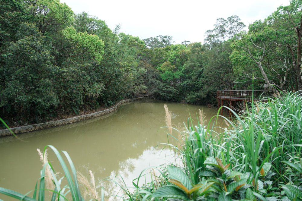
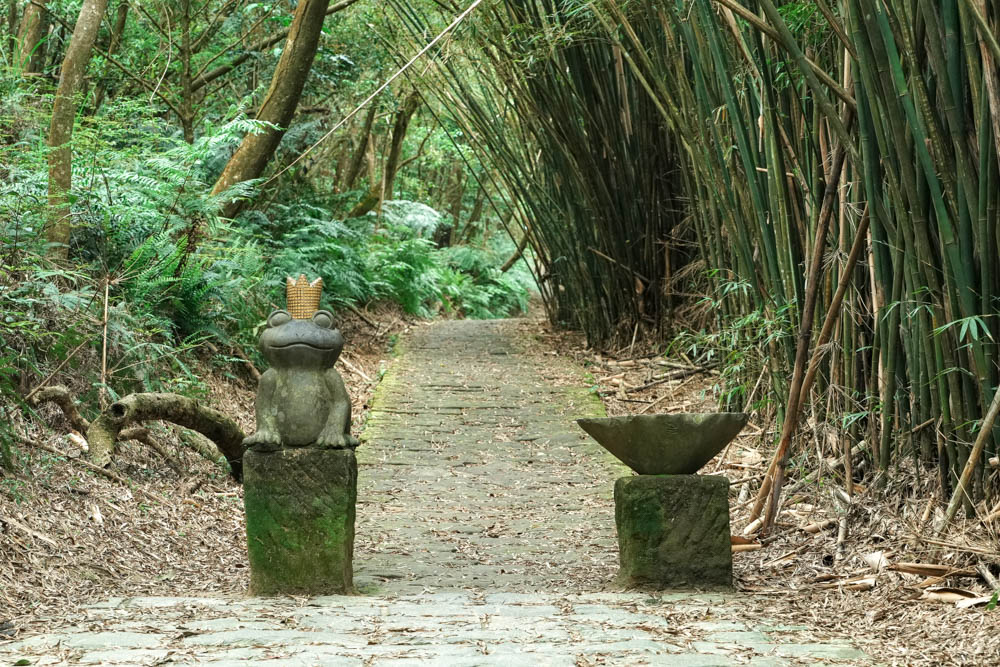
Upon reaching a “stamper” station (bring paper and a crayon if you wish to make use of this facility), the trail splits in two, and hikers bound for Mt. Dalunwei and Mt. Daluntou part ways. (“Tou” and “Wei” respectively mean head and tail, indicating that these two peaks mark the ends of the mountain range) The shorter of the two options is the left-hand route, which takes you to the summit of Mt. Dalunwei and then down to Section 2, Zhongshe Road, where you can catch a bus down to central Shilin District. Meanwhile, the route on the right joins Bishan Road close to the recently revamped Bishan Camping Ground. If you’ve done enough hiking for the day, you could follow this road left or right until you reach civilization, but for the extra-energetic among your group, heading straight ahead up Lane 44 of Bishan Road will soon deposit you at the start of the climb to Mt. Daluntou – a spot marked by a small pool (Dalun Lake). About 40m uphill, you come to a fork, marked by a whimsical statue of a frog wearing a crown.
Mt. Daluntou
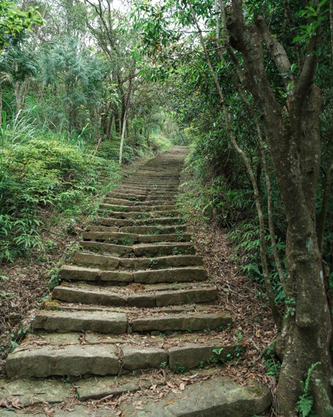
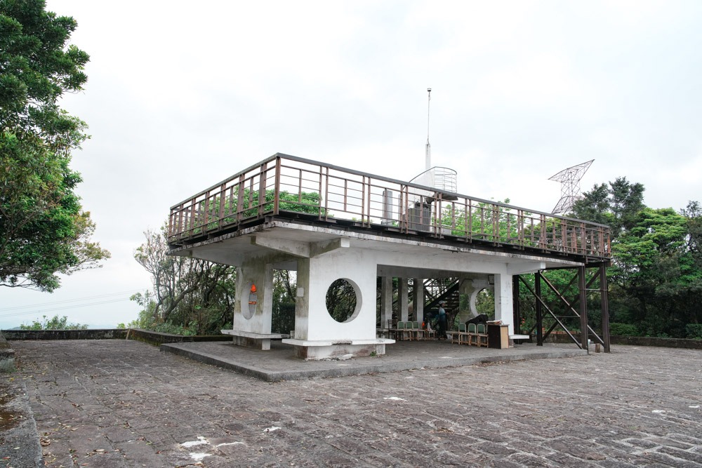
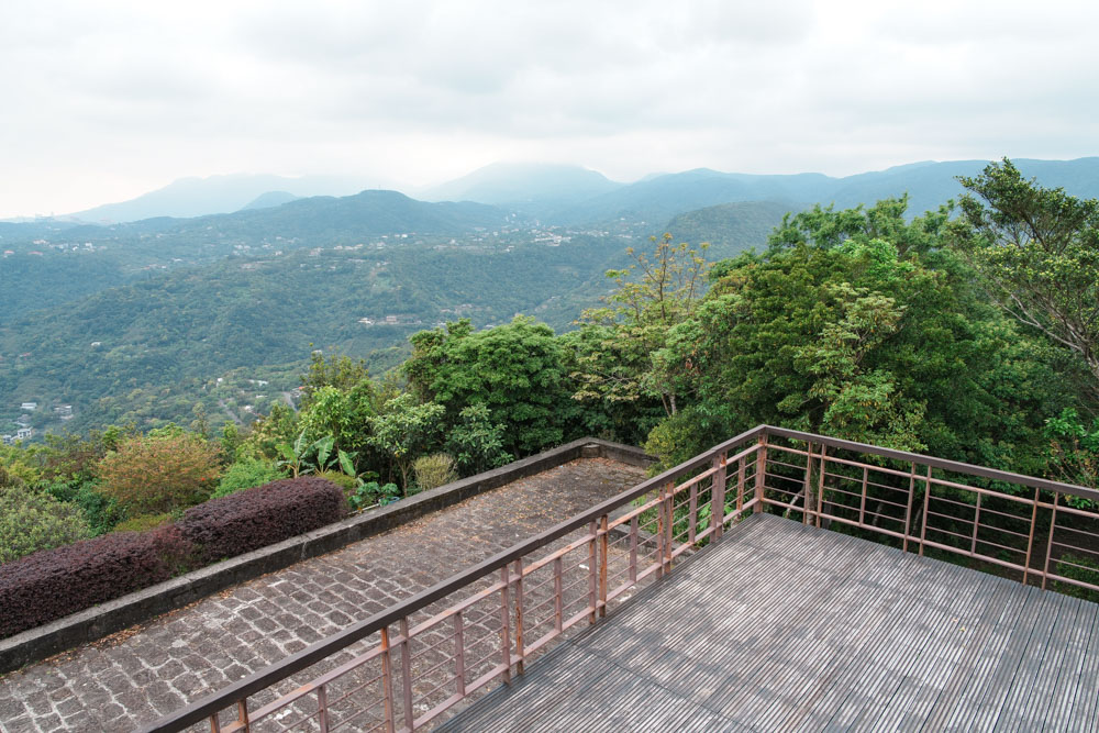
Choose between twin routes – one with stone steps, the other a rutted dirt track – which head up parallel to each other, and within 20min you should find yourself atop Mt. Daluntou. The summit is one of Taiwan’s “Small Baiyue” (also known as 100 Minor Peaks, which is a list of a hundred peaks located along suburban hiking trails that local hikers enjoy bagging), and from the viewing platform you can enjoy near-panoramic views over Taipei and the surrounding hills before heading west down Mt. Daluntou Forest Trail’s pretty boardwalk steps to the bus stop at Neishuangxi Nature Center. Just watch out for the grumpy squirrels that haunt this route – they are numerous and very vocal when it comes to letting us pesky humans know how unimpressed they are by our presence.
About the author