High Mountains and Deep Valleys, Historic Sites and Tourist Railway Line
Text | Rick Charette
Photos | Chian Chu
Grab your hiking boots, grab your camera, grab your sunblock. We’re taking you to river-valley Jiji town to visit a quaint Japanese-built heritage railway station and go “green tunnel” bike-riding, to Shuili on a visit to a heritage “snake kiln” and a pick-’em-yourself grape farm then, higher in the hills with mountains looming, to a mountainside indigenous village, to deep-mountain-valley Dongpu town for hot-spring bathing, on a hike up to tall, pretty Rainbow Waterfall high above Dongpu, and then on an ascent higher still – via highway, and much, much higher – to walk the scented fields of plateau-perched Caopingtou Yushan Tea Plantation, and finish in the clouds in Yushan National Park at panorama-embraced Tataka Visitor Center.
Day 1
Jiji Railway Station → Jiji Green Tunnel → Shuili Snake Kiln
After a pleasant 3-hour drive from Taipei, we were at our first Nantou County destination, quiet, slow-moving Jiji.
The central attraction here is the pretty Japanese-built Jiji Railway Station, made of wood, which was rebuilt after being destroyed in the devastating 921 Earthquake of 1999. The adjoining museum/gift shop has displays on the early development of the Jiji railway branch line and on the earthquake. Be sure to check out the scale model of the area displayed in the complex.
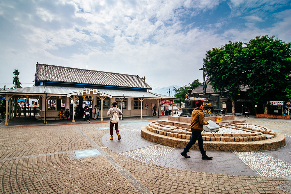
The Jiji branch line, popular with tourists, runs 29.7 km from the western plains into the mountains along the Zhuoshui River, from the town of Ershui to the town of Checheng. It was built by the Japanese colonial government in the 1920s to transport materials for Taiwan’s first great hydroelectric-dam construction project at nearby Sun Moon Lake, and soon opened for passenger traffic. The colorful air-conditioned trains slide along past farms and through small towns and thick green forests.
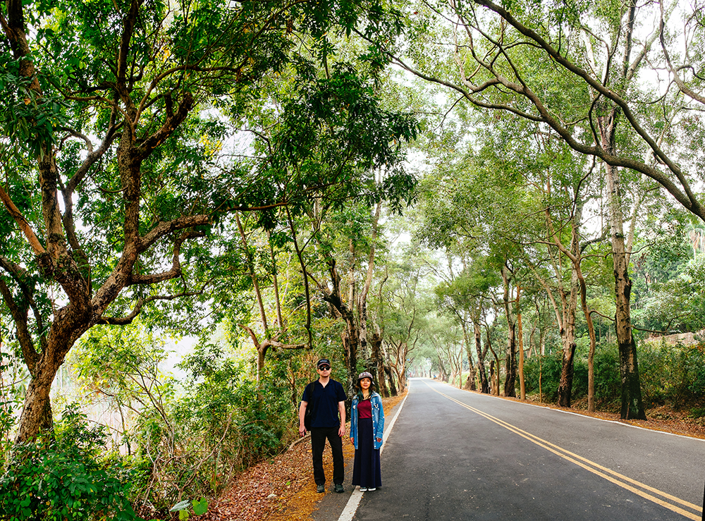
Right beside the single track west of Jiji town is the Green Tunnel, a 4.5-km stretch of leafy canopy covering County Road 152. The trees were planted during the colonial era. We followed tourist custom and rented bikes from one of the numerous rental shops right outside the station (scooters also available) and, after meandering the town’s old streets filled with heritage shops, headed out for a carefree two-hour Green Tunnel jaunt – vehicles passing by only infrequently on this weekday – very different from the Taipei world.
From Jiji it was on to the Shuili Snake Kiln southeast of Shuili town. Nantou County was once a major ceramics-producing center, a source of products such as roof tiles, myriad household items, and large ceramic vessels for aging liquor. The local water was found to be pure, the local clay ideal, the forest cover thick, and the wood needed inexpensive. The big, rambling wooden complex lies hidden away in forest cover beside Highway 16.
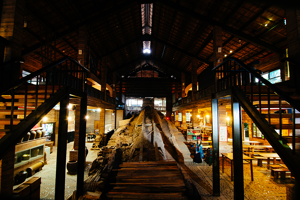
Built on a slope to get the heat inside to move upward – the firewood is placed in the lower section – the brick kiln looks very much like a fat snake. A priceless historical relic, it’s today only rarely fired, to keep it in condition. It takes 3~4 days and an incredible amount of wood to bring it up to, and keep it at, the desired 1,100 degrees Celsius. The ash created within comes to rest on the ceramic pieces, creating the inimitable wood-fired look. When the kiln is not in operation you can walk through it.
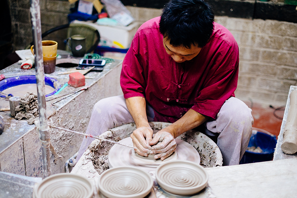
Among the many unusual and/or beautiful created works on display is what appears to be but is not a water cistern. In WW II the Japanese in Taiwan realized they’d make great individualized air-raid bunkers, buried to their lip, each customized for one man and provided a lid and a step inside for easy exit. They were buried in the thousands on beaches, in anticipation of Allied landings that never came. Another is an ingenious teapot invented for the nobility in which the access hole is at the bottom, not the top, preventing easy poisoning.
Shuili Snake Kiln (水里蛇窯)
Add: 21, Lane 512, Sec. 1, Shuixin Rd., Dingkan Village, Shuili Township, Nantou County
(南投縣水里鄉頂崁村水信路一段512巷21號)
Tel: (049) 277-0967
Website: www.snakekiln.com.tw (Chinese)
Day 2
Gan Xi Grape Farm→ Wangxiang Village → Dongpu Sun and Moon Bridges → Dongpu Hot Spring Village
The Zhuoshui River runs east-west. From the western plains we had followed Highway 16 along the river to the towns of Jiji and Shuili. To get to our homestay for the first night, we had jumped the Zhuoshui to head south, into ever-rising mountains, along the Chenyoulan River on Provincial Highway 21. This morning, after a homestay tea-tasting experience, we drove a bit further south for another educational experience amidst a great sprawling cluster of grape farms.
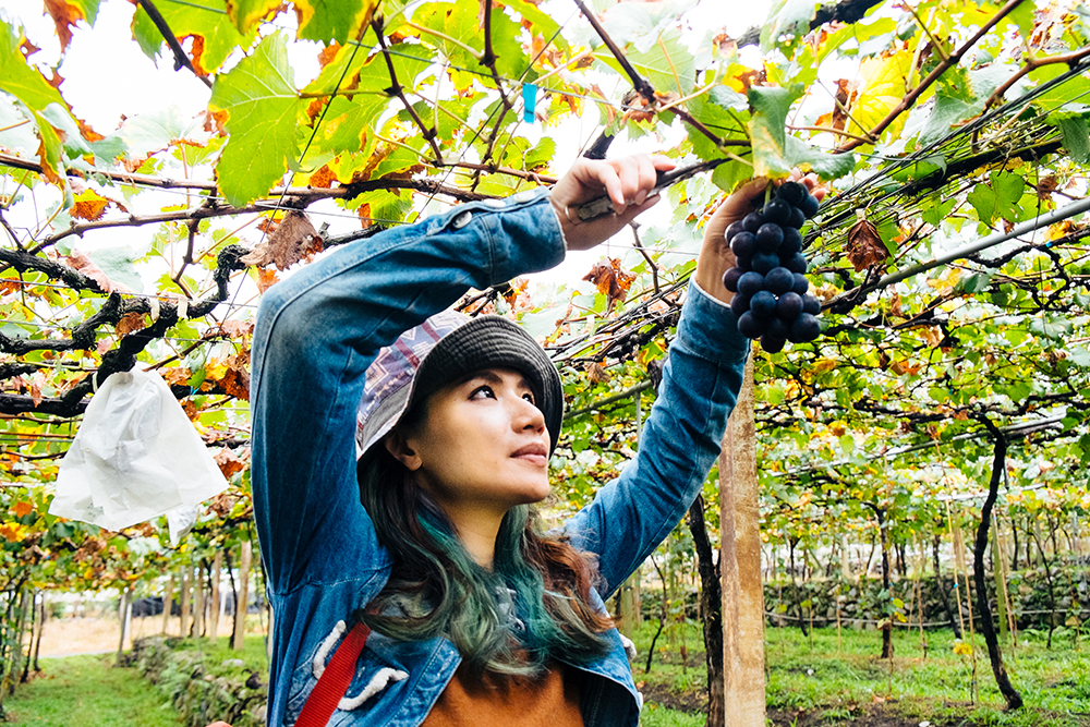
From Gan Xi (“Sweet Happiness”) Farm, between Highway 21 and the Chenyoulan River, you can look directly across the river at soaring bluffs and cliffs. Owner Zhang Yi-yao first gives you some background on the local industry (90% of Shuili Township’s grapes are grown on the cluster of farms here) and his organic grape-cultivation techniques, then takes you into his fields to learn how to identify which bunches are best for snipping through sight, touch, and smell. We learned that the first record of grape cultivation in Taiwan was way back in 1684, with pioneers using grape varieties that had made their way from Europe to China, and that after 1895 the Japanese introduced varieties from the Americas that did not take well. Successful introduction of new varieties in the 1960s brought the boom that continues today. Zhang’s educational session is free. He knows that visitors will inevitably buy the grapes they snip themselves. Farm-crafted red and white wines are also sold.
Gan Xi Farm
(甘喜農場)
Add: No. 46-1, Baibuzi Rd., Shang’an Village, Shuili Township, Nantou County
(南投縣水里鄉上安村白不仔路46-1號)
Tel: (049) 282-1613
Hours: Daily 6am~6pm
Roads just before and after the riverside village of Tongfu lead uphill to a Bunun-tribe village, Wangxiang (Kalibuan in Bunun). The village co-op has systematically developed its tourism facilities, and we chatted with friendly staff at the small visitor center (and adjoining snack bar) about the certified eco-guides available, song-and-dance shows, guesthouses and other accommodations, and bike-trail system set up on flat roads through local farm fields. We then meandered through the village, inspecting the distinctive architecture. Wangxiang is laid out in a grid – the clans were moved down from higher, deeper mountains by the Japanese, promising elders they would still have a clear view of Yushan (Mt. Jade), sacred to the Bunun. A pleasant hour was then spent on the 6-km Manuduo Hunter Trail, which is also popular with mountain bikers.

Wangxiang Village Community Cooperative
(望鄉布農渡假部落)
Add: No. 31, Wanghe Lane, Wangmei Village, Xinyi Township, Nantou County
(南投縣信義鄉望美村望和巷31號)
Tel: (049) 270-2320
FB: www.facebook.com/kalibuan
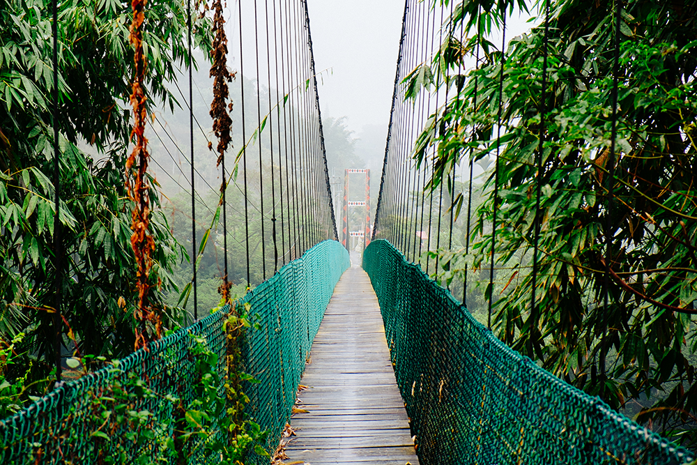
Afterwards, a short drive north brought us to the picturesque Thousand Year Suspension Bridge, which connects Wangxiang and Jiumei, another tribal village. One of the bonus pleasures of traveling in this region is the many photogenic vehicle bridges and pedestrian suspension bridges, bringing you out high above deep-valley and chasm floors, under looming mountain giants, giving you the sensation of floating in space. All this does much to heighten the already magnificent nature-sculpted aesthetics.
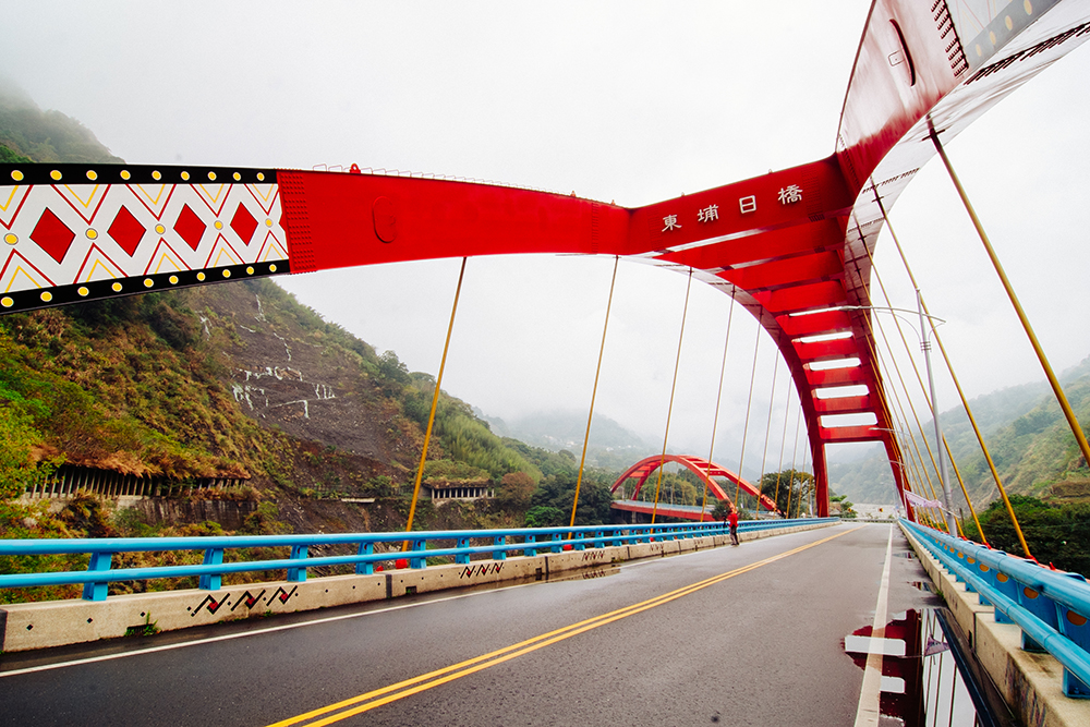
Back down at Tongfu, we left Highway 21 and followed County Road 60 along the river, headed for Dongpu, a hot-spring enclave. On the way, we stopped off at the tourist-favorite Dongpu Sun and Moon Bridges. Metal-built, with leaping arches, they span a twisting section of the river, their adjoining ends resting on a farmed headland. Just as impressive is the original cliff-hugging highway, a large section smashed down by a landslide during a typhoon. You can walk through one of the surviving arcade sections, where local Bunun tribespeople have added to the already impressive aesthetics by making it an art gallery, decorating the inner wall with images from Bunun mythology.
Dongpu overlooks the Chenyoulan River, now running much more narrow and rugged than in the Shuili area, in the shadow of Yushan’s peaks. Among Taiwan’s most popular mountain hot-spring resort villages, this is a tranquil place of mountain/forest/waterfall vistas, creating a nigh-perfect mineral-soak ambience. The air in January through April is filled with the fragrance of cherry, plum, peach, pear, and poinsettia blossoms. The hotels here pipe the acidic bicarbonate spring waters – about 48 degrees Celsius – into guest rooms, private bathing rooms, and public pools.
Batongguan Trail
This trail, which stretches 152 km from Dongpu across the Central Mountain Range to the eastern part of Taiwan, was completed by Qing Dynasty authorities in 1875, as an inland route in the event of colonial-power attack. It took advantage of existing indigenous trails. Today a 20-km section from Dongpu to the Batongguan meadows in the Yushan range is well maintained and popular with serious hikers. Many just hike from Dongpu to nearby Father and Son Cliff, a section of trail hacked from a perpendicular rock face.
Day 3
Dongpu (Rainbow Waterfall, Suspension Bridge) → Caopingtou Yushan Tea Plantation → Husband and Wife Trees → Tataka Visitor Center
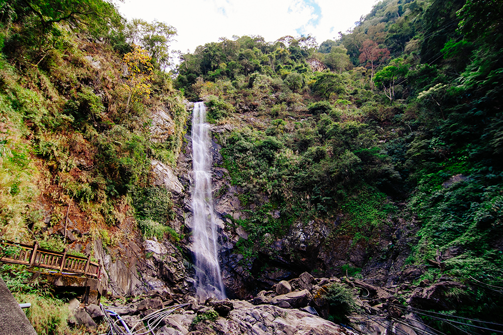
The green-framed Rainbow Waterfall can be spotted from many Dongpu vantage points, the tall ribbon of feathery water spilling out of dense forest cover high above the village. In the morning we headed out for it along the popular eponymous trail, which takes you across the pretty Rainbow Suspension Bridge on the 45-to-60-minute, much-stepped route. The pool at the fall base is source of much of Dongpu’s hot-spring water, and along the trail you’ll see many pipes laboriously fitted over the streambed and through the streamside foliage.
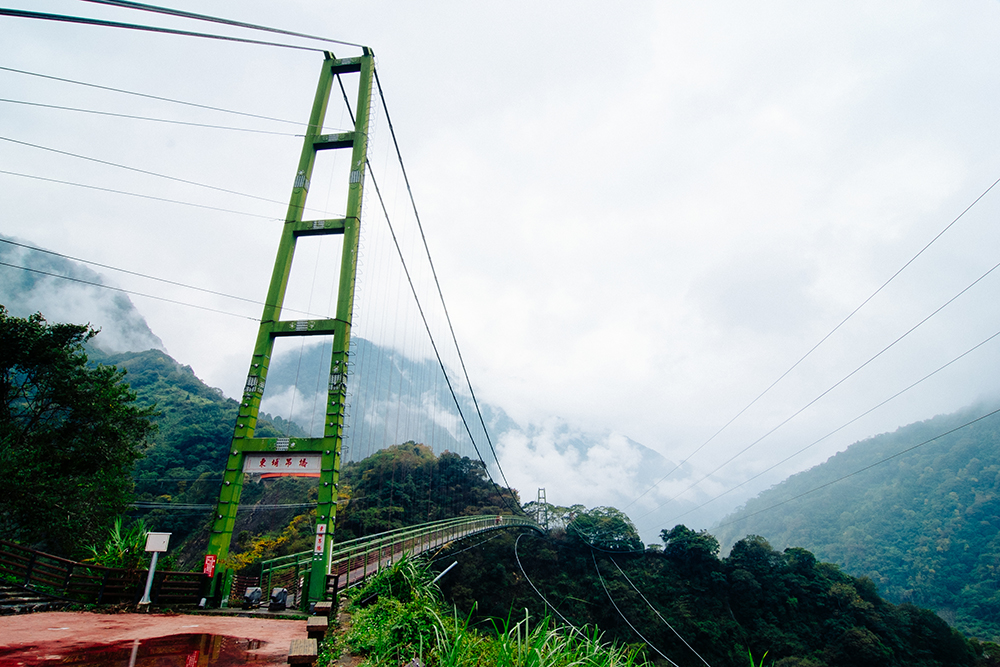
Just outside Dongpu is Dongpu Suspension Bridge, spanning a rugged, choppy stream and its deep, narrow valley. The walkway has a very high arch – you can’t see people on the opposite half – taking you thrillingly high above the canyon treetops. There is a sweeping view of the mountainsides across the river, with farmstead homes in seemingly gravity-challenging positions on the steep slopes.
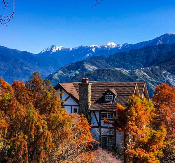
Back on Highway 21 at Tongfu, we traveled up to magnificent bird’s-eye vistas of the high mountains, valley bottoms far below, the road now twisting this way and that, a “beautiful!” moment around most every corner. There are numerous lookout points. My travel crew unanimously voted the section with Dongpu in view far, far below most spectacular, the village looking like a tiny child’s playset village.
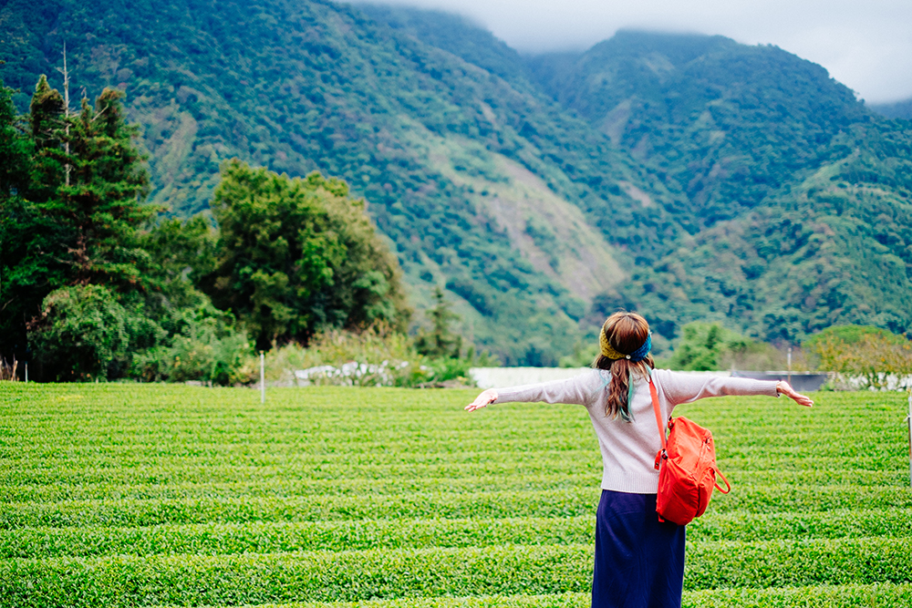
The Caopingtou Yushan Tea Plantation, nestled before the entrance to Yushan National Park, is home to a cluster of plateau-situated tea farms prized for premium-quality Yushan High Mountain Oolong Tea. Laced with short paths and longer trails, the area has terrific high-mountain views, including some of the Mt. Jade peaks. The farmsteads welcome individual visitors and sell tea in small allotments. Peak photo season is spring, when the rows of deep-green tea bushes are colorfully framed by the crimson blossoms on the thousands of local cherry trees.
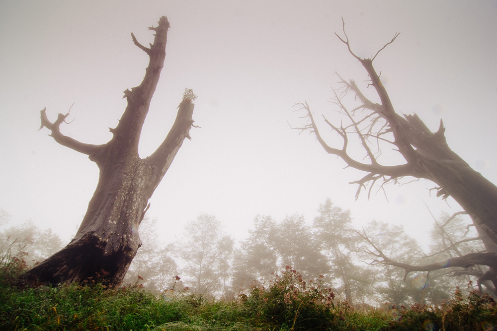
Higher up, after entering mighty, lofty Yushan National Park, we first visited the roadside Husband and Wife Trees, two giant side-by-side Formosan Cypress that survived a great forest fire sweeping the area in 1963. We followed this up with a relaxing, lengthy break at the attractive Tataka Visitor Center, which sits at the top of a pass amidst soaring, nicely scented coniferous trees at the highway’s highest point. The center offers a film on the park in English, print materials in English and English-speaking staff, info displays, a gift shop, a comfy café-restaurant – and breathtaking scenery.
Tataka was the end of the road on this trip. We turned around and headed back on a long yet contented 5-hour ride back to Taipei.
Hiking Mt. Jade
Hiking to the main peak of Mt. Jade (northeast Asia’s highest mountain) requires minimum 5-day advance booking; visit the national park website for online registration (www.ysnp.gov.tw). For those looking for easier day hikes, there are four trails spread out from the Tataka Visitor Center area. These vary from a quick one-hour jaunt through grassland above the center to a full-day outing that traverses the surrounding tall-forest wilderness. The center offers maps and advice on all park excursions.
Further reading on other sites:
Turbo Charged: 玉山- Yu Shan Weekend Trip Report
Nantou tours on KLOOK.COM
Sun Moon Lake One-Day Tour Departure From Taipei
Sun Link Sea Forest and Monster Village Day Tour from Taichung
About the author

Rick Charette
A Canadian, Rick has been resident in Taiwan almost continually since 1988. His book, article, and other writings, on Asian and North American destinations and subjects—encompassing travel, culture, history, business/economics—have been published widely overseas and in Taiwan. He has worked with National Geographic, Michelin, APA Insight Guides, and other Western groups internationally, and with many local publishers and central/city/county government bodies in Taiwan. Rick also handles a wide range of editorial and translation (from Mandarin Chinese) projects.

