Exploring the Southernmost Reaches of Nantou County’s Xinyi Township
TEXT / AMI BARNES
PHOTOS / RAY CHANG, VISION
Mt. Jade (Yushan) has beckoned many an intrepid adventurer to climb towards the heavens, but the island’s highest peak is far from the only reason to visit southern Nantou County in central Taiwan. Contained within the following pages, you’ll find blooming blossoms, big bridges, beautiful birds, balmy bathing, and other delights without neatly alliterative names.
Mountainous and sparsely populated, Nantou County’s Xinyi Township borders Chiayi County and Kaohsiung City to the south and Hualien County to the east. Vast tracts of its eastern landmass are protected wilderness areas threaded with challenging overnight treks, making it a much-loved destination among outdoor enthusiasts. The region is also home to members of the indigenous Bunun tribe, but the majority of the population – Bunun or otherwise – lives in a scattering of settlements clustered along Provincial Highway 21 in its western area. Many residents here are engaged in the production of tea, grapes, or plums, with agritourism forming a significant pillar of the region’s leisure industry. Whether you’re seeking high-elevation adventures or a quiet day on the farm, Xinyi Township is calling.
Yushan National Park
Reaching 3,952m above sea level, the summit of Mt. Jade is the highest point in Taiwan – the literal and metaphorical pinnacle of many a Taiwanese bucket list. The traditional two-day route, while easy by Taiwan mountaineering standards, calls for an overnight stay at Paiyun Lodge, not to mention the forethought and luck required to secure one of the coveted limited-number permits. If that sounds like a bit too much fuss, do not fret, Yushan National Park has a great alternative trail that can be done with minimal pain.
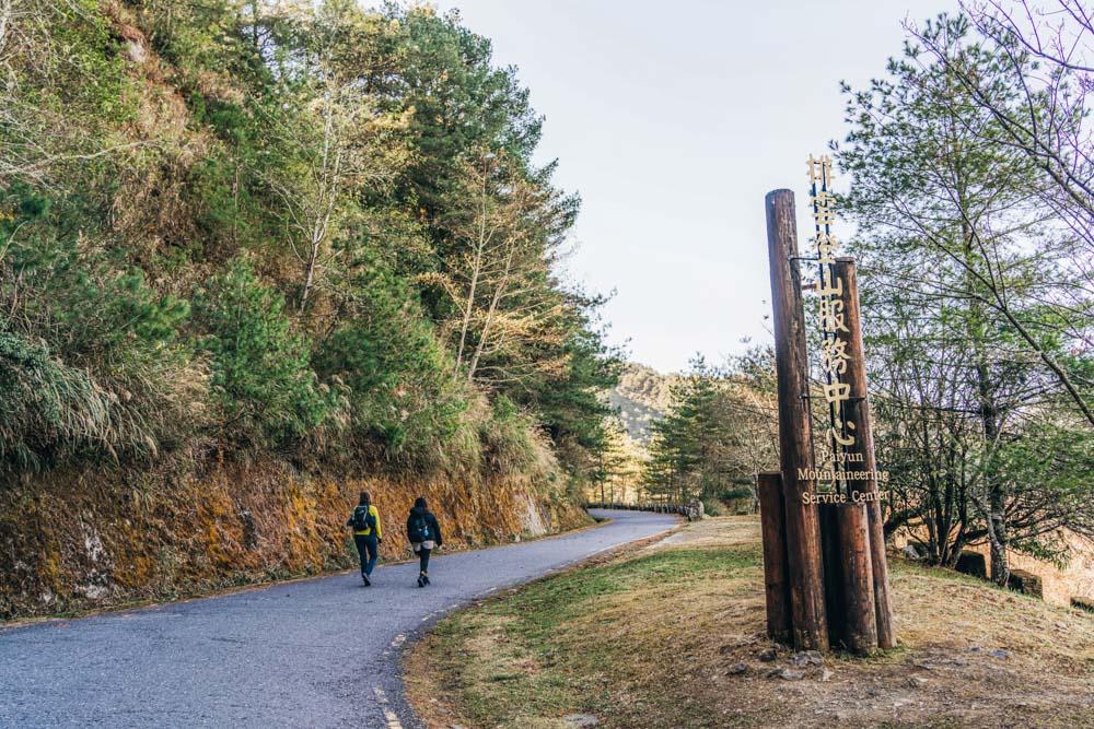
Before embarking on a description of this route and its attractions, it is worth pointing out that even for a casual day hike, preparation is essential. Once you arrive at Shangdongpu Car Park, close to the trailhead, there are no places to purchase provisions, so bring snacks and a water bottle (water dispensers are available at Paiyun Hiking Service Center and Lulin Cottage, both introduced momentarily).
Weather is another important variable. For every 100m of elevation ascended, there is a 0.6 degree Celsius drop, so expect temperatures significantly cooler than at lower reaches, but be prepared for changeable conditions. I’ve visited this part of the park twice, once on a cool and rainy July day, when coats were very much required, and once in early February (for this article) with bright sun that would have made it comfortable to wear a T-shirt. Speaking of sun, the effects of UV rays are experienced more acutely the higher up you go, and with parts of this trail being entirely exposed, sunscreen and a hat are a must. Finally, note that our hike begins at around 2,500m above sea level – the elevation that is generally considered to be when people first experience high-altitude illness, so be alert to the risks.
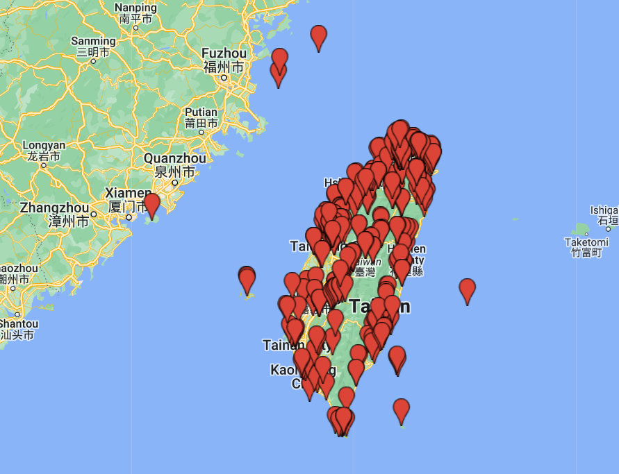
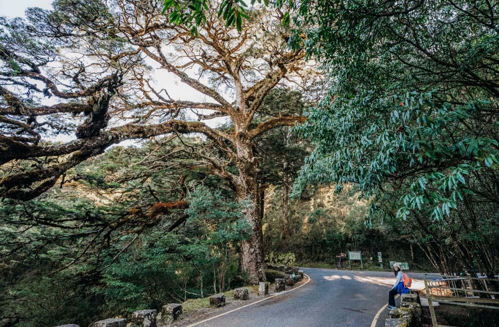
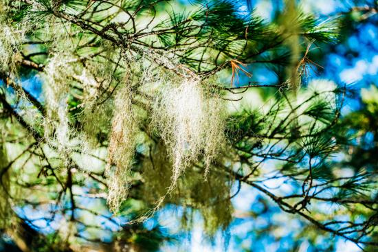
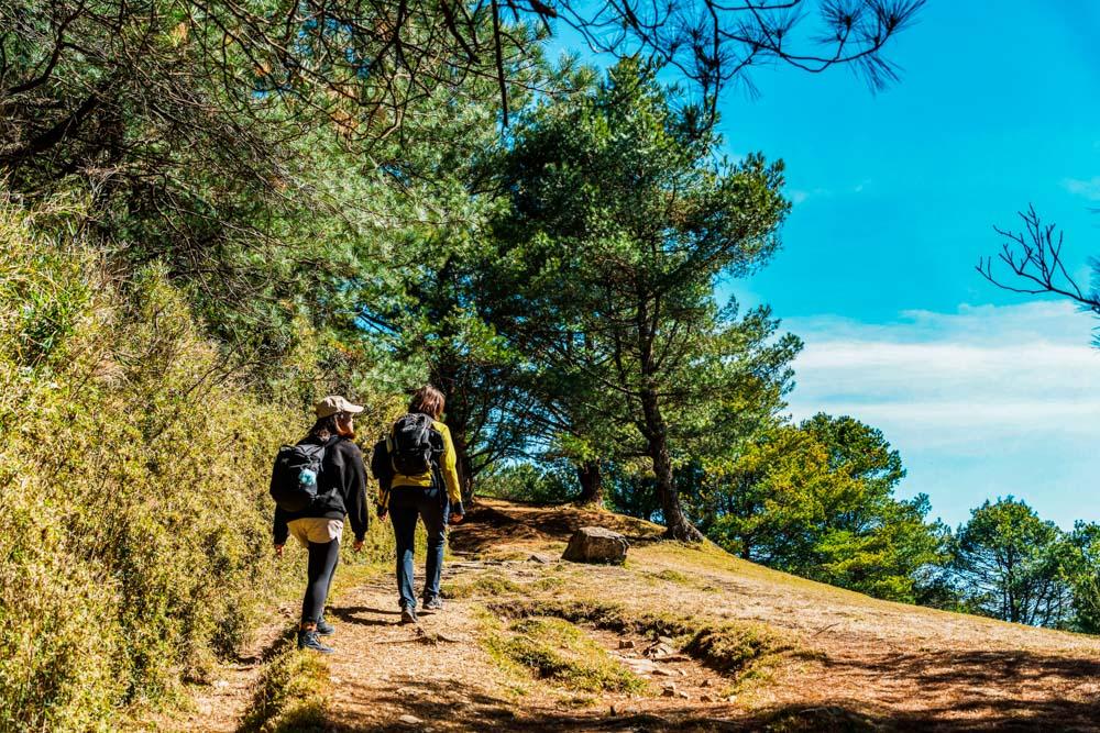
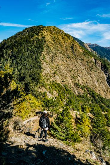
There are several interlinking trails just to the east of Highway 18 (Highway 21 ends and becomes the 18 at Tataka Visitor Center, a little to the north). From the Shangdongpu Car Park, hikers first follow asphalt-topped Nanxi Forestry Road to the Paiyun Hiking Service Center, where you have to report if you are hiking to the peaks of Mt. Jade and beyond; no mountain permits are needed for the trails introduced in this article. After a 30min uphill stroll, you will find yourself standing in the shadow of the Giant Taiwan Hemlock. This 600-year-old park parishioner guards the junction of Nanxi Forestry Road and Yushan Forestry Road, its sprawling boughs clad in green penny ferns and draped with tendrils of lichen. You can take either road for the loop route that includes Mt. Lulin and Mt. Linzhi, but turning right onto Yushan Forestry Road offers a marginally easier hike.
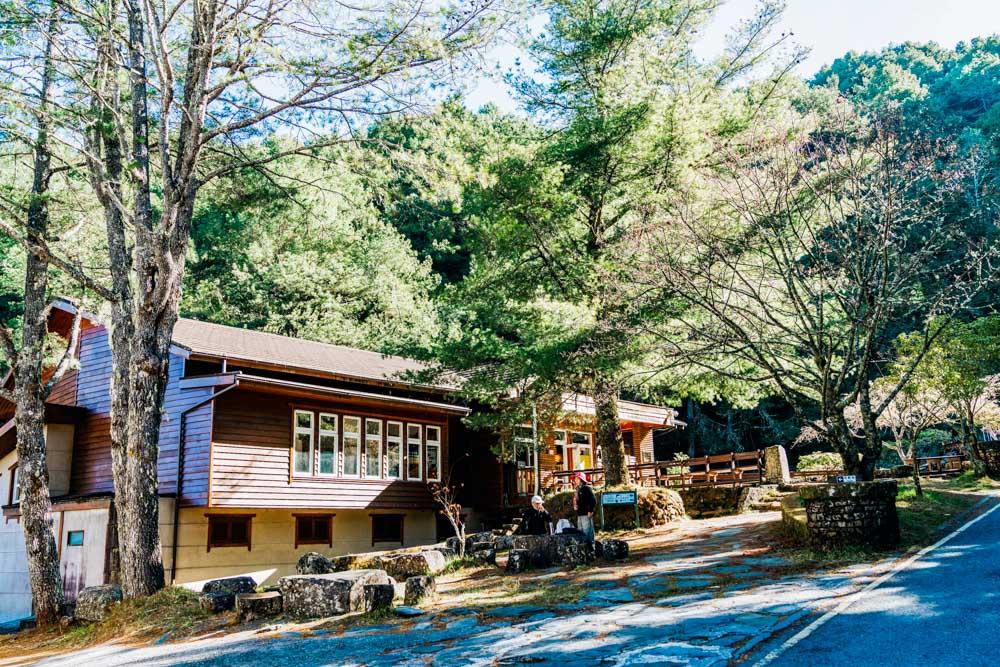
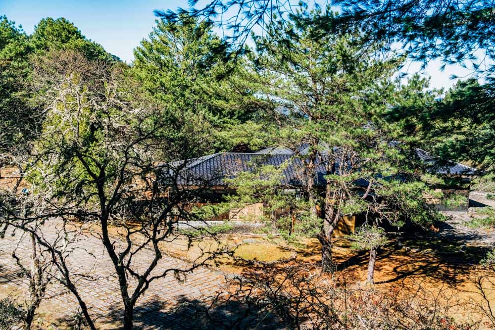
After turning right at the junction, walkers follow a gently ascending road padded with mounds of pine duff to reach the next point of interest, Lulin Lodge. This lodge was built in 1934 using Formosan cypress trees felled in the Alishan area to the west (which Highway 18 goes through). In the old days, this was the place where hikers stayed before taking on the final ascent of Mt. Jade. These days, only workers of the Forestry and Nature Conservation Agency (Forestry Bureau until 2023) have the privilege of staying here, while most aspiring summiteers bunk at Dongpu Lodge close to the Shangdongpu Car Park.
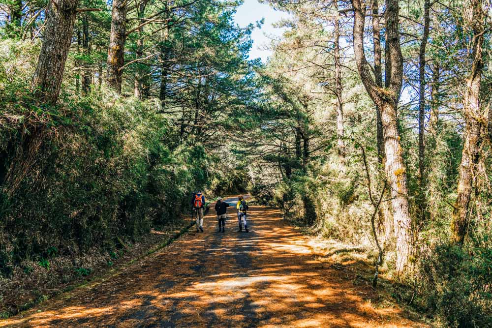
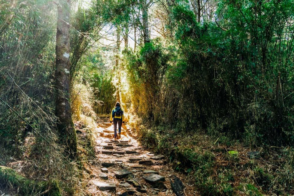
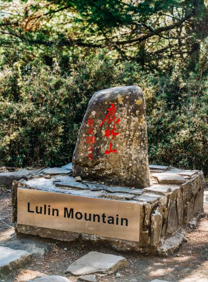
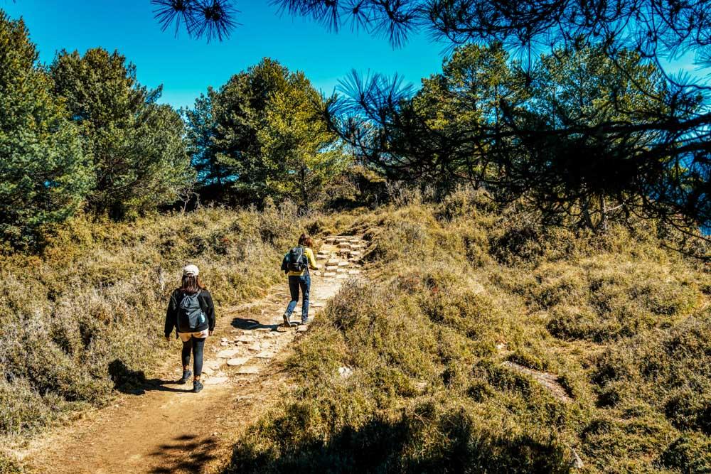
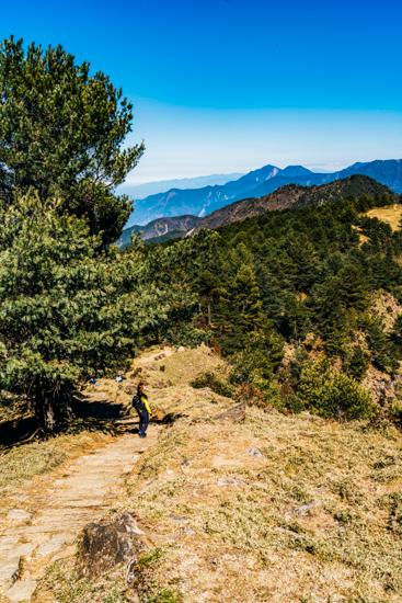
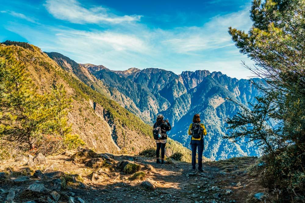
Moving onwards, you will soon reach the start of the proper trail. This is the last stop with a water dispenser and bathroom facilities, so it’s the perfect spot to pause for a while. From here, it’s a steep and steady 30min climb up steps lined with pine trees and arrow bamboo to the vistaless summit of Mt. Lulin (2,845m). The steps are steep, but whether lit with tree-filtered sunlight or shrouded in fog, the trail’s beauty is almost enough to make you forget the heaviness of your legs.
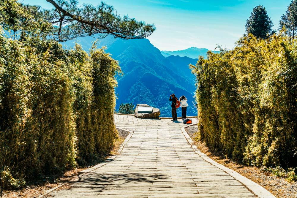
Where the trail from Paiyun Hiking Service Center to Mt. Lulin offers some wonderful walking through forest, the path leading onwards to Mt. Linzhi is a non-stop parade of scenic outlooks – at least in clear weather. On our Travel in Taiwan research trip for this article, we were welcomed by glorious sharp-cut sunlight picking out distant crags and crevices in high contrast, but on my earlier trip, a mud-to-heavens wall of not-quite-white fuzzed the edges of trees even five meters away. (You take the beauty you get on the day – such are the mercurial whims of high-mountain weather.)
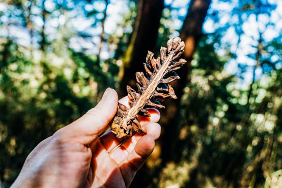
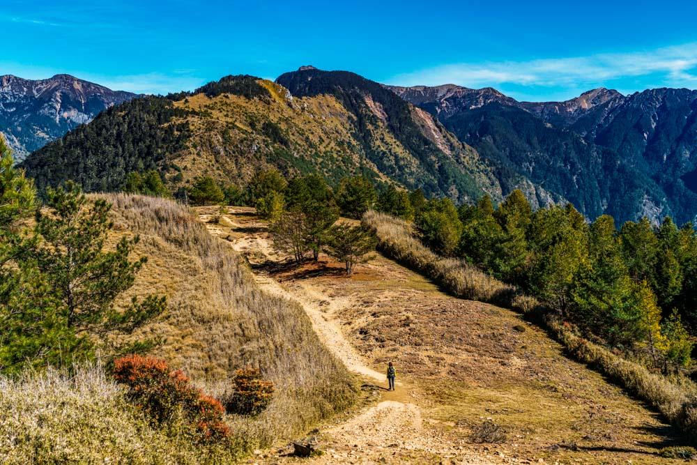
The well-marked trail cuts a meandering route down towards the Mt. Linzhi Saddle. Along the way, the most conspicuous flora species encountered are Taiwan red pines and Armand pines –the two easily distinguished by their differing cones, with the Armand cones being larger and more elongated in contrast to the rounder, stubbier cones of the Taiwan red pine. Depending on the season, you may also spot oxeye daisies, tall foxgloves in shades of pink and white, or the spiky-leafed and amethyst-hued Yushan thistle.
Flora
Armand pine 華山松
foxglove 毛地黃
oxeye daisy 法國菊
Taiwan red pine 台灣二葉松
Yushan thistle 玉山薊
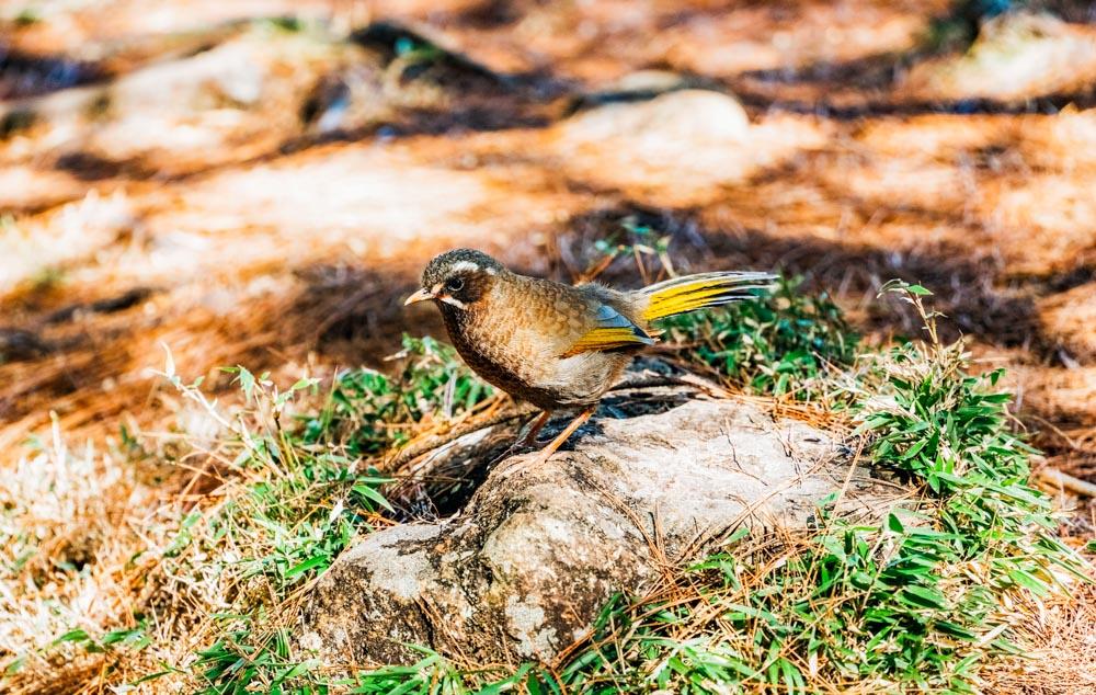
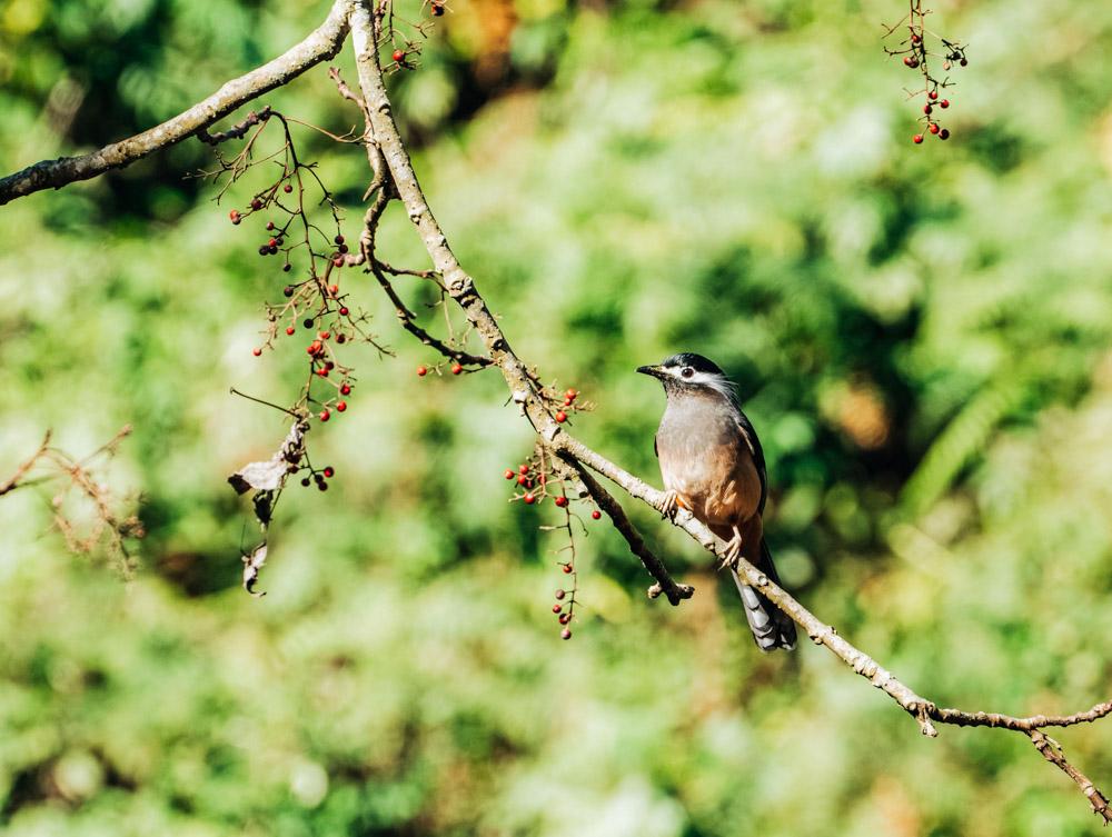
It’s not just botanists who will have lots to see. Birdwatchers and wildlife fans stand a reasonable chance of some close encounters with the local fauna. Sightings of the Eurasian nutcracker and the Taiwan-endemic white-whiskered laughingthrush are all but guaranteed. The former is chocolatey brown and black with a white speckled hood and crow-like caw, while the latter is identifiable by its yellow wing bars, white facial stripes, and brazen, inquisitive nature.
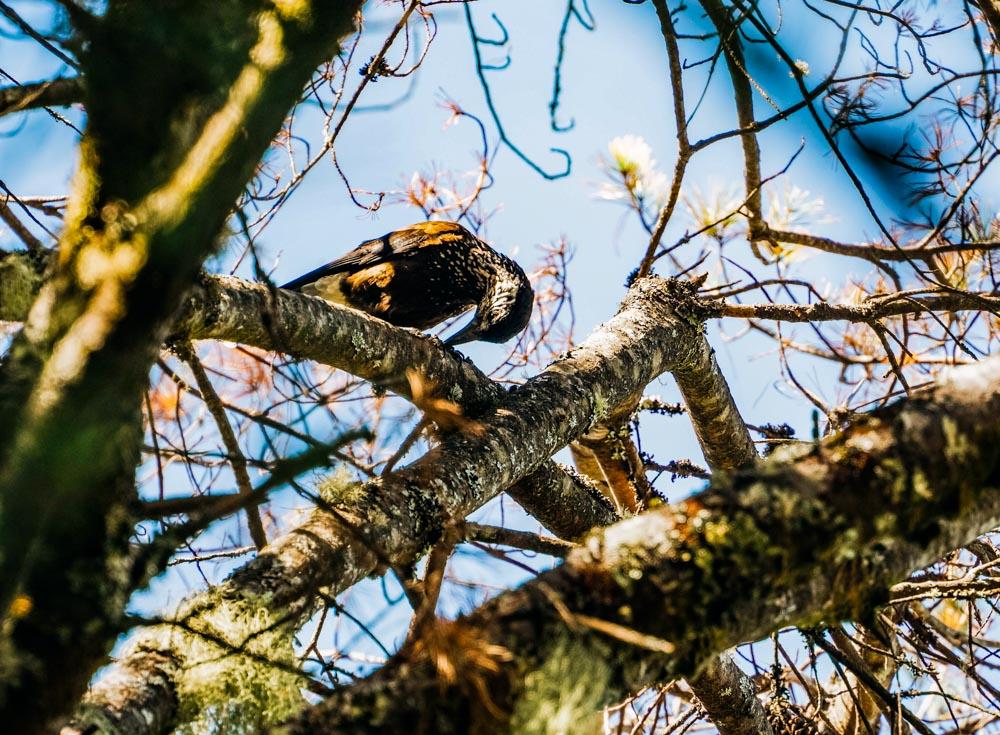
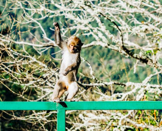
Muntjacs and Formosan rock macaques are also commonly sighted, while other species, including the Taiwan serow, yellow-throated marten, Formosan sambar deer, and Mikado pheasant may appear if you have luck on your side. On this most recent visit, my wildlife highlight was a flamecrest, a tiny endemic bird, the males of which sport the most adorable firey mohawks. And even if the creatures are being reticent, you can still divine traces of them in the landscape. Their prints stud the muddy bottoms of trailside alpine pools, and piles of poop dot the meadows – size is the key to identification, muntjac droppings are tic tac-esque, while sambar deer droppings are the size of a jumbo chocolate-coated peanut, and serow poop is somewhere between the two.
Fauna
Eurasian nutcracker 星鴉
flamecrest 火冠戴菊鳥
Formosan rock macaque 台灣獼猴
Formosan sambar deer 台灣水鹿
Mikado pheasant 帝雉
muntjac 麂
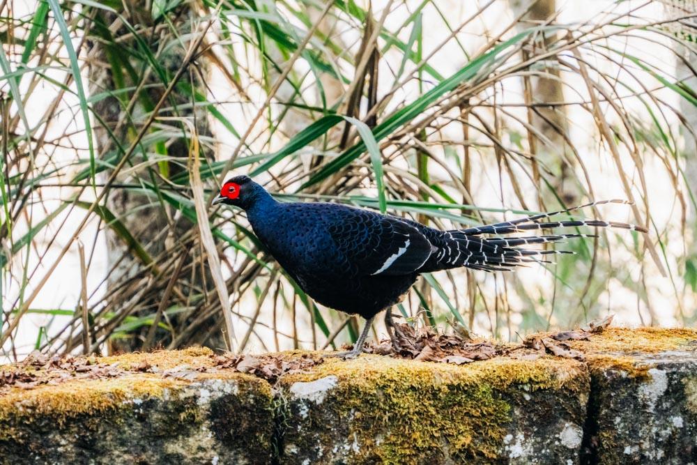
Swinhoe’s pheasant 藍腹鷳
Taiwan serow 台灣長鬃山羊
white-whiskered laughingthrush 金翼白眉
yellow-throated marten 黃喉貂
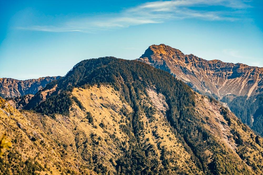
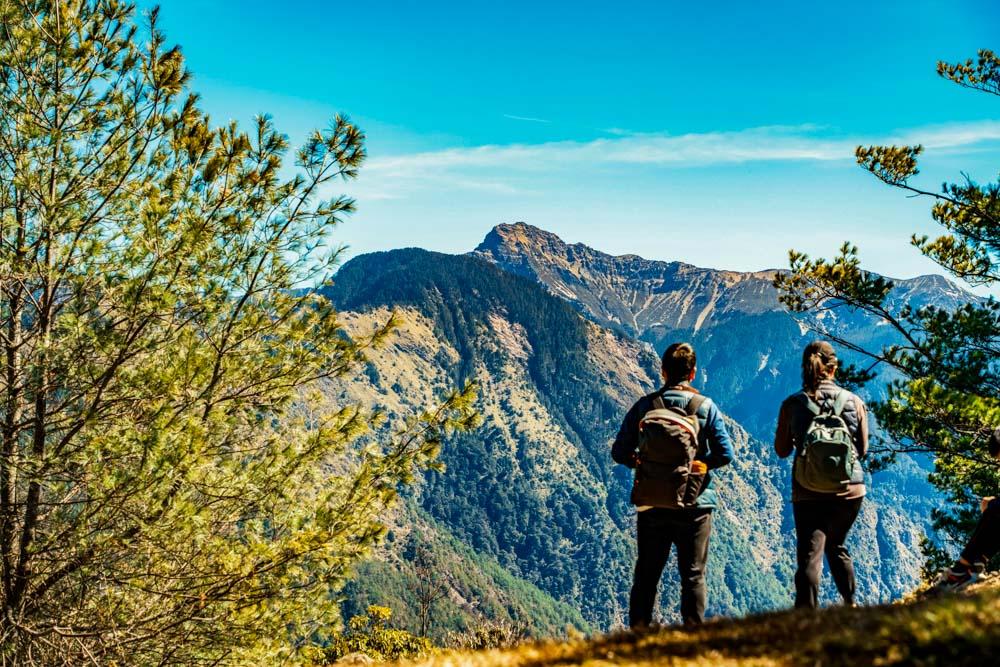
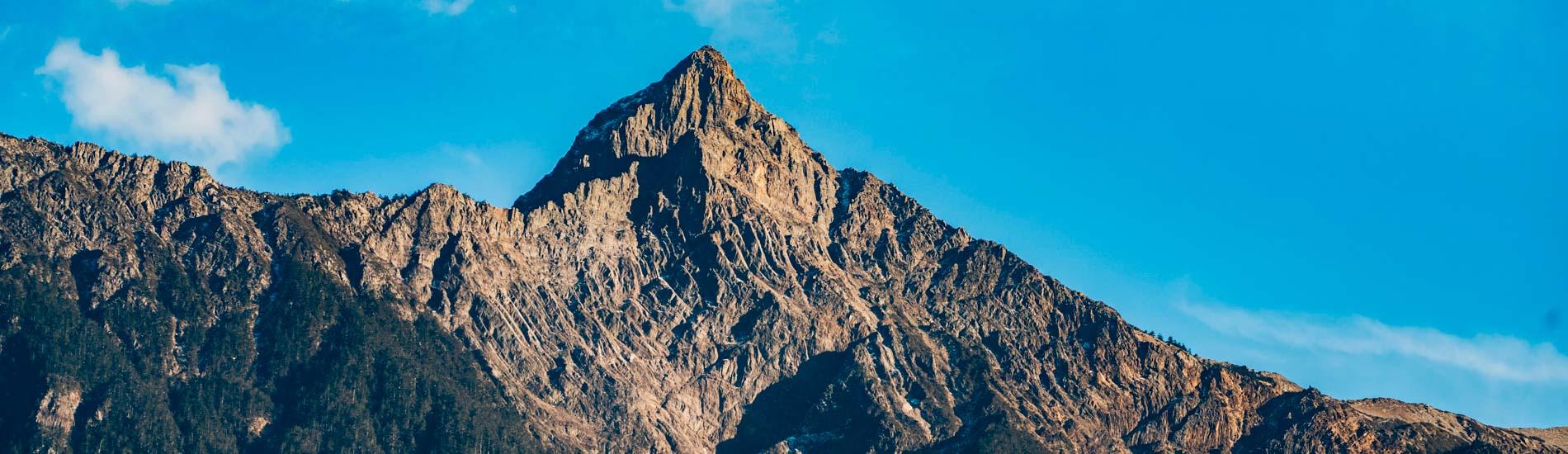
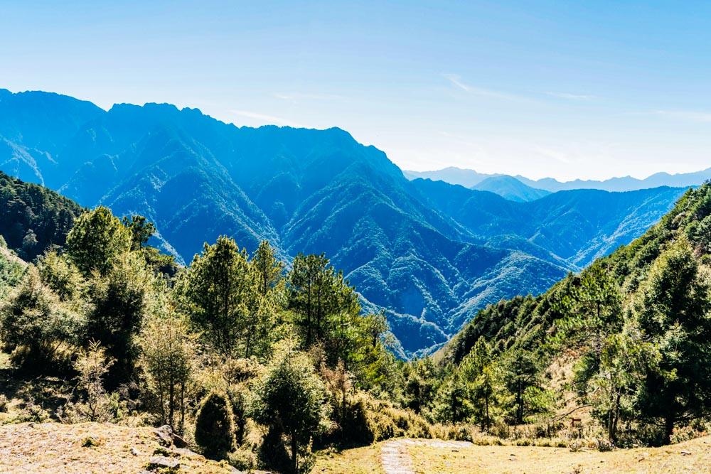
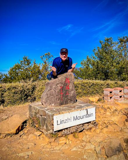
Of course, wildlife sightings are indisputably exciting, but the primary draw of the trail to Mt. Linzhi (2,854m) is its spectacular scenery. Whichever way you look, there are layers upon layers of peaks in view. In clear sunny weather, nearer slopes are painted green with the occasional patch of exposed rock, and distant peaks take on a bluish haze-filtered tint. For much of the walk, the towering rocky main summit of Mt. Jade dominates the eastward vistas. On our visit, its face was ribboned with a latticework of white following a dusting of snow a week earlier. In addition to Mt. Jade’s various peaks, several other of Taiwan’s highest mountains are huddled among the summits grazing the skyline.
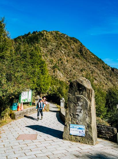
The descent from Mt. Linzhi is by far the steepest part of the day’s walk, and a test for tired thighs. The steps run down to rejoin Nanxi Forestry Road at the Yushan Trailhead (2,600m). There, you can hop on one of the shuttle bus services (NT$100 per passenger) and be swiftly returned to Shangdongpu Car Park.
Sights Along Highways 21/18
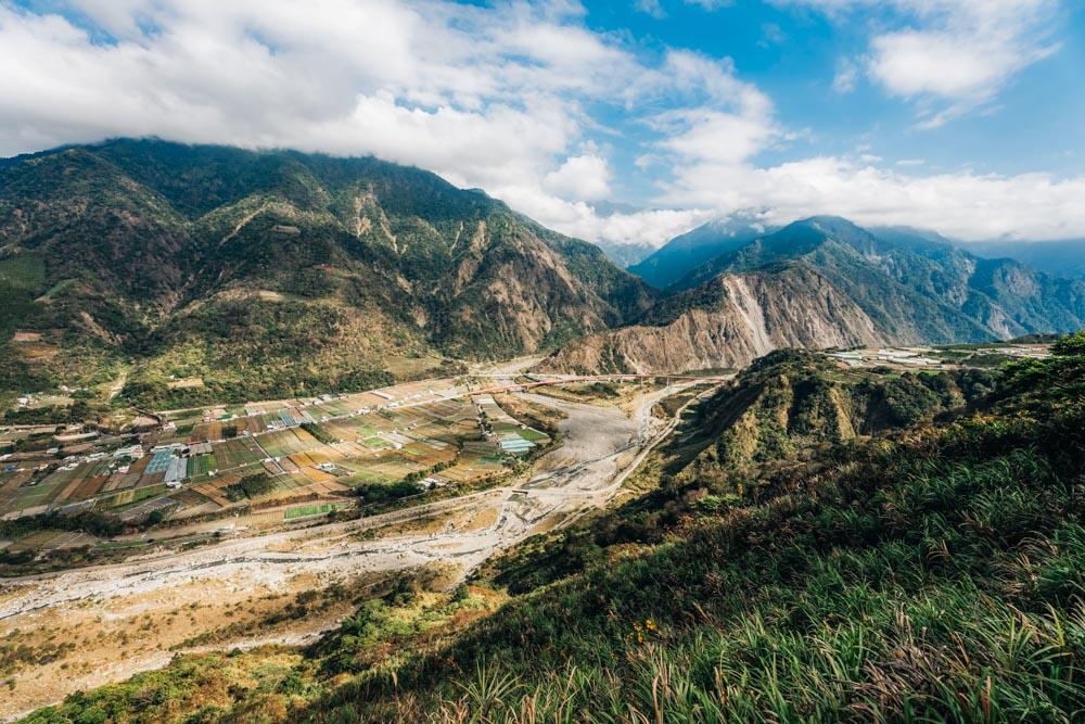
Anyone wishing to hike the trail detailed in the previous pages has two ways of arriving at the trailhead – either by following Provincial Highway 21 south from the town of Shuili or Provincial Highway 18 eastwards from the Alishan area. For those approaching from Shuili, the road sticks close to the Chenyoulan River as it passes through a string of agricultural settlements with both Mandarin and Bunun names. Vineyards, plum orchards, and cozy B&Bs are the most significant sources of income for residents in this region. Unfortunately, we visited three months before the spring plum harvest and about six months too early to enjoy the summer’s sun-sweetened glut of plump kyoho grapes.
The village of Heshe is the last pit stop with a convenience store before the waterway cleaves in two. The Chenyoulan River narrows as it approaches Dongpu village, while Highway 21 follows the Heshe River for a short distance before doubling back to climb up to the Caopingtou Yushan Tourist Tea Garden. From this point on – where there are yellow gates that are shut between 5:30pm and 7am to prevent traffic from entering the national park at night – the highway begins to ratchet things up a gear as it snakes its way through ever wilder terrain. Visible on your left-hand side as you pass kilometer marker 119, an Yushan National Park boundary marker announces your arrival into parkland, and five minutes later a pull-off spot offers a chance to stretch your legs and get an initial glimpse of Mt. Jade.
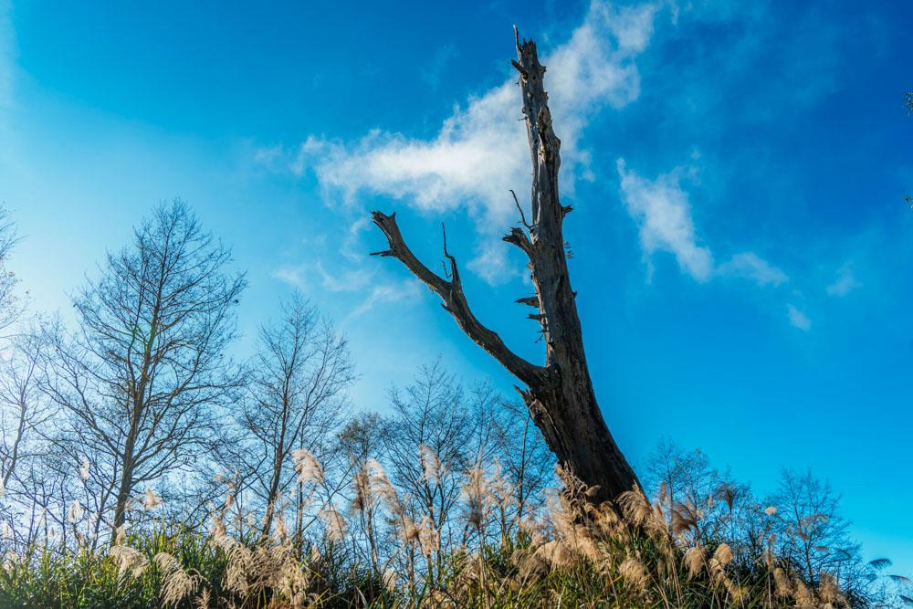
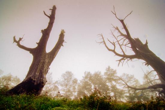
Wildlife sightings are common along this road, as evidenced by the many warning signs urging drivers to slow for furred and feathered friends. Our journey was brightened with the spotting of a Swinhoe’s pheasant and a monkey or two. A little further up, we saw a male Mikado pheasant – of NT$1,000-note fame – as we pulled into a parking lot beside the Tataka Husband and Wife Divine Trees site, where only the heartbroken and sunbleached skeleton of the wife tree remains standing. Before the husband tree fell (June 30, 2017), their interlocking branches gave the appearance of coupledom. This cute anthropomorphic description appeals to many, but an indigenous story offers an alternative version. According to that telling, the trees contained the spirits of a pair of ne’er-do-well magicians, eternally imprisoned within as castigation for disturbing the peace. Despite their captivity, the duo were still accused of affecting traffic in the vicinity, for which the 1996 lightning strike that cut off their entwined limbs was punishment.
Driving a further 10min uphill will bring you to the Tataka Visitor Center, which is a great place to stop if you’re interested in learning more about Yushan National Park. Bilingual displays cover topics including the history of mountaineering in the area as well as local indigenous culture, geology, and ecology, and the center is also home to the only restaurant for miles around.
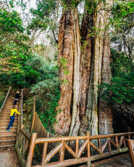
Our hike to Mt. Lulin and Mt. Linzhi started just a kilometer southwest of the Tataka Visitor Center at Shangdongpu Car Park. Continuing westwards on Highway 18 from there will soon bring you to the second boundary monument, marking your exit from the national park. Not far beyond this is the Lulin Divine Tree. While somewhat visible from the road, the true scale of this millennia-old Formosan cypress doesn’t become apparent until you’ve descended zigzagging steps and stand at its base. At 43m, it’s not the tallest tree in Taiwan – not even close – but it is believed to have the second-largest circumference. Record-breaking or not, there’s little more awe-inspiring than being in the presence of an entity that has seen a hundred human generations live and die.
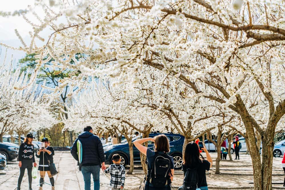
As mentioned in passing above, Caopingtou Yushan Tourist Tea Garden is a pleasant stopping point on Highway 21. Known for the 4,000-odd fruit trees that brighten the slopes, blossom season sees it transform from a peaceful tea-growing community to a floral fiesta. It gets so busy, in fact, that a park-and-ride system has been established to deal with all of the tour buses, and cars are siphoned off onto a side road to purchase tickets (NT$50 per person, and another NT$100 for parking).
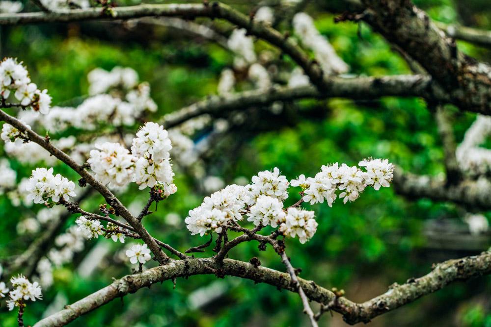
I have seen my fair share of blossom hotspots, so I was prepared to be underwhelmed, but the sheer volume of the blossoms at Caopingtou was incredible. We visited in the early days of February, so the plum blossom was the undisputed star of the show. Ramrod-straight branches shot up as thick and fluffy as an undocked lamb’s tail. Gazing up at the perfect combination of white petals against a clear blue sky, I enjoyed watching the honeybees half clambering, half flying from blossom to blossom, hind legs laden with golden pollen, and wings lazy from abundance.

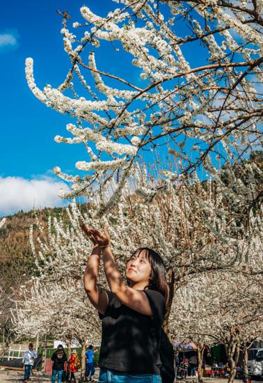
Later in the season, cherry trees take center stage. Even in early February, however, the early-blooming Taiwan mountain cherry trees were already adding patches of hot fuschia to the landscape. Throughout February and March, first Fuji, then Yoshino, and then double-layered varieties take turns to paint the hills. Each variety is beautiful in a different way – the blossom of the Yoshino cherry is large-petaled and elegant, Fuji cherries have the most exquisite color palette of pinkish-white petals converging around dusty-pink stamen with chartreuse leaves, and the late blooming double-layered cherries seem to be determined to end the season with a bang by producing so many petals that they resemble miniature tree-borne carnations.
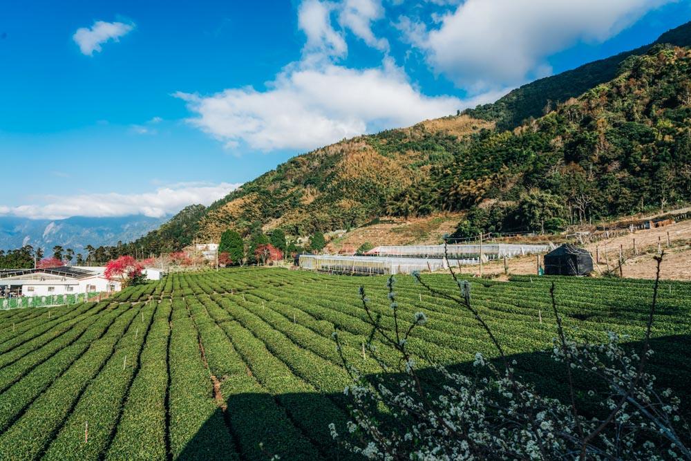
Sakura tourism is the number one activity at Caopingtou, but it is not the only draw. Visitors also head here to enjoy the aesthetically pleasing contrast of neatly lined tea plantations against a backdrop of high-mountain scenery. Farmers take advantage of the elevation’s cooler temperatures and year-round mists to produce Yushan Oolong – which according to connoisseurs is a delicate tea with a sweetly mellow and floral taste that is evocative of its growing environment.
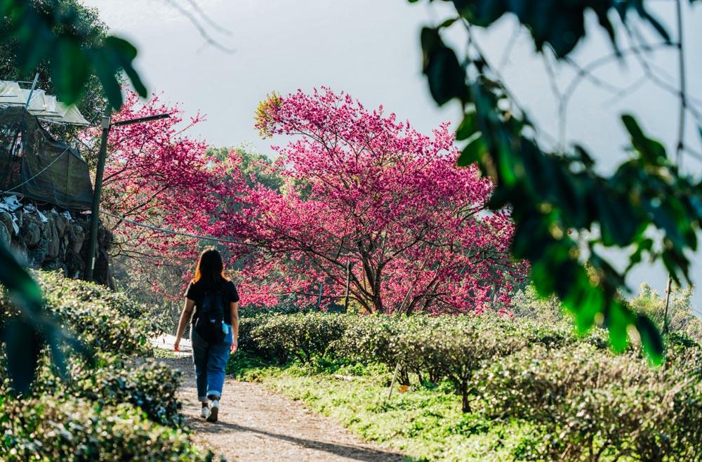
Another great place to appreciate tree blossoms in Xinyi Township is the village of Fengguidou. About halfway between Caopingtou and the town of Shuili, reached by a winding minor road on the west side of the Chenyoulan River valley, this spread-out village is said to produce around four-fifths of Taiwan’s greengage plums. The majority of the trees here are 30~40 years old, but the settlement’s celebrity is a characterful septuagenarian dubbed the Plum King, whose branches curve expressively downwards in stark contrast to its many betel-nut neighbors.
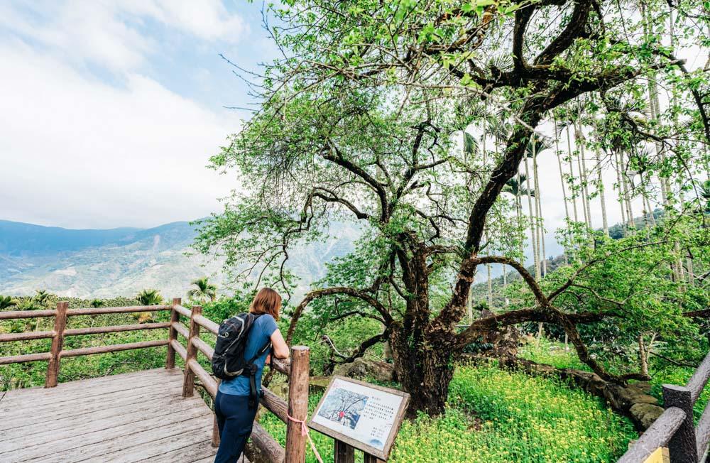
Come late December, the white-flecked canopies appear like misplaced snowdrifts in an otherwise green landscape. Such scenery is especially sought-after because it requires that the conditions be just so. Too much wind, an extreme cold snap, rain – these can all contribute to a season being a wash-out, and indeed, there was just a light dusting of petals clinging to the trees when we visited. But even if you miss out on the blossoms, Fengguidou is worth the trip. Year-round, there are enchanting views of distant mountains, and as spring arrives the focus shifts to harvesting and processing the crop. Visitors can enjoy the efforts of the farmers’ hard work by sampling plums that have been powdered, pickled, jellied, juiced, vinified, vinegared, and otherwise turned into all kinds of plummy treats.
Dongpu
An overnight stay somewhere along Highway 21 is a common way to kick off or conclude a foray into the Yushan National Park mountain fastness. One commonly chosen destination is the hot-spring village of Dongpu, which can be accessed by turning onto Nantou County Road 60 at Heshe village.
Dongpu is well-known among the local hiking community as the jumping-off point for one of Taiwan’s best-loved multiday treks – the Batongguan Traversing Trail. First constructed in 1875 at the request of Qing officials, it was one of several cross-island routes built in the wake of the 1871 Mudan Incident – a watershed moment in Taiwan’s history – with the intent of quelling restive indigenous communities. That trail quickly fell out of use, only to be rebuilt around 1920 by Japanese colonial authorities following a similar route and with similar animus. The entire journey, which cuts southeast from Dongpu as it makes its way over the county border into Hualien, takes eight days to complete and requires hikers to apply for permits and carry tents. The first four kilometers from Dongpu, however, can and should be done by almost anyone who loves hiking. The path climbs gradually upwards along mostly well-kept paths to Yunlong Waterfall, and in terms of the ratio of views enjoyed to the effort expended, this walk is hard to beat. That said, the trail is not entirely danger-free – walkers are required to exercise caution while crossing sections that have been wiped out by landslides.
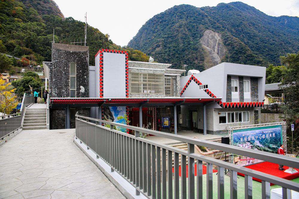
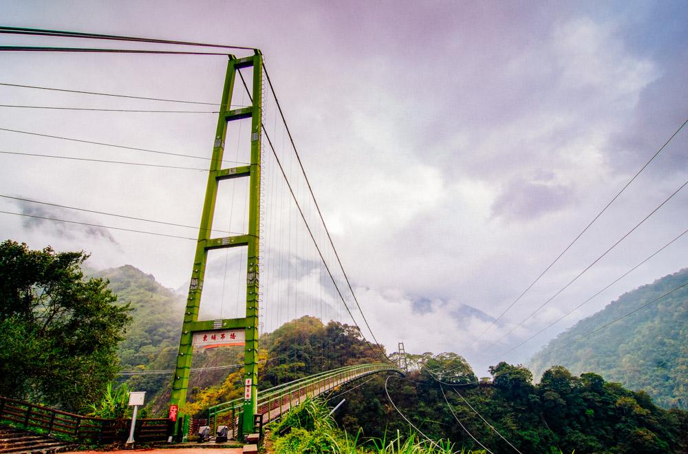
If you’re feeling the need for something less strenuous, you might want to enjoy the trail vicariously by reading about its history at the Dongpu Multifunctional Service Center – which is also where hikers setting off to complete the full route need to register. Another gentle adventure awaits in the form of the Dongpu Suspension Bridge. When it opened in 2005, this 128m-high, 200m-long span was the highest bridge in Taiwan. A pair of wild-boar sculptures sits at the northern entrance to the bridge, sly smiles suggesting they’ve seen many a boastful tourist defeated by the vertiginous drop visible through the bridge’s metal grillwork. Those bold enough to step foot onto the bridge will have their bravery rewarded with cinematic valley views.
As the evening draws in, what better way to soothe those travel-weary muscles than with a dip in a hot-spring bath? Dongpu’s thermal waters are clear and odorless, and their restorative properties have attracted bathers for a century or more. Like many hot-spring destinations, a small industry has grown to cater to out-of-towners, so you can now choose from a dozen or so hot-spring operations with a genteel, Japanese kind of aesthetic. And with many of the hotels allowing guests to pay an NT$250~300 fee to use their spring facilities, even travelers on a budget get to end their day with a satisfying soak.

___________________________________________________________
About the author