Jiufen hiking? The small mountain town of Jiufen is one of the top tourist draws in northern Taiwan, attracting visitors who come to walk through its alleys, sample snack foods, buy souvenirs, and snap pictures of the Pacific coast off in the distance. Many leave without knowing that there is much more in store close by: several easy-to-follow trails that lead to lofty peaks, including Mt. Jilong and Teapot Mountain, bringing you through an amazing landscape of verdant mountains and blue sea.
Text: Richard Saunders; Photos: Richard Saunders, Vision
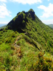
Teapot Mountain
Summer and fall are the best times to explore this stunning corner of the island, when the weather is at its best. Note, however, that the sun is blisteringly hot from June to September, so be sure to bring sun protection and lots of water. In October and November, when the weather has cooled off somewhat, sunny days are still common, and the steep hillsides are covered with an ocean of beautiful silvergrass blooms.On a map, the five main peaks in the area around Jiufen and the neighboring town of Jinguashi don’t look extraordinary. Yet despite the fact that the highest is significantly lower than many hiker-visited peaks in Yangmingshan National Park, on nearby Taipei’s north side, the dramatic airiness, the feeling of vast, wide-open spaces, and the vertical drops and angular rocky towers make the mountains here appear high and imposing. This exuberant flourish of pointy summits (which, like those in Yangmingshan, are of volcanic origin) looms over Jiufen and Jinguashi, twin historic mining settlements overlooking the northeast coast, and walking along the rocky ridges on a fine, sunny day, with a vast swath of blue ocean laid out far below, is one of the most exhilarating outings in the Taipei area.
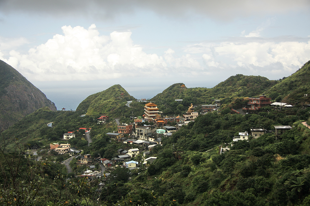
Jinguashi Village
The easiest of the surrounding peaks to summit is towering Mt. Jilong (587 meters), which is located immediately northeast of Jiufen. To get to the trailhead from Jiufen’s Old Street area, just follow the main road through the town (County Highway 102) further uphill a few hundred meters until you see stone steps on the left side of the road. There are two paths to the summit. The more direct route is a 40-minute slog up steps all the way; a newer trail branching off to the left a few minutes’ walk from the trailhead meanders more gently around the flank of the mountain, giving views over a wide sweep of ocean far below and beyond. It joins the main path below the summit, which commands magnificent 360-degree views.
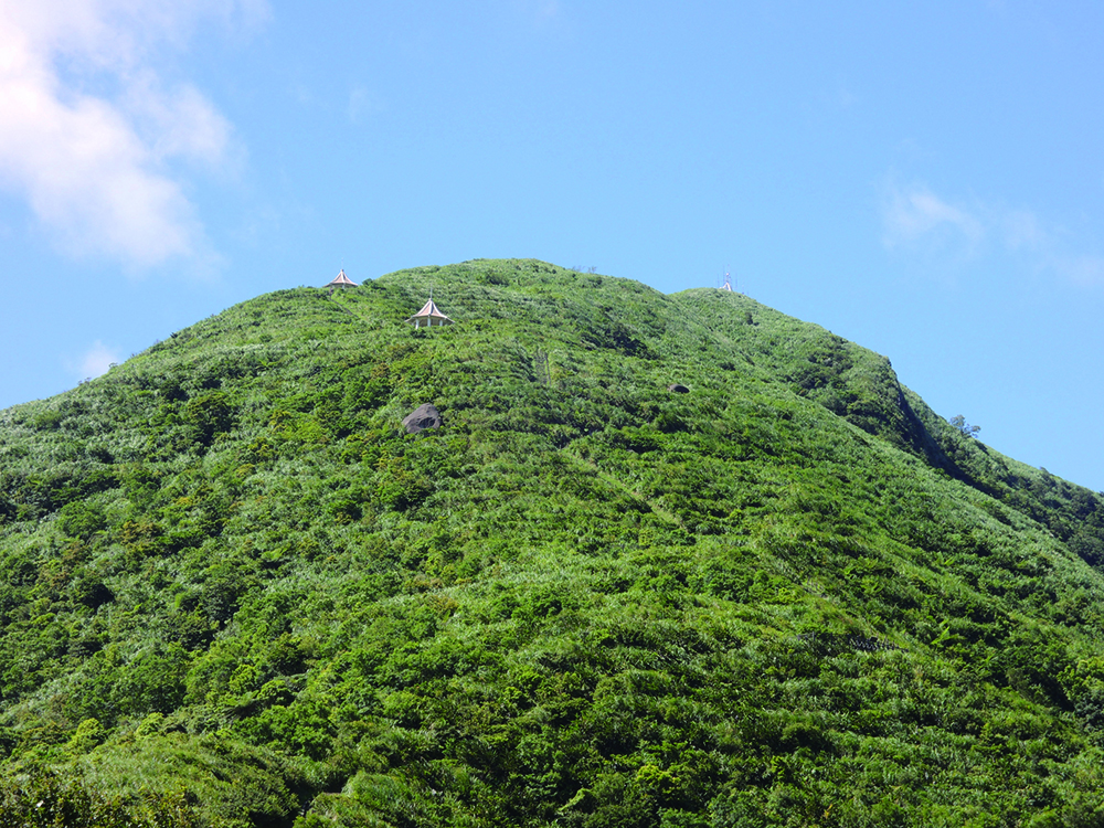
Mt. Jilong
The best base for exploring the hills around Jinguashi is the Gold Ecological Park (www.gep.ntpc.gov.tw), in the center of the town, which has narrow alleys of quaint old houses also well worth exploring. Getting to the rocky pinnacle of Teapot Mountain (599 meters), east of Jinguashi, is a slightly more strenuous proposition than climbing Mt. Jilong, but even if you don’t make it up to the summit rocks (not suitable for less-experienced hikers, as the peak is bounded by sheer cliffs, and the climb is rough and very steep in places), walking even just part of the way gives you fantastic views over Jinguashi and the coastline. The mountain is one of the most eye-catching landmarks in the area, and it really does look like a teapot from some angles (the Chinese name is actually “no-ear teapot mountain,” for the “teapot” has no handle or “ear”).
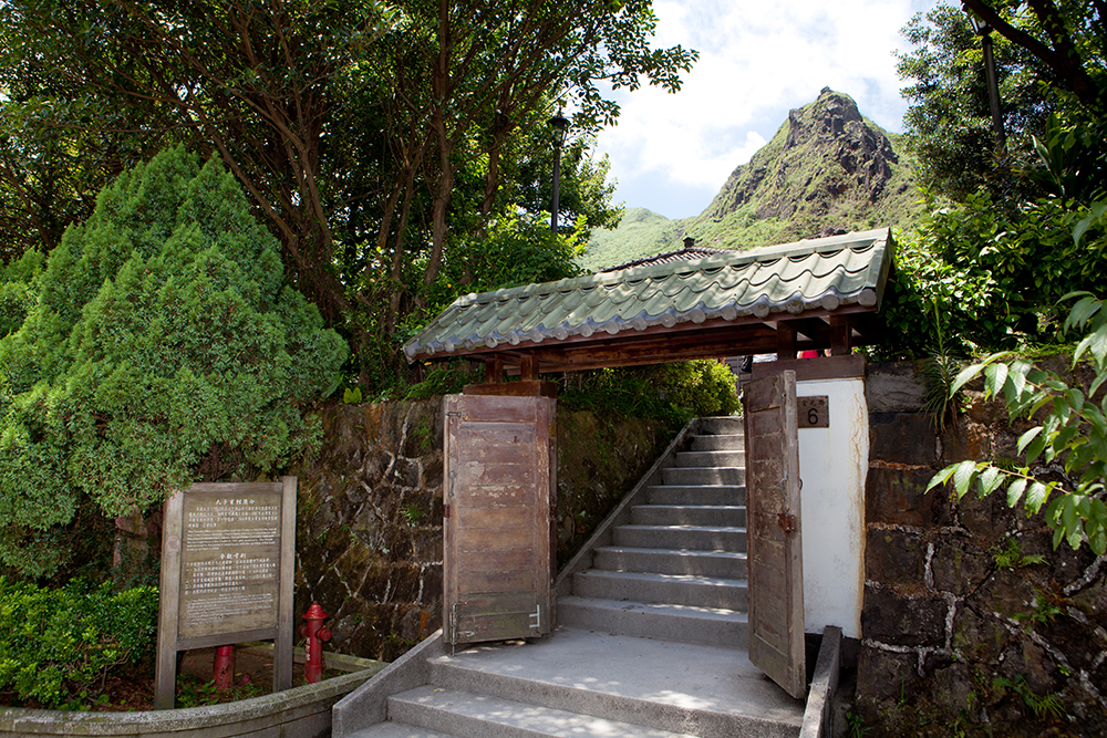
Gold Ecological Park
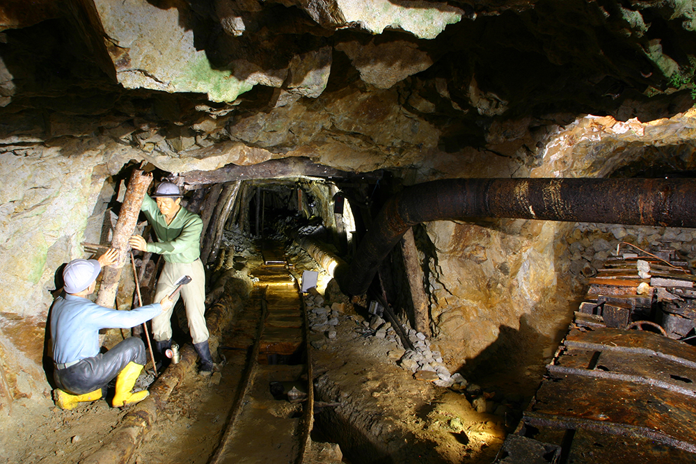
Gold Ecological Park tunnel
After entering Gold Ecological Park, pass the popular Benshan No. 5 Tunnel (where visitors can explore the first stretch of an old gold-mine tunnel), and turn right at a set of steps immediately after crossing a stream. Turn left at the top of the steps onto a minor road, which climbs to the trailhead of the path to the top of Teapot Mountain. The trail is a steep 20-minute climb that ends at the base of the summit rock, where you can rest and enjoy the breathtaking views from a pavilion.

Teapot Mountain
If climbing the area’s striking peaks doesn’t appeal, several shorter hikes around Jinguashi offer a rewarding combination of natural beauty, exceptional views, and historical interest. Turn right off the main artery through the Gold Ecological Park shortly before Benshan No. 5 Tunnel, onto a stepped trail which climbs between Japanese-style stone lanterns and through a pair of torii (ceremonial gates) to the remains of Jinguashi Shinto Shrine. The temple, built by the Japan Mining Company in 1933 to commemorate its taking over of the Jinguashi mines, was dedicated to the three kami spirits of metallurgy, and originally included a main hall, a prayer hall, and a pavilion for performing rituals. Largely destroyed following Taiwan’s retrocession to Chinese rule in 1945, all that remain are lines of tall stone pillars and stone foundations, which curiously give it the vague appearance of a Greek or Roman ruin. A photo of the shrine as it looked during the Japan-rule era can be found in the park’s Environmental Building.
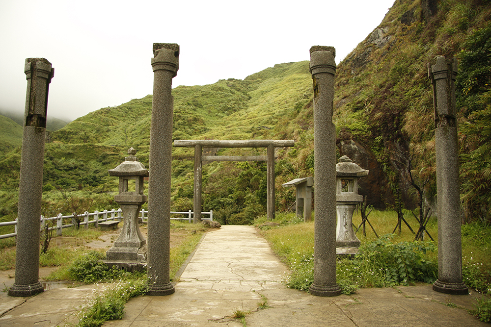
Jinguashi Shinto Shrine
Past the shrine ruins, the stepped trail continues uphill for some distance. Turn right onto a level track contouring the grassy mountainside, and on the left is one of the area’s open-cast mines, now open to the public, with several interesting info boards explaining mining processes. Follow the steps on uphill, and at the top is a narrow road which gives access to the area’s highest peaks: Mt. Banping, Mt. Canguangliao, and Mt. Cao. A clearly signposted trail follows the ridge to the top of craggy Mt. Banping; the way is quite easy, but the ground is rocky and strong walking shoes are needed. Another, easier, option is to proceed along the road, and then turn left at the large sign announcing Diaoshan Historic Trail, a wide, surfaced trail that drops into the beautiful valley below Mt. Caiguangliao (738 meters), the highest peak in the area. If hiking this route, rather than climbing all the way back up the same way, it’s easier to follow the road at the end of the trail for 2 kilometers to Mudan Railway Station, a small stop on the main railway line between Taipei and the city of Yilan.
During the Second World War, Jinguashi was the site of the notorious Kinkaseki POW camp, where allied troops captured by the Japanese during the fall of Singapore and other Southeast Asian regions were put to work in the copper-rich mines in the area. Over 1,100 POWs were interned here, many of whom died under appalling conditions before the camp was closed in June 1945 and the prisoners moved to another POW camp for the remaining months of the war. All that remains of the camp, which was located just north of today’s Gold Ecological Park, is a bridge, a small fragment of wall, and a gatepost (marked by a plaque inscribed in English and Chinese). The remainder of the original site is now home to a small park with a memorial wall inscribed with the names of the POWs and a monument where a memorial service is conducted in their honor each year, on the second Sunday in November.
It’s just a short walk downhill from the Kinkaseki site, along the winding road or newly-cut trail, to what is perhaps Jinguashi’s most unusual landmark, the Golden Waterfall. The stream here is laden with minerals exposed during mining operations on the hillside above. Over the years they have been deposited on the bedrock of the many-spouted cascade that plunges down the grassy hillside, turning it bright orange. It’s a great spot for photos, but don’t try paddling in the stream, as the high levels of heavy metals and other toxic chemicals naturally present in the earth of the hills above are dissolved in the water.
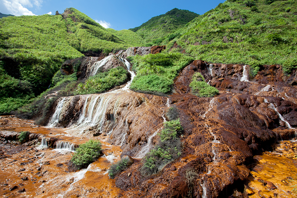
Golden Waterfall
Jiufen and Jinguashi can be reached directly from Taipei in just over an hour by taking bus no. 1062 from MRT Zhongxiao Fuxing Station (departures every 20-30 minutes 6am to 9pm). Alternatively, take a train from Taipei to the town of Ruifang, and then a bus (departures every few minutes) from the bus stop immediately in front of the station to Jiufen/Jinguashi. To get to the Golden Waterfall by bus, and then perhaps down to the coast at Shuinandong (location of two-colored sea waters) and then east along the coast to such places of interest as Nanya (strange rock formations), Bitou Cape (hiking trail on cape), and Fulong (golden-sand beach), take the Taiwan Tourist Shuttle (www.taiwantrip.com.tw) bus on the Gold Fulong Route (day tickets NT$50; buses leave from Ruifang every half hour on weekends/holidays, and once an hour on weekdays).


