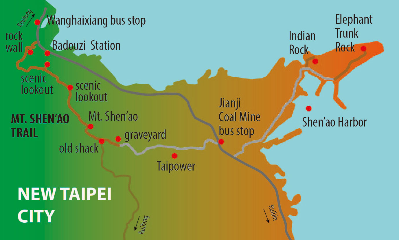
Here is a weekend hike that is not too technical, but has great scenery. To get to the trail head you have two convenient options. From Taipei take a train to Keelung and transfer to bus No. 103 (bus stop opposite the entrance to the old railway station building). Get off at the last stop, Wanghaixiang. If you follow the highway further on for a few hundred meters you’ll see the new Badouzi Railway Station. The second option is logically taking the train there. From Taipei take a train to Ruifang and there transfer to the train that goes to Badouzi (this is now the terminal station for the Shen’ao/Pingxi Branch Line).
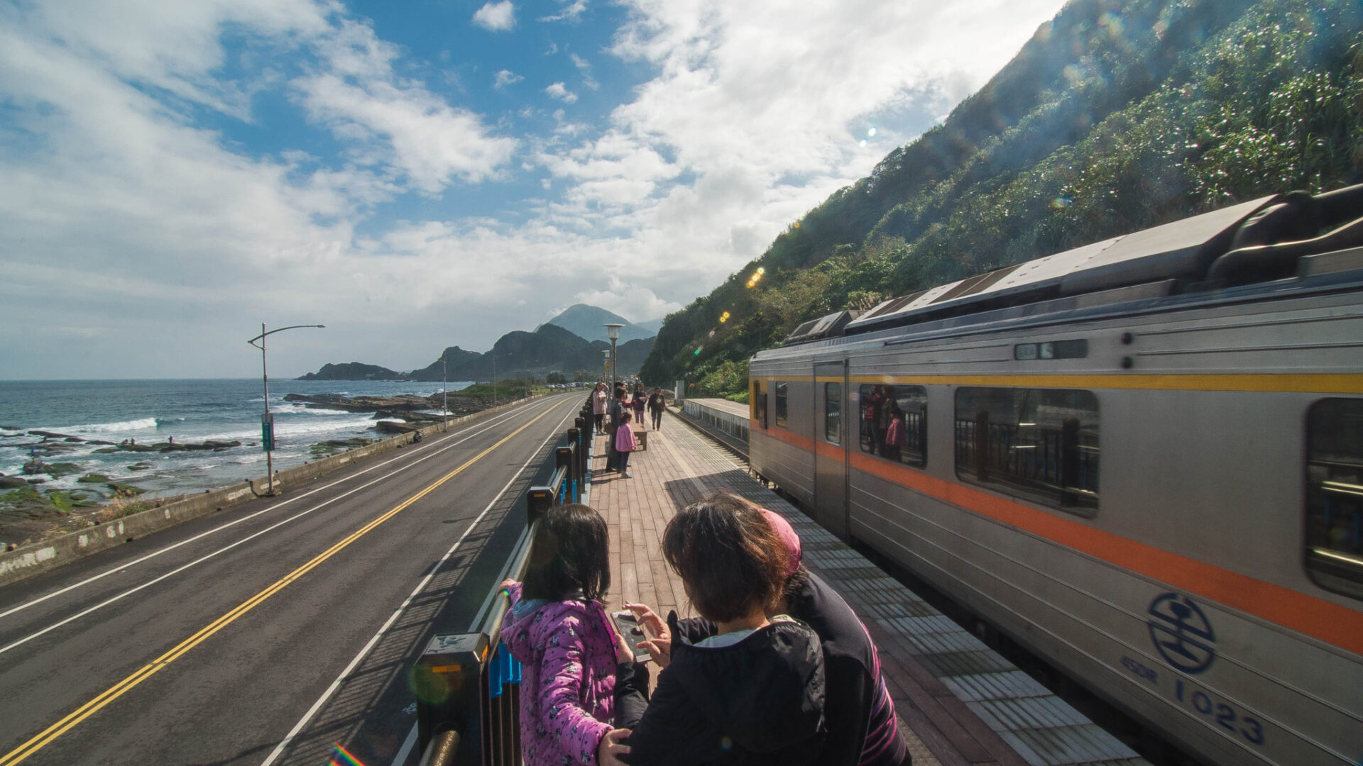
Badouzi Railway Station
The start of the trail up to Mt. Shen’ao is somewhere between the bus stop and the railway station. You immediately come to the tracks of the railway line. Cross the tracks with caution! Then you pass a little patch of land were someone grows vegetables.
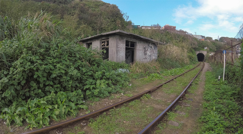
Shen’ao Branch Line
Head further up and you come to an imposing rock wall. The trail goes right by and around the wall (no need to climb over it).

Below the rock face
Then you’ll be walking up the mountain slope through tall grass. The trail is easy to follow, but it can be wet and slippery. I wouldn’t recommend going there on a rainy day. Looking back you have great views over Badouzi and you can see Keelung Islet in the far distance.

Badouzi and Keelung Islet
Then you walk through a section with trees; the trail goes up and down, but it’s never too steep. If you see a fork to the left, turn left and you’ll come to a great lookout spot where you have a 180-degree view of the coast. Don’t get greedy and get too close to the edge!

View from Scenic Outlook Spot (1)

View from Scenic Outlook Spot (2)
Back to the fork go further on. Now the trail is taking you to dense vegetation, trees, fern, bamboo. During sunny days the shade is welcome, but prepare for mosquitos…
About 90 minutes after starting the hike you’ll come to the peak of Mt. Shen’ao. It’s just 170m high, but the view over the coast is dramatic.Continue on and you’ll soon come to an open area with tall grass. There is an old shack and during the late summer you can see many day lilies blooming here. Turning right before the shack you can walk all the way to Ruifang on a pleasant dirt road.

Tall-grass area

Old shack
Continue on and you’ll soon come to a graveyard area. Then, just follow the asphalt road downhill, passing property on the right that belongs to Taipower (I guess). When you come to a right bend in the road, take the stairs down (a shortcut).

Graveyard area
You’ll soon reach the main highway. Turn right and then take the next left to get to Shen’ao Harbor. The harbor is busy with tourists on good-weather weekends. There are many boats equipped with seats for anglers, so I guess you can hire those boats for deep-sea fishing. Just follow street along the harbor until you see a huge rock in the distance. It looks like the face of an Indian (Chief’s Rock) for further away. On the right side, across the open water you can see Mt. Jilong and, to the right of the mountain, Jiufen. You can walk to a grassy area below the Indian’s face and have a look at the coast and peculiar rocks there.
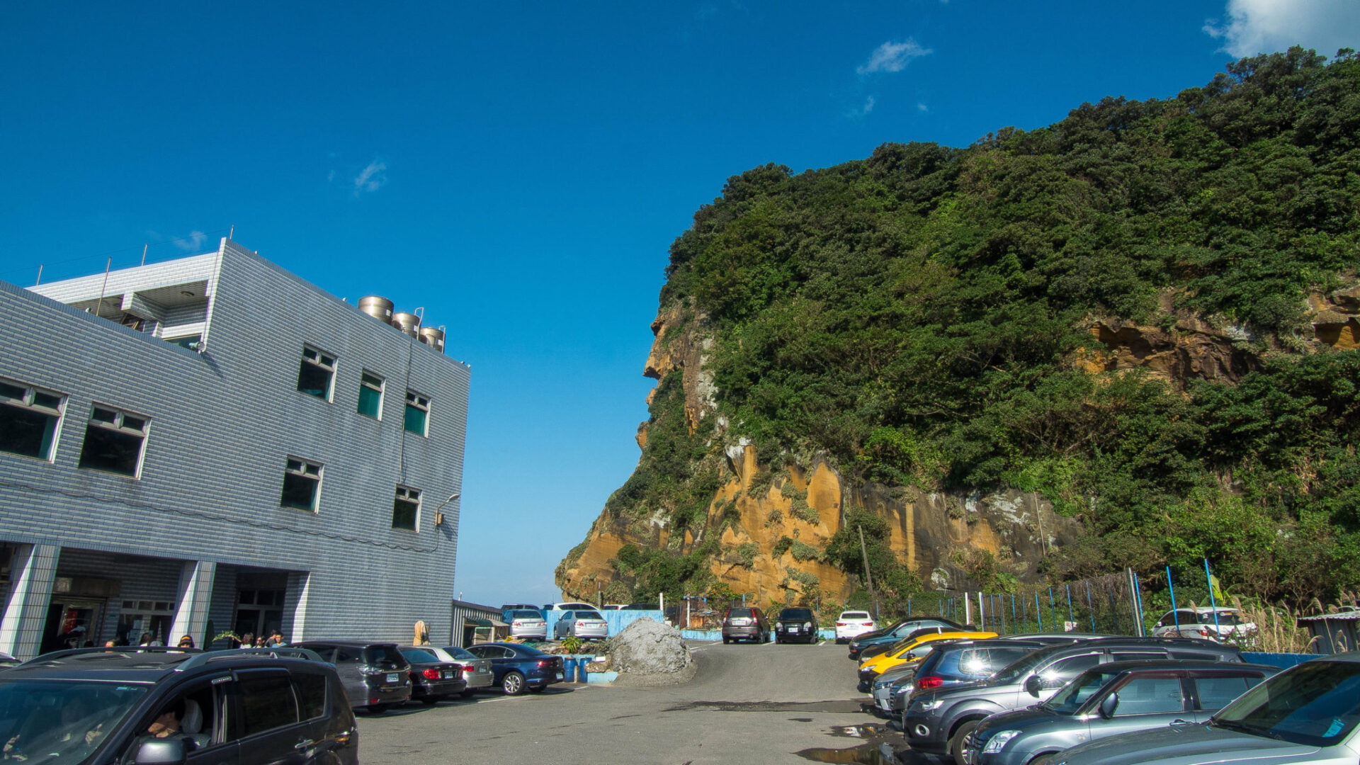
Indian (Chief) Rock
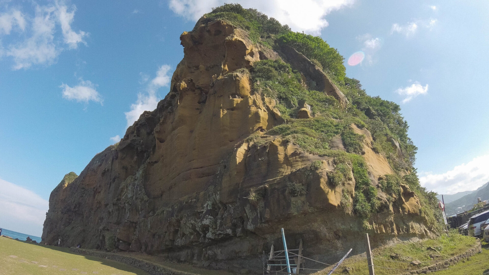
Indian (Chief) Rock from below
To get to Elephant Trunk Rock you need to circle the rock on the right side. There are some vendors at the entrance to the rock area. On the weekend we went, there were hundreds of tourists there (the typical crowds attracted by harbor side restaurants, not hikers). It was a bit of a circus there. Probably much quieter on weekdays. Lot of photo opportunities there with mushroom rocks galore. The center of attention is of course the Elephant Trunk Rock. The resemblance is striking. If you dare you can walk on top of the trunk and make photos there. Telling from the people I saw doing that, just a matter of time until someone slips. It’s about 30 meters down to the water. Not a good idea… Be safe!
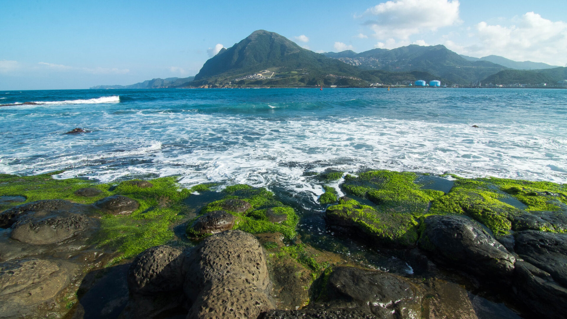
Mt. Jilong and Jiufen in the distance
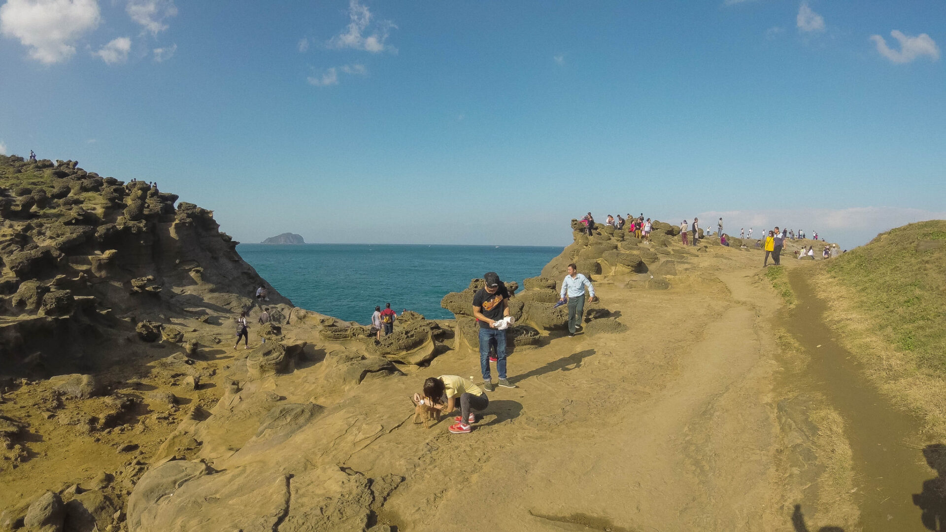
On the way to the Elephant Trunk Rock
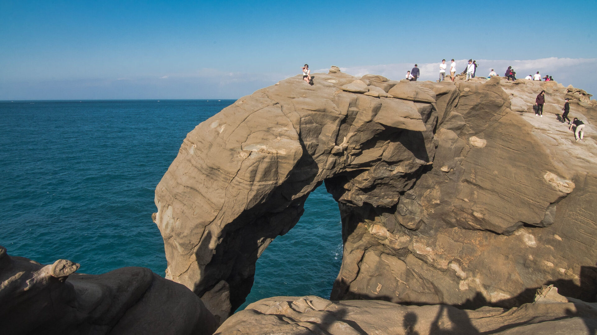
Elephant Trunk Rock
And that was our weekend hike to Shen’ao. I liked it because it’s not too difficult and the scenery is amazing. The only thing I didn’t like were the crowds at the harbor and at the Elephant Trunk Rock. 🙂
(Text, images, and video by Twelli)
Also read:
Josh Ellis Photography: Shen’Ao Elephant Trunk Rock (深奧象鼻岩)


