There is a wide range of options when it comes to hiking in the greater Taipei area. The Sandiaoling Waterfall Trail is one of the most popular routes for casual hikers since it’s easily accessible, doesn’t present major challenges, goes through a lush natural environment and has as scenic attractions three pretty waterfalls along its way.
Text: Richard Saunders; Photos: Twelli
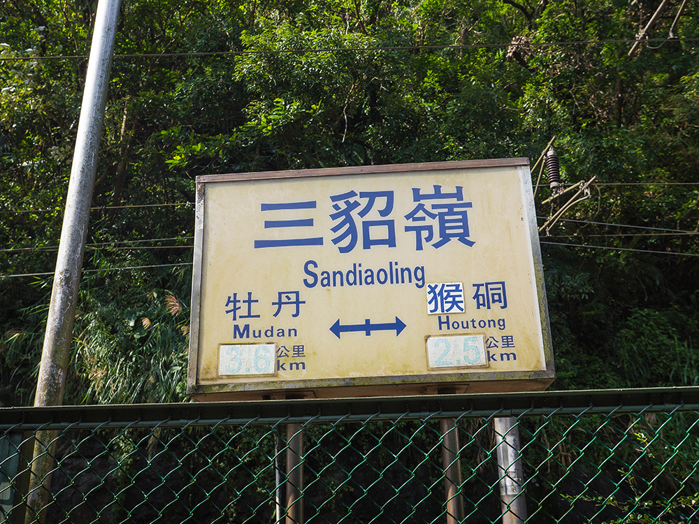
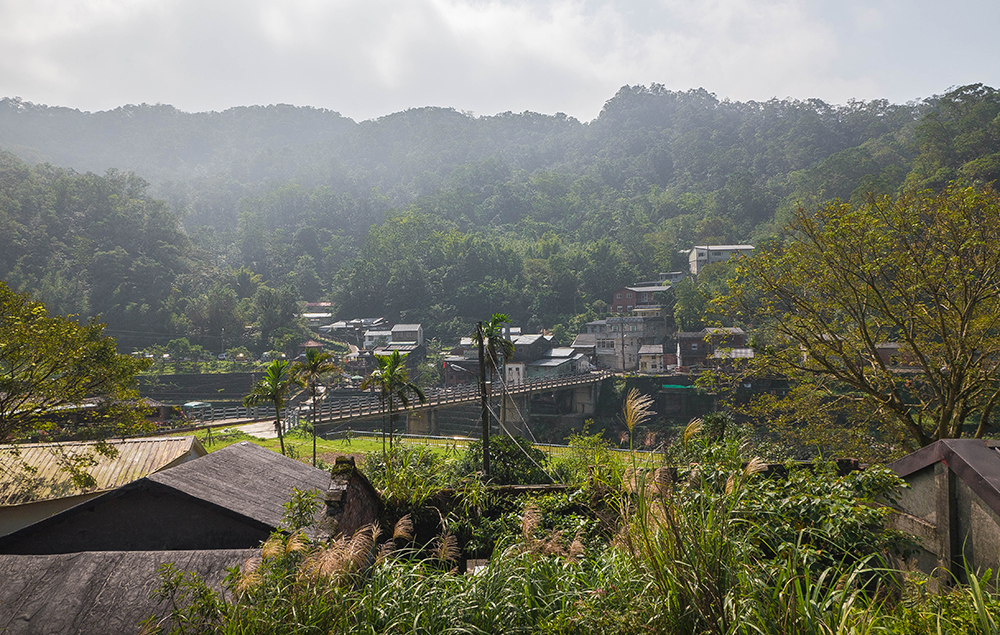
Pingxi Railway Line
A ride along the Pingxi Branch Railway Line, which runs through a picturesque valley about an hour from the Taipei City center by train, is a great way to spend a day of relaxing sightseeing, but it also provides easy access to some of northern Taiwan’s finest day walks. Hikers are truly spoilt for choice in this area: there’s enough to discover hereabouts to keep an explorer happy for a week of hikes or more. If there’s only time to do one of the easier routes, however, the choice is pretty clear. One of the finest short hikes within day-tripping distance of Taipei is the stunningly scenic Sandiaoling Waterfall Trail.
More good news is that nowadays the trail is suitable for families too, since several once slightly tricky stretches of the route have been eliminated, bringing the outing within the range of most walkers. One thing to bear in mind when planning a visit to this area, it must be noted, is that it rains a lot in this corner of Taiwan. Therefore, check the weather forecast before heading out, to avoid spending a day walking in rain and on a muddy path – although the three waterfalls do, of course, look their best after a downpour!
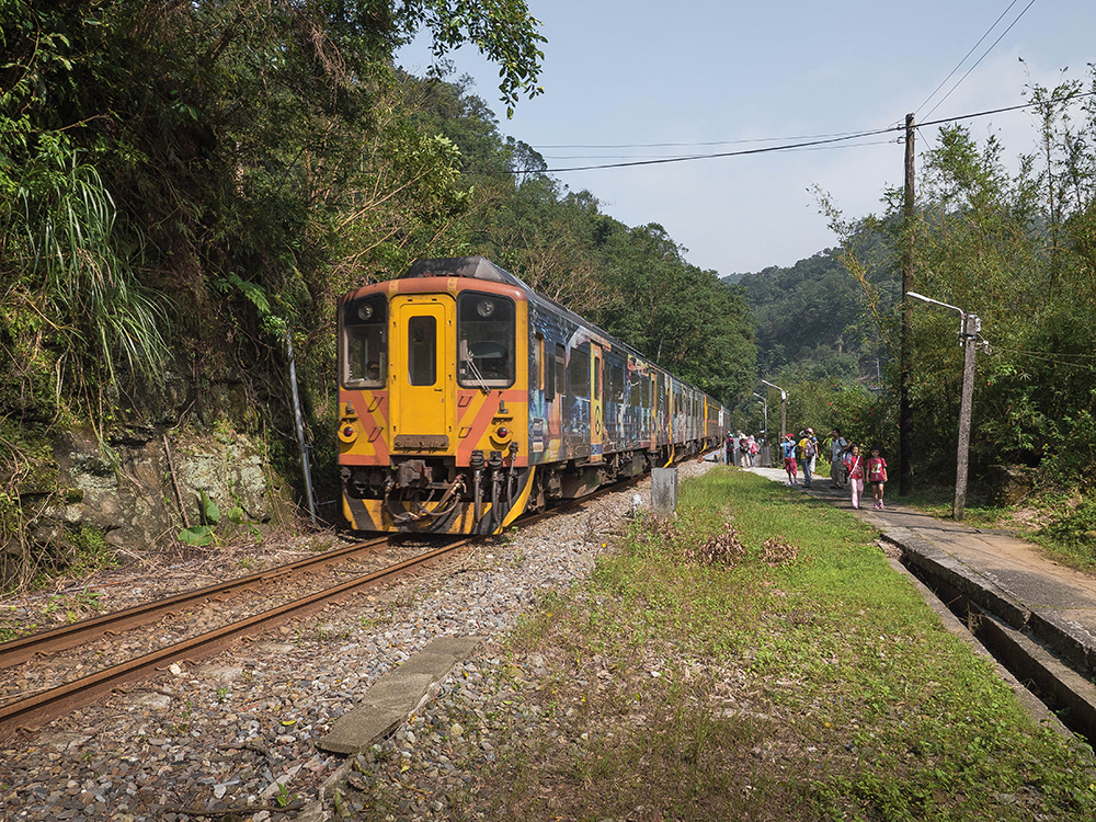
Sandiaoling Station
The Sandiaoling Waterfall Trail is named for three waterfalls, Hegu, Motian, and Pipa Cave, all three impressive, though the first can only be seen from a distance. It takes about two hours to get from Sandiaoling Railway Station to the last of the falls (about 2.5km). From there, most casual hikers will take the same route back, but for more adventurous types there are two alternative routes, one to Dahua, the next station on the Pingxi line, the other to Houtong, the station before Sandiaoling when coming from Taipei.
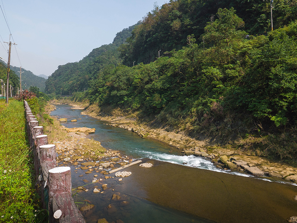
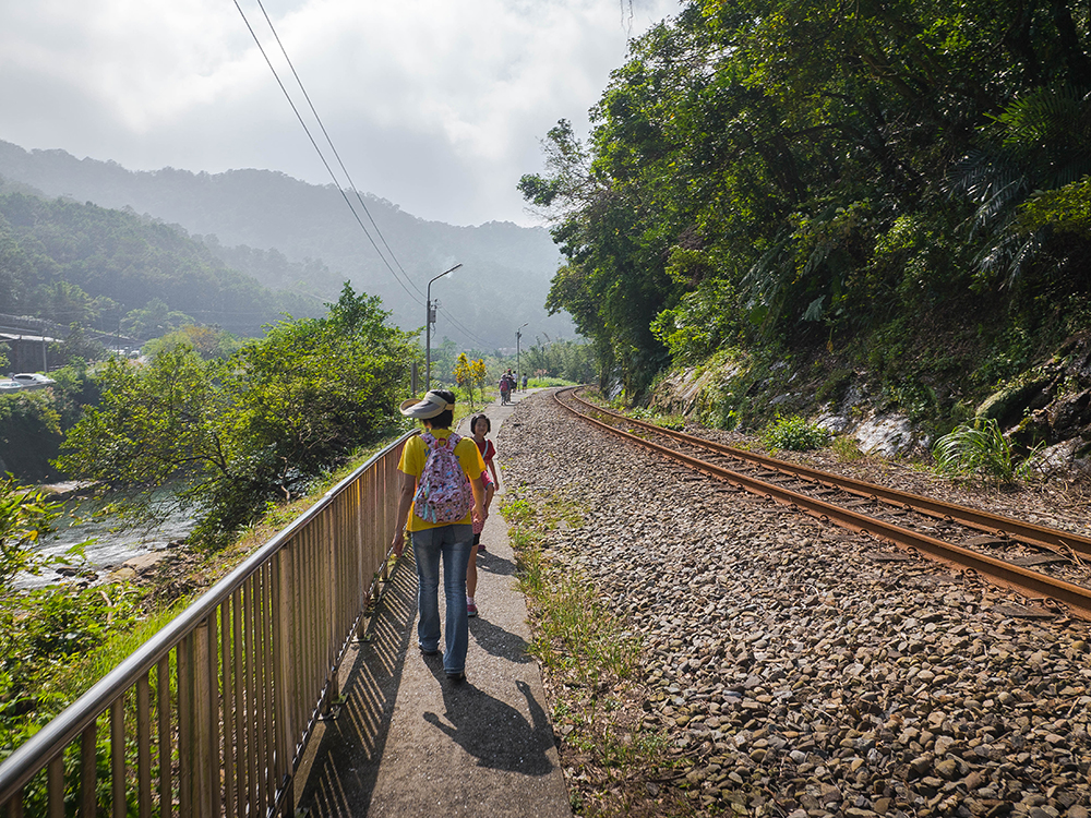
Getting to the trailhead is easy. Take a Local Train (NT$59 one way; about one hour) from Taipei Main Station to Sandiaoling, a tiny settlement picturesquely set in the densely wooded valley of the young Keelung River. Leaving the station, follow the tracks away from the Taipei direction towards a tunnel. Before the tunnel, the Pingxi line splits off from the main trunk line, which heads to the northeast coast. Take the pedestrian underpass under the railway, and then follow the path beside the Pingxi line. After walking about ten minutes, the tracks enter a small settlement, passing the pale-blue building of the abandoned village elementary school across the tracks. Cross the tracks (keeping a lookout for trains!) and you have reached the trailhead, which is right beside the school building. Walk up the concrete path, passing a few houses and following the steps, to reach the wooded hillside above.
Hegu Waterfall
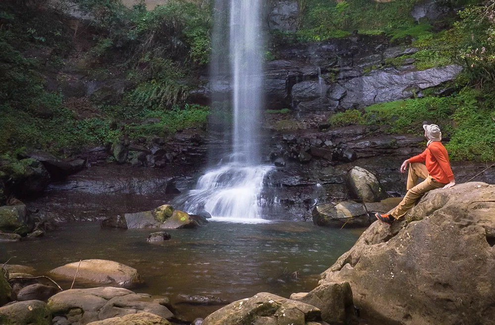
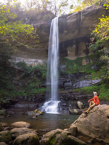
After a short ascent the trail levels out, and then it’s an easy 30-minute walk through mixed woodland, including several attractive bamboo groves, to the first of the three waterfalls. Hegu Waterfall, 40 meters in height, plunges into a deep gorge below, and can be seen in the distance from a flat observation area to the left of the path.
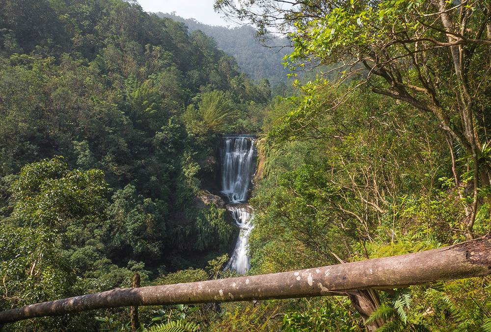
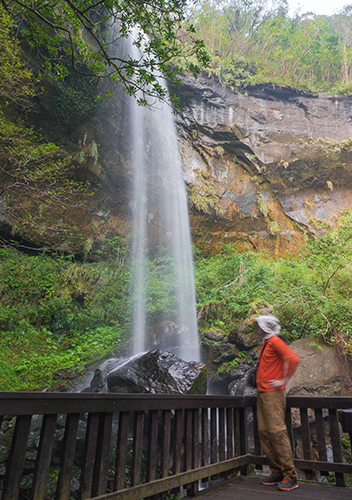
Motian Waterfall
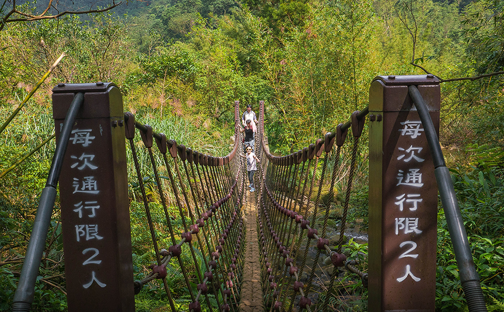
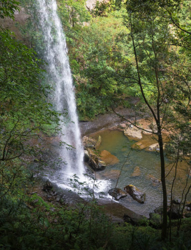
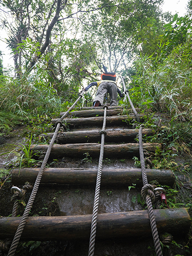
Above Hegu Waterfall, the path joins the stream of the waterfalls for the first time, crosses a pair of small suspension bridges, and continues along the left bank of the stream, now through thick jungle. The trail becomes narrower, and is a little rough in places, with some slippery tree roots and small rocks to negotiate, but the scenery is beautiful. After 20 minutes the trail reaches the foot of Motian Waterfall, which falls well clear of the cliff face.
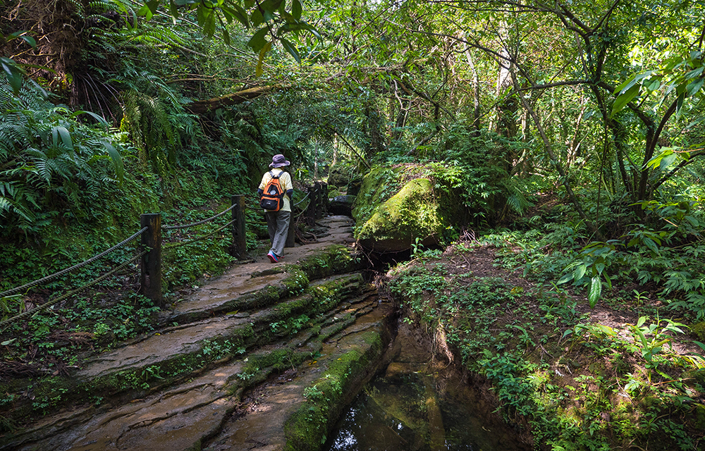
A small wooden viewing platform offers great views of the waterfall from below. More adventurous walkers can follow the trail a few meters further as it starts to climb out of the gorge, then turn right at a junction and traverse a short but muddy path that leads into the overhang, where it’s possible to get right behind the waterfall.
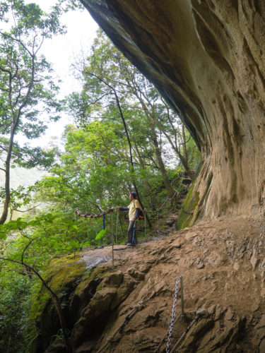
Pipa Cave Waterfall
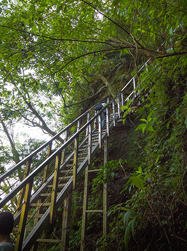
To continue the walk to the third fall, head back to the junction and turn right to continue along the main path, which climbs out of the gorge via a newly installed metal staircase. At the top, less than a hundred meters above the second fall, is Pipa Cave Waterfall, a slightly smaller version of its sister below, which leaps over an overhanging cliff of golden sandstone. Both waterfalls are perfect spots for a rest or a picnic lunch, although the upper fall is generally quieter on busy weekends.
Chailiao Historic Trail
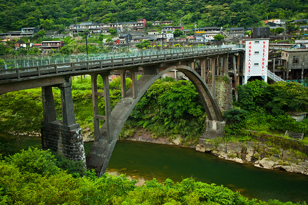
From this point the trail leads out of the gorge (via a short, almost vertical wooden ladder), and a couple of meters later joins a concrete path, where there’s a choice of directions. One option is to turn right, cross the stream immediately above Pipa Cave Waterfall, and take the signposted Chailiao Historic Trail, which meanders through the wooded hills (about 6km) before descending to the famed “Cat Village,” Houtong, where several hundred cats tended by animal-loving locals walk around freely. Also worth a look is the interesting Houtong Coal Mine Ecological Park. Houtong was an important coal-mining center until several decades ago, and the abandoned coal-dressing plant, mine entrances (now barred for safety), dormitories, and the arched Coal Transport Bridge across the Keelung River are all passed on the walk from the end of the trail to Houtong Railway Station. From there you can take a train back to Taipei (service about once an hour).

Alternatively, turn left at the junction above Pipa Cave Waterfall, and in about five minutes the trail joins a quiet road. Follow this for another five minutes, then take the trail veering off to the left. This soon crosses a second narrow lane, and eventually descends by steps to the tiny settlement of Xinliao. Turn left and walk through the hamlet, then left again immediately after crossing the stream. Cross the large car park at the end of this road and take the often slippery steps opposite, climbing up the slope at the far end, then down the opposite side (take care – the trail is very slippery when wet!) to cross the Keelung River via a large red footbridge. Here the trail climbs up the far bank to join the tracks of the Pingxi line. Turn left and walk beside the tracks; Dahua Station is only a couple of minutes away. Westbound trains run around every hour to the large town of Ruifang, where a connecting train can be caught back to Taipei.
Shifen
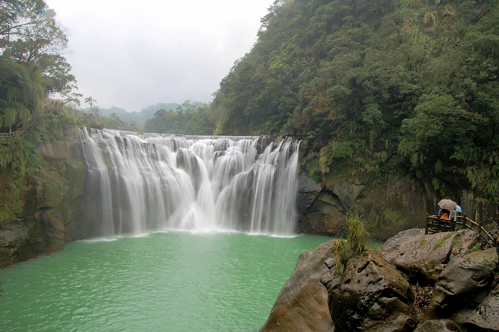
To explore a little more of the Pingxi line, and maybe launch a sky lantern (for which the area is renowned), take a train further up the line (i.e., headed away from Taipei/Ruifang) and spend some time exploring several of the villages along the route. In a few minutes from Dahua, the train runs straight down the main street of the quaint village of Shifen, before pulling into the village’s station. Shifen is a great place to set off a sky lantern and eat traditional Taiwanese snack foods. It’s also the jumping-off point for the famous Shifen Waterfall, sometimes called “Taiwan’s Niagara Falls” for its great width and mini-Niagara look.
Pingxi
The trains on the Pingxi line also stop at the villages of Wanggu, Lingjiao, and Pingxi, before the line terminates at Jingtong. From Jingtong you can either take a train back to Ruifang and then Taipei, or take bus No. 795 to Taipei’s Muzha area. Pingxi and Jingtong are popular with tourists, both having a number of snack food-eateries and coffee shops. There are also plenty of reminders in both places of the coal-mining industry, to which the Pingxi line owes its existence and which made the beautiful valley through which the line runs prosper in the decades before it became a magnet for both tourists and hikers.
More Hiking in the Taipei area
JIUFEN Hiking — Mountains in Northeast Taiwan
ELEPHANT MOUNTAIN — Great Views of Taipei!
DACUKENG Historic Trail (from Houtong to Jiufen)
KLOOK:
Yangmingshan Hiking Tour from Taipei
Taipei Zen Hiking Tour with Qigong Experience
BOOKING.COM
Hotels in Ruifang District
OVER THE CITY: YOUKENG AND CUKENG WATERFALLS HIKE