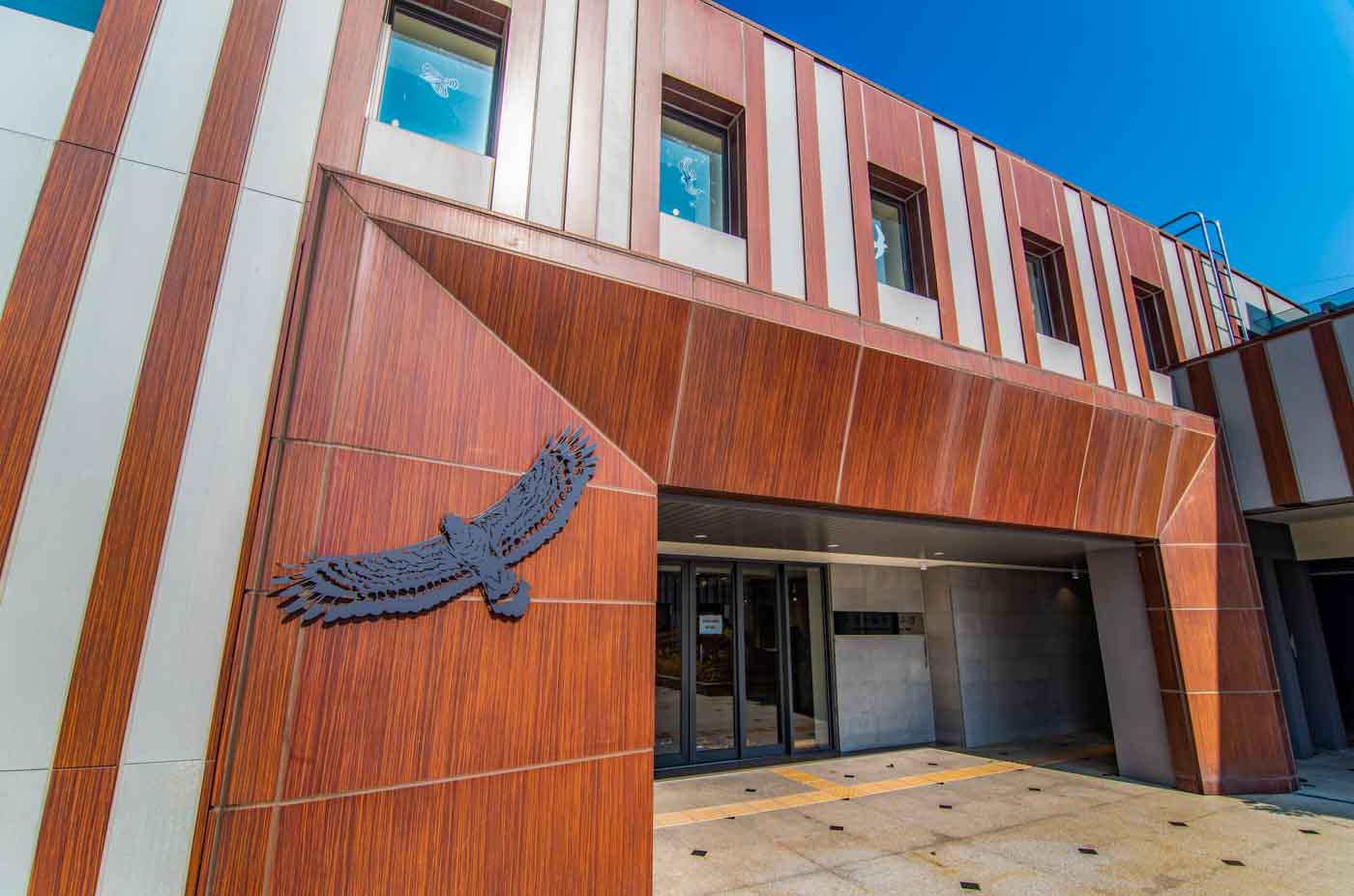
Mountain Backdrop, Sweeping Blue Ocean Foreground
TEXT / RICK CHARETTE
PHOTOS / VISION
The North Coast. Pounding surf on rugged rocky shores. Artistic nature-chiseled stone sculptures. White-sand beaches. Stylish seaside eateries and cute mobile back-of-the-van cafés. Exposed reefs teeming with marine life. SUP, surfing, and other watersports. Raptor spotting. And much other entertainment beyond. All within easy day-trip reach of central Taipei City.
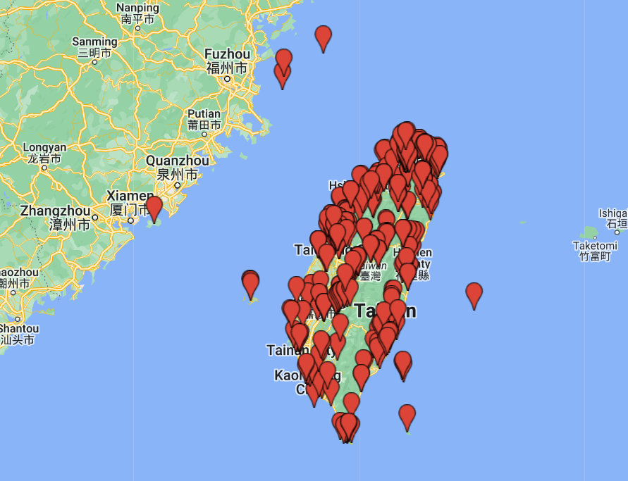
An ocean of happy adventure awaits the international traveler just an hour or so from the dense busyness of downtown Taipei. Look up, and north, from points all around the city and you’ll see the hulk of the Yangmingshan massif, a mountain playground for the local citizenry. Directly behind this is the North Coast, a 30km oceanside playground extending in an arc from Tamsui town on the west to Keelung City on the east.
In this article we’re taking you on a quick tour of many of this area’s most popular enticements, almost all right on the coast along Provincial Highway No. 2.
From Tamsui to Baishawan
New Taipei City’s Sanzhi District is just northeast of Tamsui town. Between Tamsui and Keelung the population density is low, with just a sprinkling of towns. Heading north from Tamsui on Highway 2, for a time you’re too far inland and the sea is out of sight – then, suddenly, as you lean into a curve at a point where only the sky has been in view dead ahead in the moments before, there it is laid out directly before you. Just moments later you’re at Qianshui Bay, our first destination.
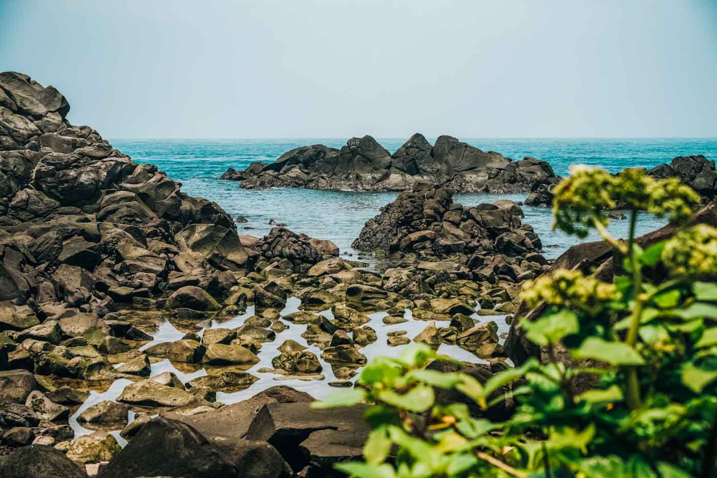
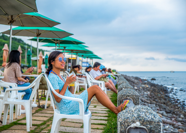
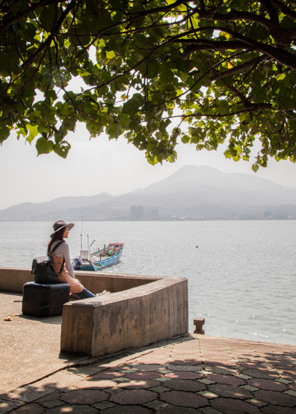
“Qianshui” means “shallow water”; this bay is an intertidal zone. Many structures in the long line of buildings that stands between the highway and bay’s edge have been transformed into beachfront-oriented cafés and bars. Each evening sunset-watchers crowd their outdoor seating areas and the boardwalk in front. At low tide the water curtain is drawn back on the bay’s rich mini-ecosystem, and visitors spread out among the large rocks encrusted with clam shells and the many tidal pools, each an isolated neighborhood of tiny black fish and scuttling crabs. At this time the ever-present school of local fishermen have all moved out to the exposed algae-covered reefs by the receded deeper waters, adding to the charm of your photo mise-en-scenes.
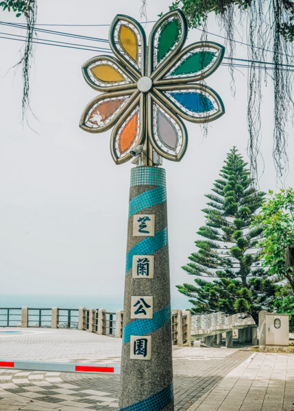
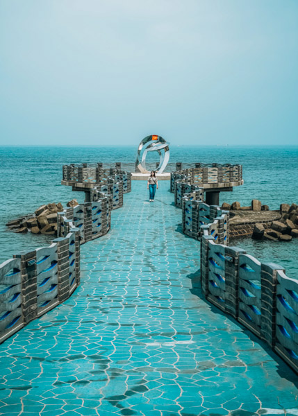
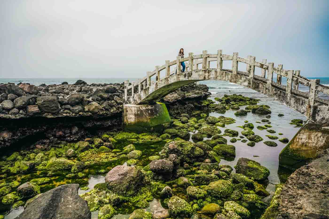
At the bay’s east end is Zhilan Park. The main attraction here is its charismatic-design Ocean Viewing Platform, dubbed the North Coast’s “most beautiful runway.” Its lookout, at the end of a bridge corridor with a striking aqua blue design, juts out 57m into the bay. On it is a large wedding ring-sculpture installation artwork. The site is at its most romantic when the tide is in and the sun is setting/rising, the shiny rings reflecting the water’s blues and sun’s red-range pastel hues.
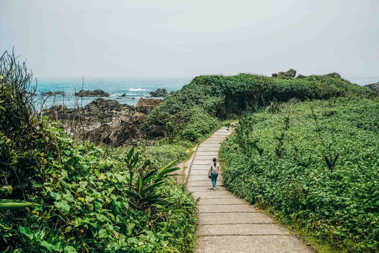
The Shuangwan Bikeway, following the coastline, perambulates east about 8km from Qianshui Bay, ending at Baishawan (“White Sand Bay”), which we’re visiting momentarily. “Shuangwan” means “twin bays,” referring to the east and west launch points. There is tree shade among much of its length, as well as a wonder-teeming temporarily revealed underwater world of rocks alongside you at low tide. The pathway is paved and very flat, the environs generally quiet, though of course the noise level picks up on weekends/holidays when day-tripper numbers pick up noticeably. Easy-pedal sorties take about an hour to complete (one way).
Along the way you traverse the pretty-as-a-picture Linshanbi Recreation Area. This attraction and Baishawan are in the northwest corner of Shimen District, which is on Sanzhi District’s east. Linshanbi, or Linshan Cape – the “bi” literally means “nose,” referring to the cape’s jutting geo-shape – sports a mini-web of appealing trails and family-fun beach-ecology explorations. Black volcanic rock is prominent here; view this and Fugui Cape immediately east on Google’s satellite view and you’ll clearly see the paths of lava flows from days long gone when the Yangmingshan massif was volcanically explosive.
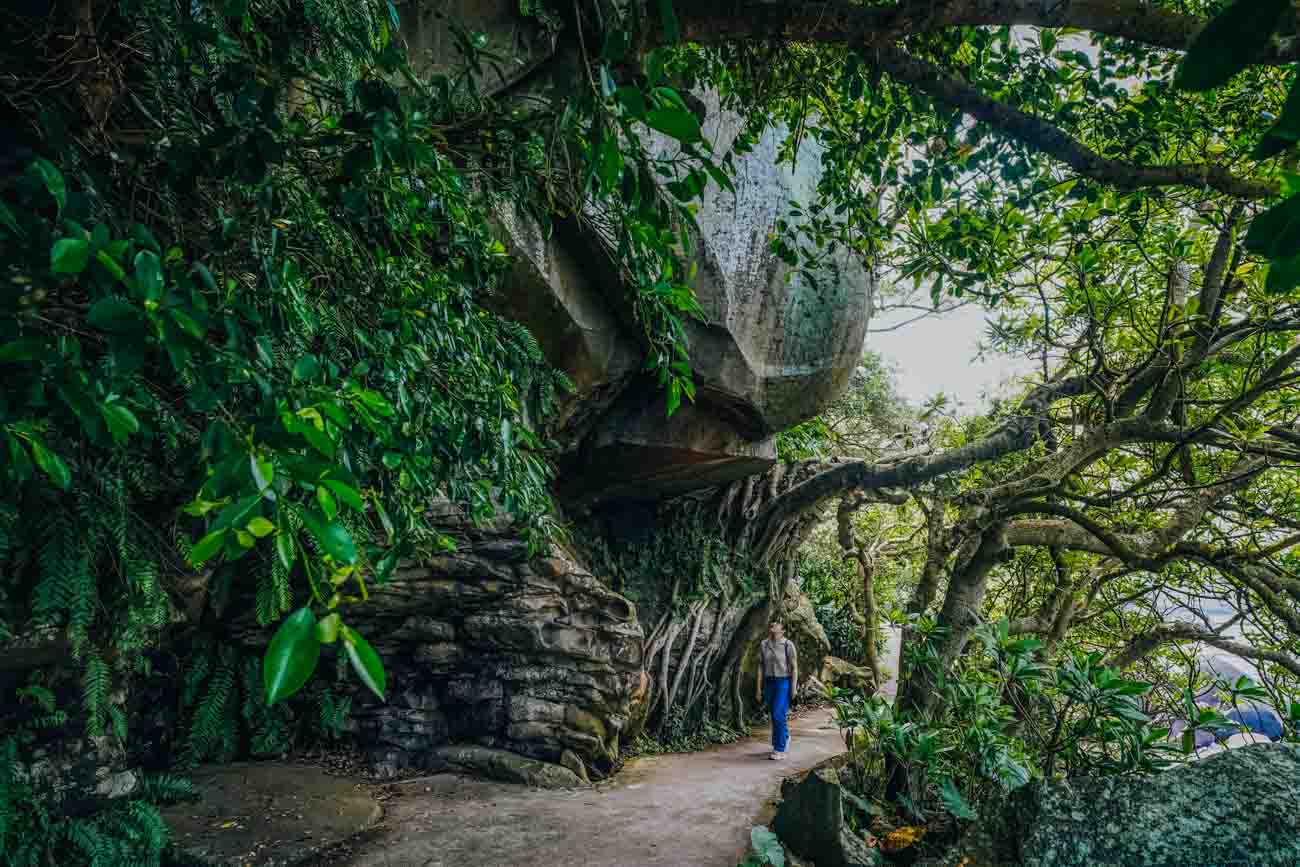
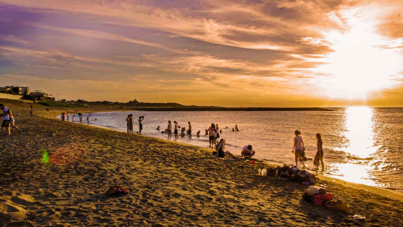
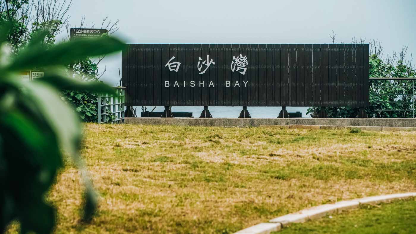
Crescent-shaped Baishawan (Baisha Bay) is tucked into the crook formed by Linshan Cape and another less geo-dramatic promontory on the east. This is perhaps the most popular North Coast beach with Taipei City dwellers, and definitely so with its expatriates. Defined by consistent calm waters with minimal tide effect, among the panoply of for-rent fun gear here are iconic white cabanas, rattan beach mats, boogie boards, standup paddleboards, and big unicorn floats. There’s also brick-and-mortar and mobile refreshment vendors galore.
From Fugui Cape to Shimen Arch
As with Linshan Cape and Baishawan, the destinations in this section are all within Shimen District, named after our last district stop, the Shimen (“Stone Gate”) Arch.
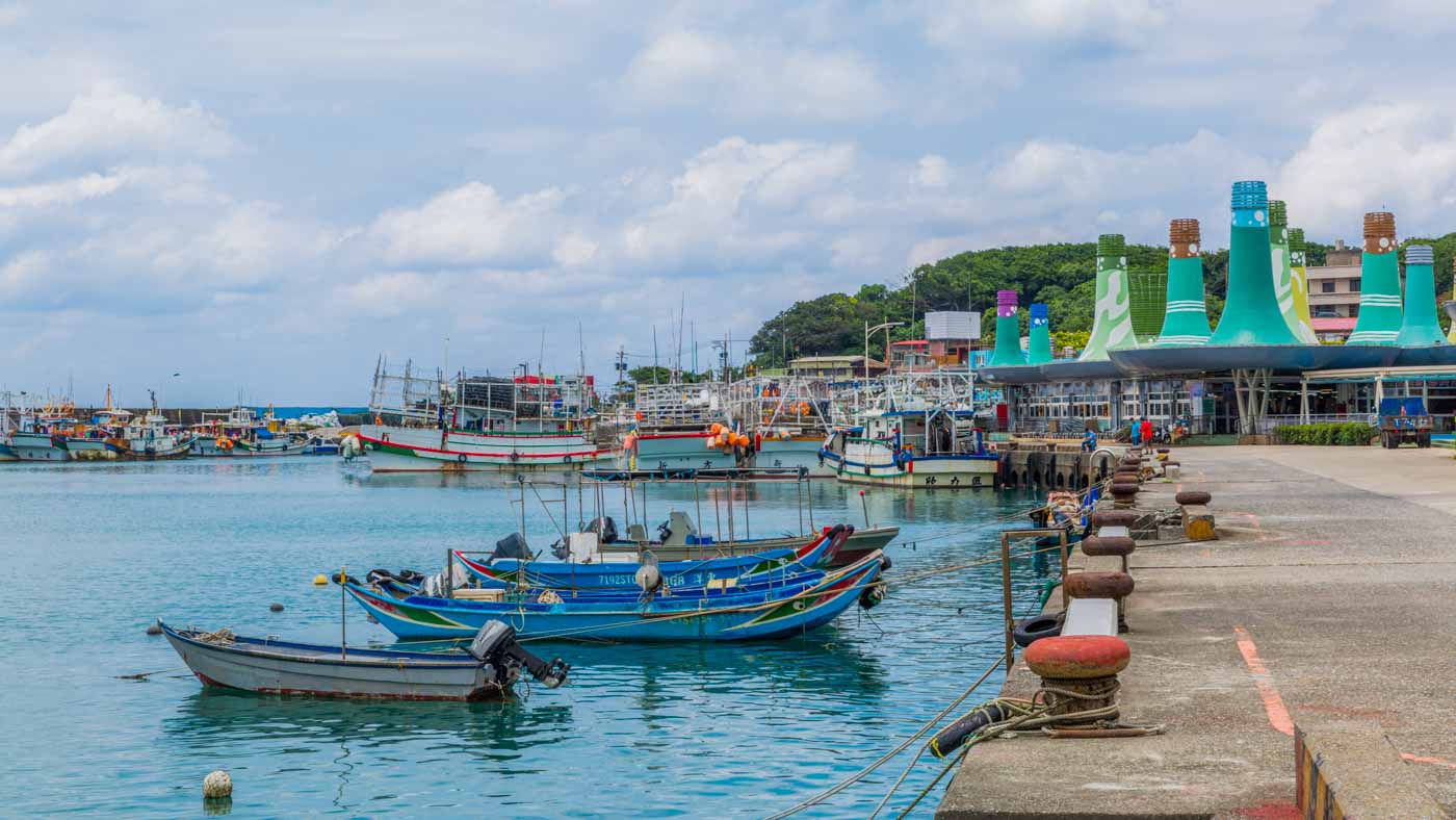
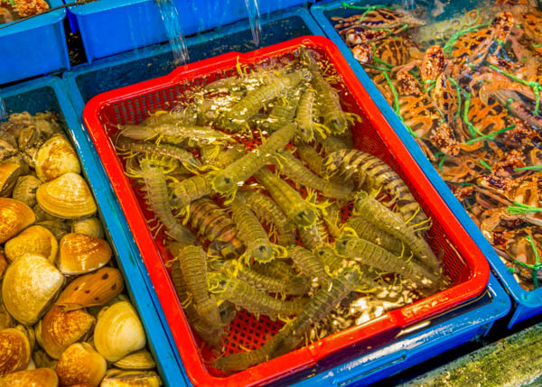
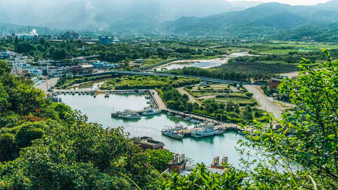
Fugui Cape is the island of Taiwan’s northernmost point. The compact Fuji Fishing Harbor is found at the cape’s west-side base. Known for ultra-fresh seafood, the narrow roads leading up away from the waterfront are packed like a sardine can with simple restaurants. The wide-ranging edible marine harvest includes curiosities such as roe, sea cucumbers, urchins, and varied seaweeds. If desired you can point out your food, still swimming in tanks at the eatery’s front, before sitting down. The local fishery association has also developed a comely sales center displaying high-quality products available to individual consumers.

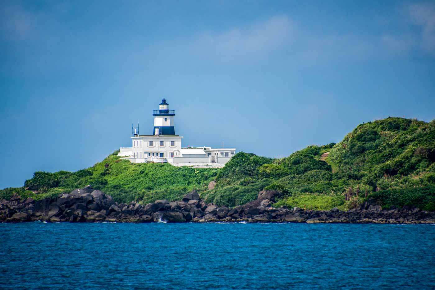
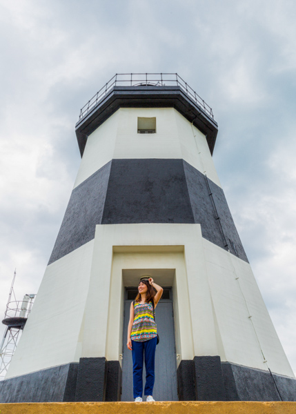
The octagonal Fugui Cape Lighthouse is in a windswept park that takes up the majority of the cape, with paved paths leading to scenic outlooks. The lighthouse itself is on a small air force radar base, with access limited to weekends. The original phare here, constructed in 1896, was destroyed by the Allies for strategic reasons during World War II. The current edition, erected in 1949, has conspicuous black-and-white stripes for augmented discernment in fog.
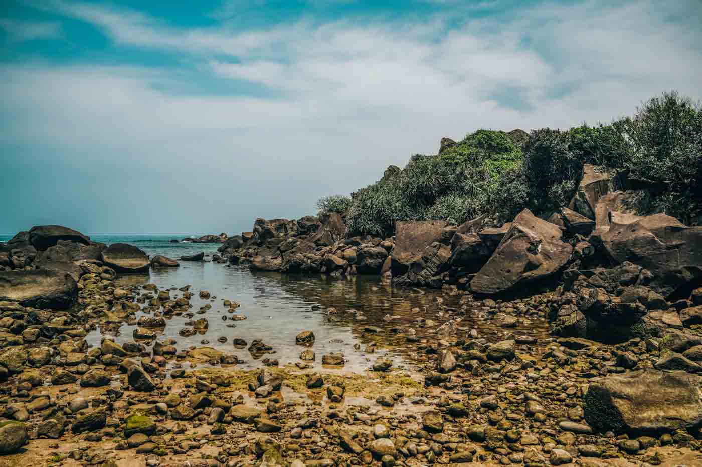
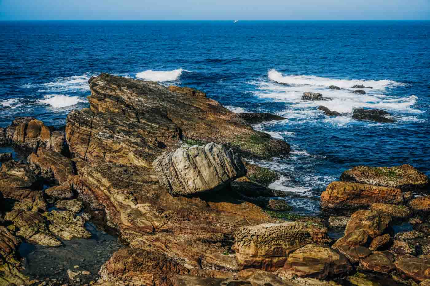
One of the distinctive natural features that will prominently feature in the photos you take when meandering the park are ventifacts – i.e., here, large shoreline rocks peculiarly “decorated” by the artist Mother Nature using wind-driven sand. And just south of this bulging water’s-edge collection, at the cape’s east-side base you’ll find an assemblage of sand dunes. This is the start of Laomei Bay. These are backed by a mini-forest of stunted “wind-cut” trees, and the dunes themselves are populated by resilient deep-rooted beach plants that help to hold the dunes in place.
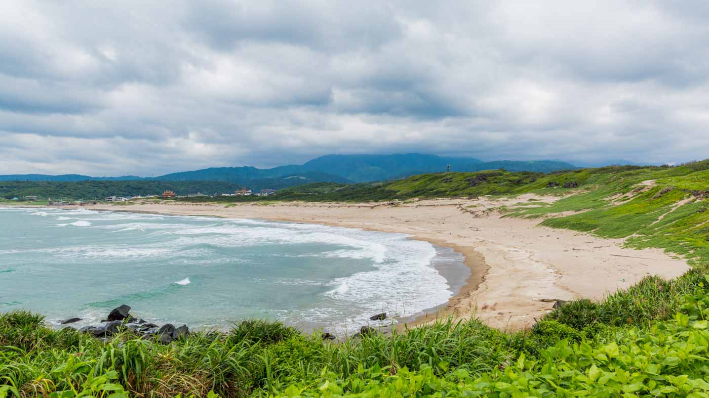
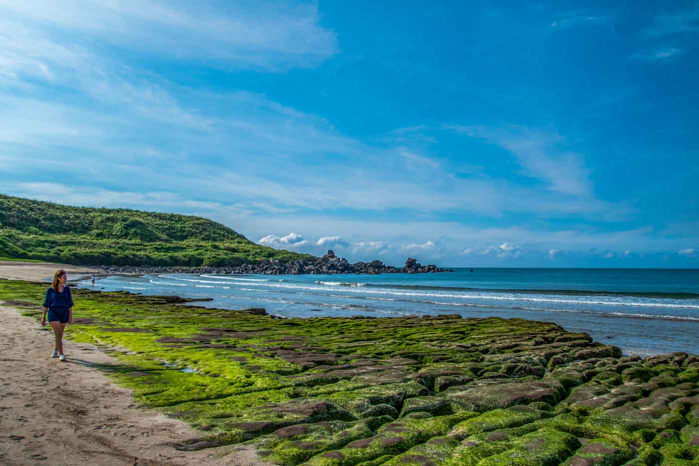
The iconic visual at Laomei Bay, however, is the mystical, magical Laomei Green Reef. The material that constitutes the reef is derived from Yangmingshan’s past volcanic activity. Over time the sea has eroded soft sections, leaving a pattern of long, zigzagging, roughly parallel trenches. During the northeast monsoon season from February through May, wave action brings in sea lettuce and green hair algae, turning the reef formation a lush green. This magnetic coloring, matched with the changing palette of blues/greens/grays in the sea beyond, in turn brings in steady waves of photographers. (Note: Walking on the reef is not permitted, for eco-protection reasons.)
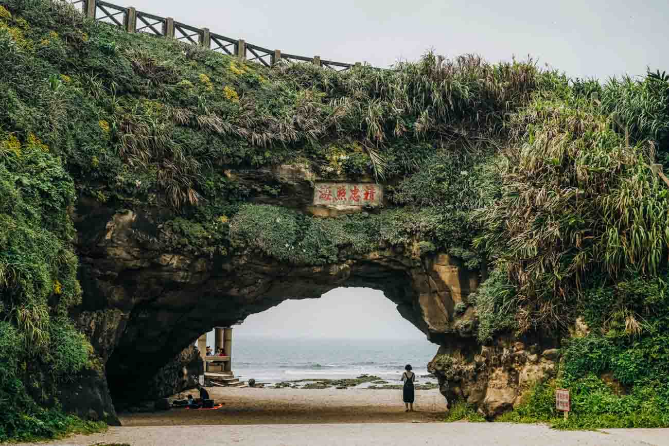
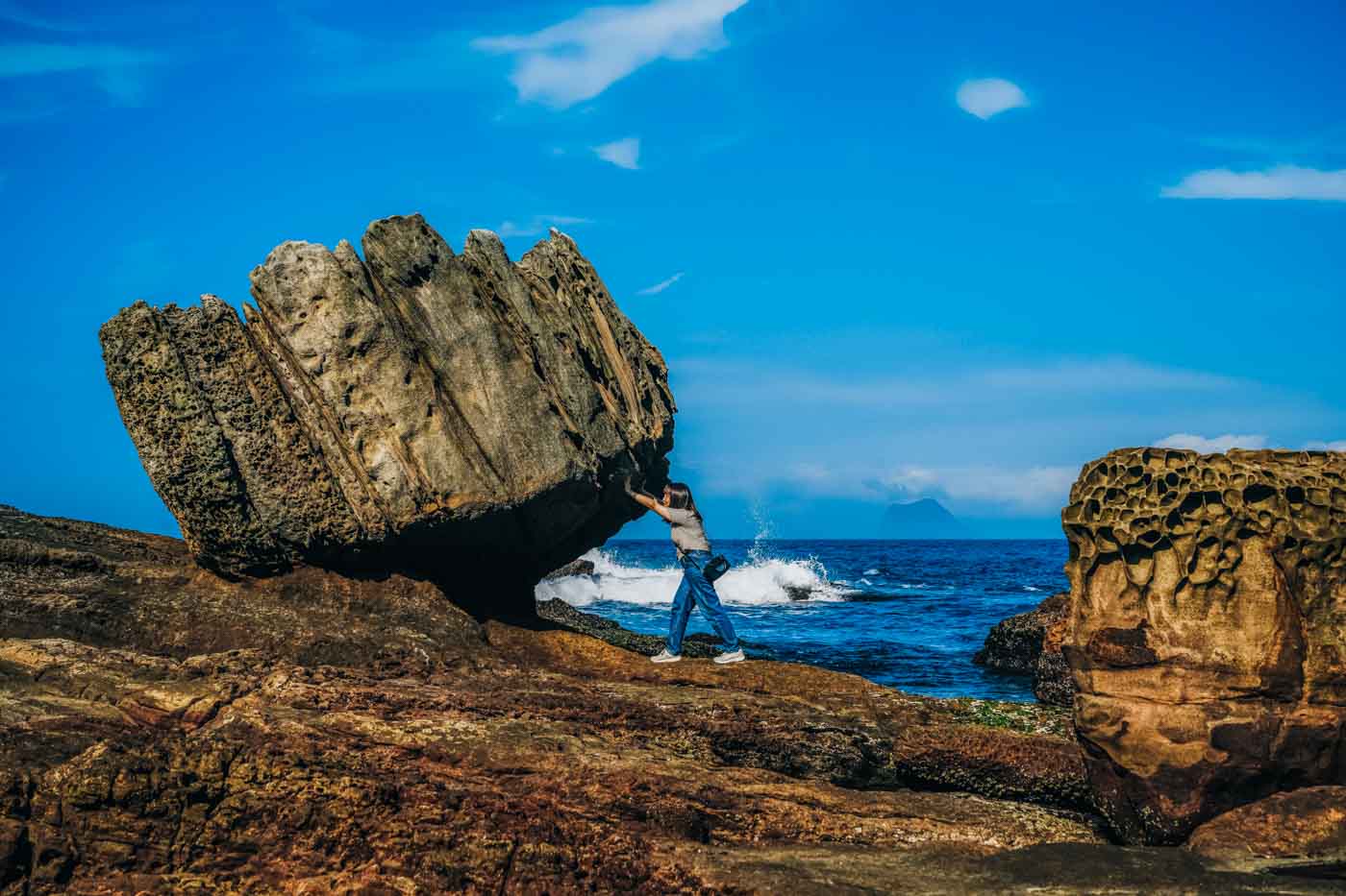
The Shimen Arch stands right beside the coastal highway. This is a massive block of conglomerate rock through which wind and primarily tidal-wave erosion long ago carved a cave-like doorway 10m tall. Tectonic activity has brought the block inland and about 2m up from the water’s level. The “Stone Gate” name was bestowed by the area’s Han Chinese settlers in the Qing Dynasty. Steps lead up to the top of the arch, where you’ll find sea-view seating and the remains of a military gun emplacement.

Through Jinshan and Wanli
Jinshan, the nucleus of Jinshan District, is the largest town between Tamsui and Keelung. Wanli District is right next door to the east. The winding and very scenic Provincial Highway No. 2A, which leaps the Yangmingshan massif through Yangmingshan National Park, has its North Coast terminus here.
The gradient-friendly Jinshan-Wanli Bikeway runs about 8km parallel to the coastline in Jinshan and Wanli districts. The route is a mix, featuring paved path, wooden boardwalk, separate paved bike lanes on roads (about 1km in total), and one quick 200m section on the coastal highway. You’ll breeze by beaches, wetlands, coastal hiking trails, and myriad establishments offering good food and drink. The cycleway gives you access to all the other attractions introduced in this section.
Zhongjiao Bay, wide and comparatively shallow, has long been the North Coast’s hottest spot for surfing, and now also for SUP (standup paddleboarding), which has become very popular in Taiwan in the last decade. The young, voluminous Jhongjiao Bay Surf/SUP Center, beside the coastal highway at the bay’s west end, has been set up to promote it as an international surf/SUP destination. Gear rental/sales and both surfing and SUP training are provided (fee; available in English), along with tourism services, a snack bar, shower facilities, etc.
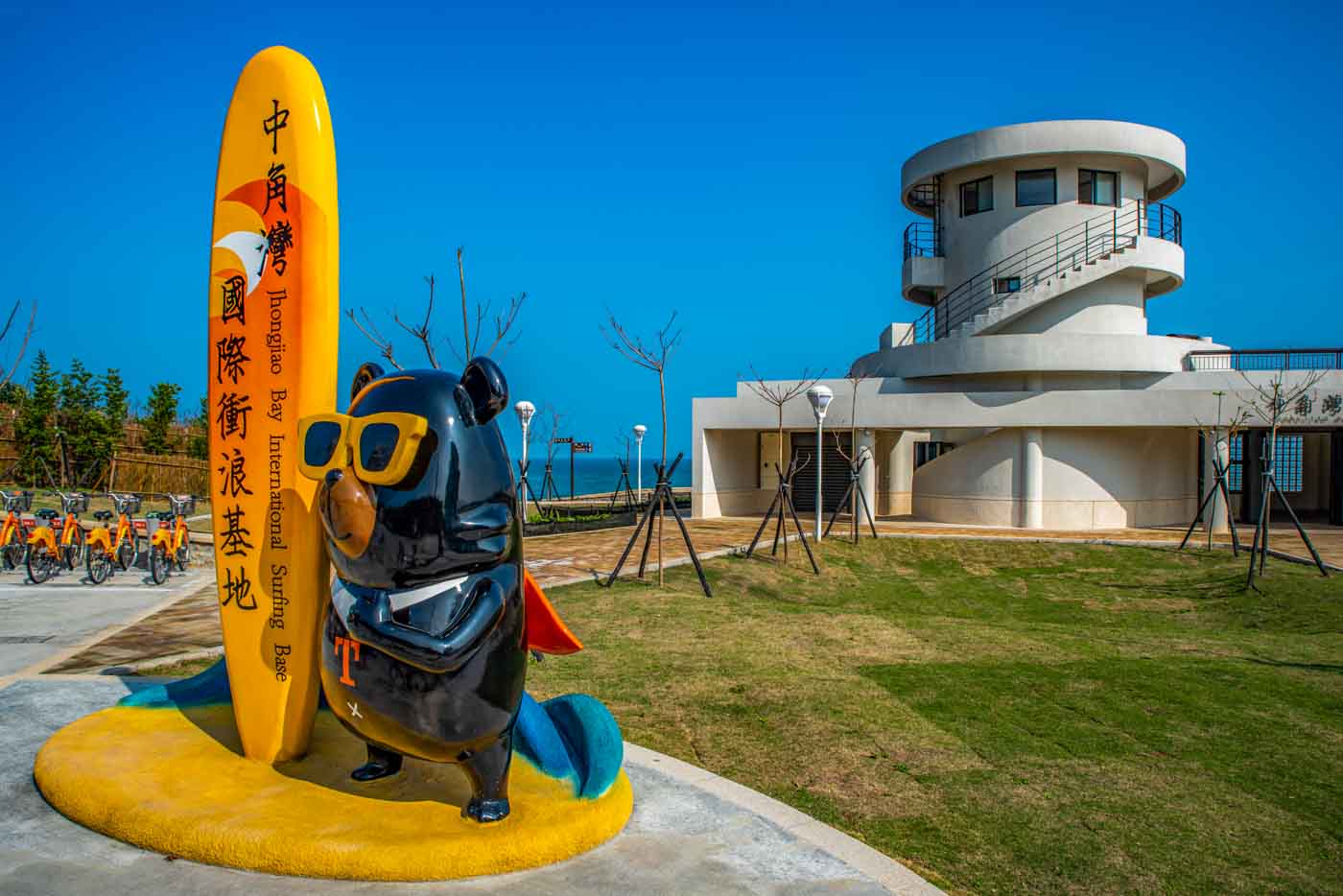
Jhongjiao Bay Surf/SUP Center (中角灣國際衝浪基地)
Tel: (02) 2498-8226
Add: No. 162-1, Haixing Rd., Wanshou Borough, Jinshan District, New Taipei City
(新北市金山區萬壽里海興路162-1號)
Facebook: www.facebook.com/jinshansurfing
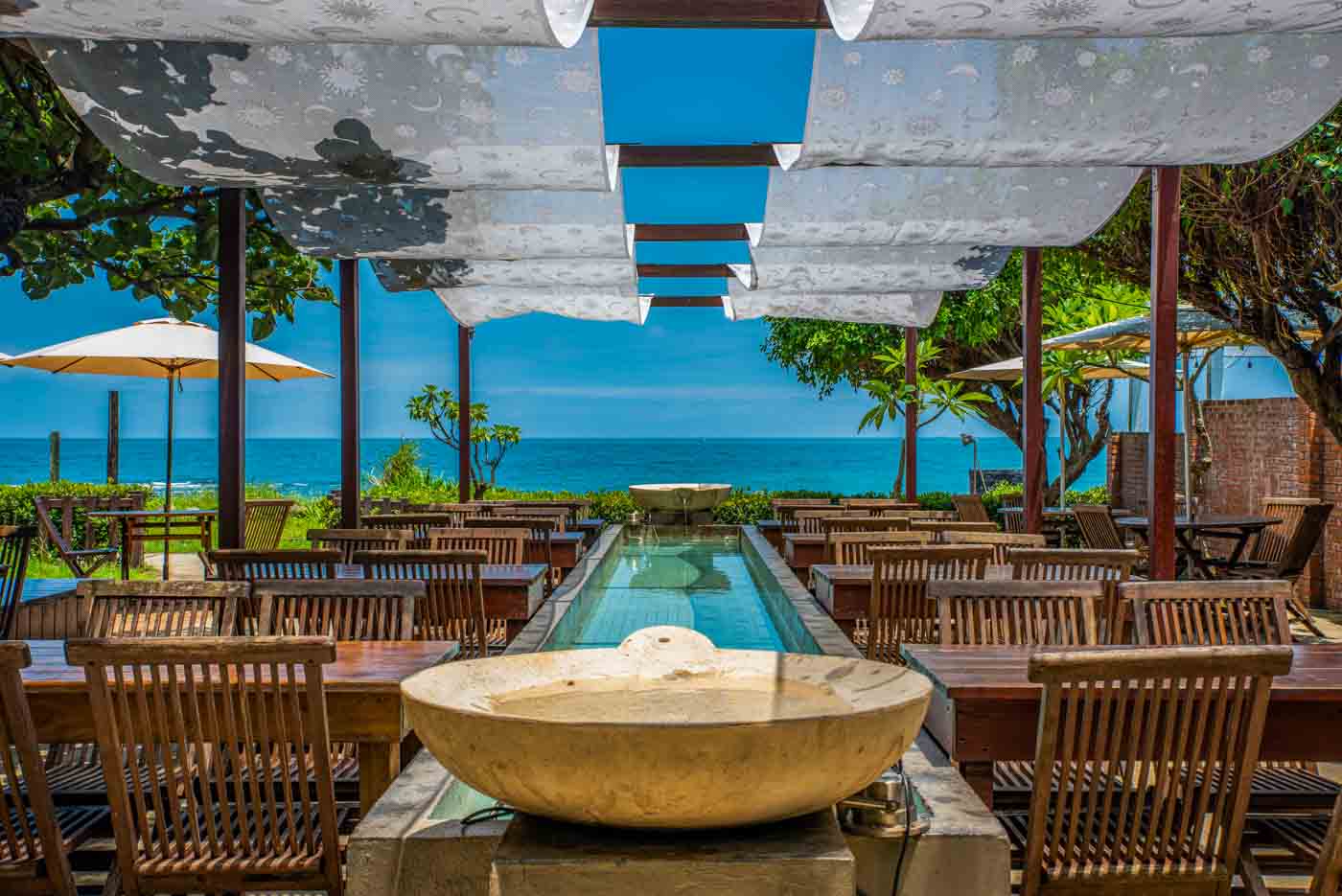
The irresistible Umi Coffee Bus (www.facebook.com/umicoffeebus), which has become a North Coast-traverse milestone, is in a nearby parking lot overlooking the fine-sand beach’s west-end tip. The van, painted bright red and white, is nigh impossible to miss. A long row of umbrella-shade tables runs along the top of the waterside bluff. Beyond invigorating and/or refreshing lattes, cappuccinos, and milk teas, from the “kitchen” also come hot hit-the-spot waffles and pizzas.
Between central Jinshan and the sea is forested Shitoushan Park, which takes up the better part of Jinshan Cape. Pleasant well-paved pathways wend over the promontory. For much of the last century this was an off-limits military zone. One beneficial result for today’s visitor is the well-protected natural ecology, with a splendidly diverse forest physiognomy, artistry-augmented with the cultivation of trail-side Formosan lilies and red spider lilies. Another intriguing leftover is the presence of fortification remains such as barracks and artillery emplacements.

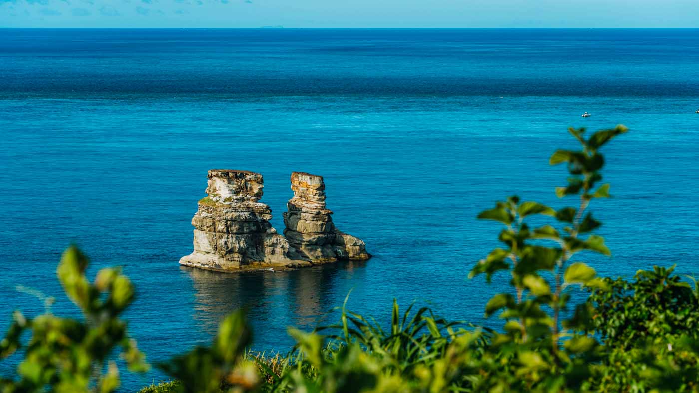
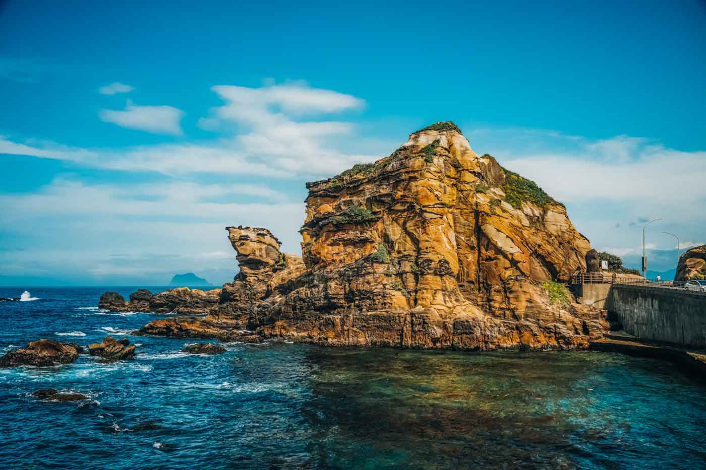
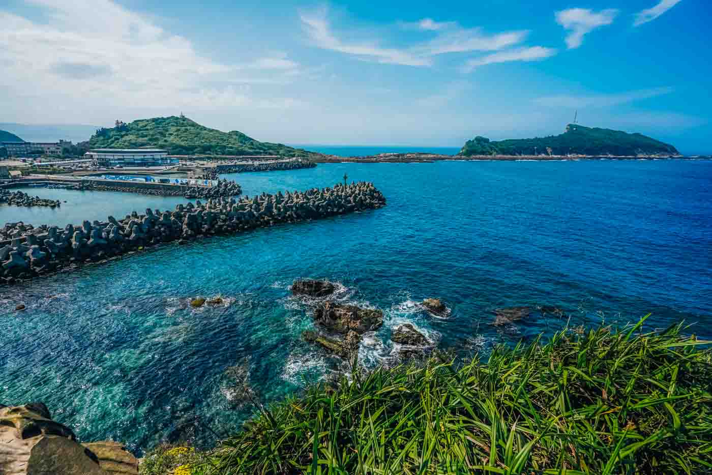
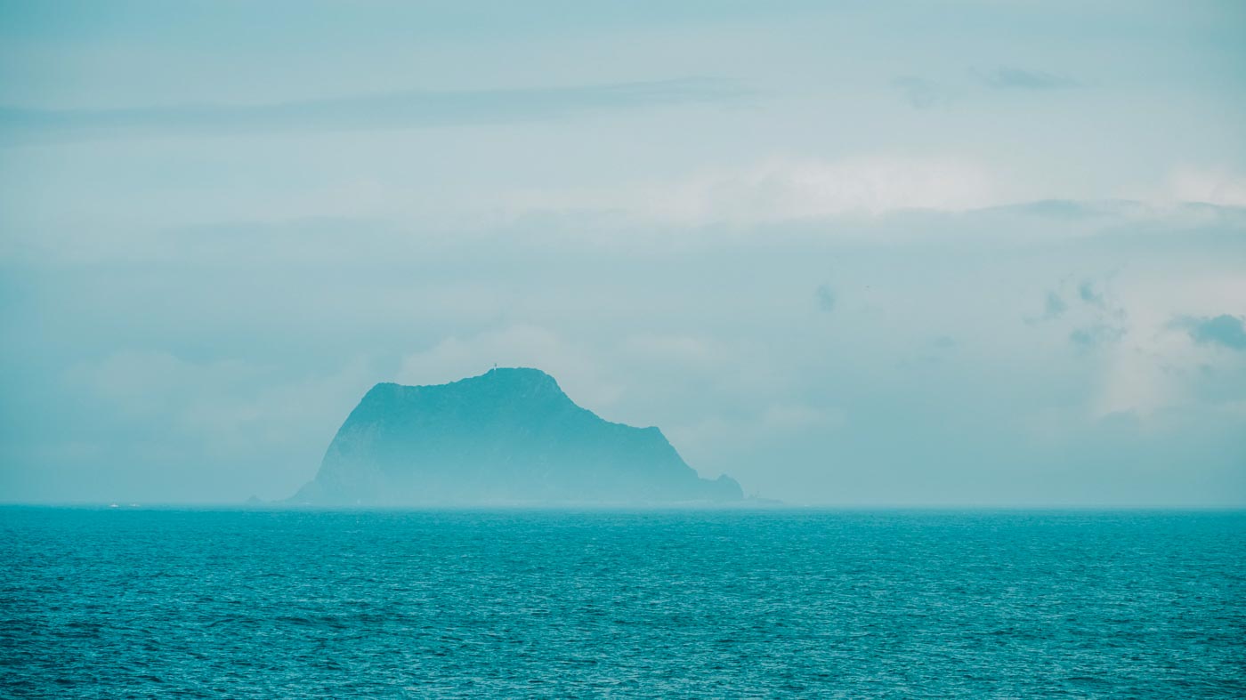
Look out to sea from lookouts along the outer edge of Shitoushan Park and you’ll see one of the North Coast’s geo-icons, the Twin Candlestick Islets. These two rocky outcrops, 60m high, leap straight up out of the waves 450m offshore. Not in fact individual islets, they are mounted atop a partially exposed one-piece understructure. This unique formation was long-ago “hidden” within a much larger Jinshan Cape, and for a long period after the geo-sculpture was freed by erosion and tectonic forces the candlesticks were connected at the top, forming a great stone arch. The surrounding 19m-deep waters, rich with flamboyant marine creatures, are regularly visited by pods of scuba divers.
Yeliu and Eastward
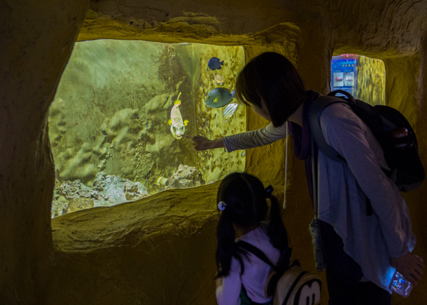
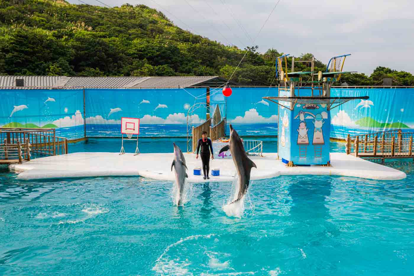
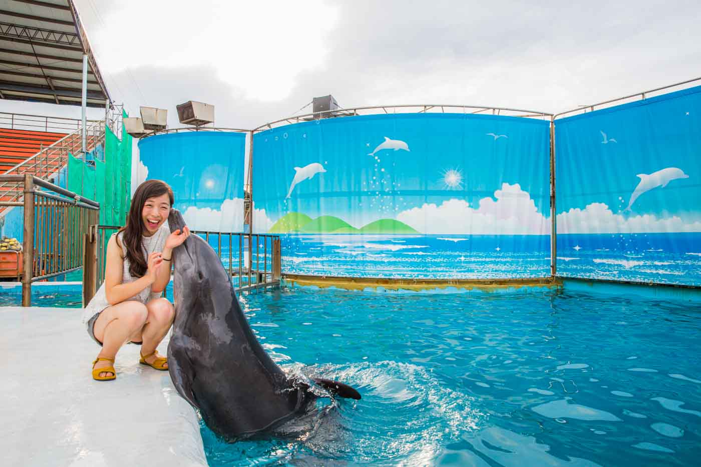
A short side-road drive takes you from the coastal highway along the base of coast-side cliffs on the next cape to the east to close-packed Yeliu Fishing Harbor – i.e., both the boats in the tiny harbor and the surrounding settlement’s buildings are crammed into tight spaces. At the village’s heart is a cluster of unpretentious, inexpensive eateries extremely busy on weekends/holidays. Within view of these, on the settlement’s ocean edge, is Yehliu Ocean World, an oceanarium offering dolphin and sea lion shows plus a 100m under-the-sea aquarium tunnel.
Yehliu Ocean World (野柳海洋世界)
Tel: (02) 2492-1111
Add: No. 167-3, Gangdong Rd., Yeliu Borough, Wanli District, New Taipei City
(新北市萬里區野柳里港東路167-3號)
Website: www.oceanworld.com.tw
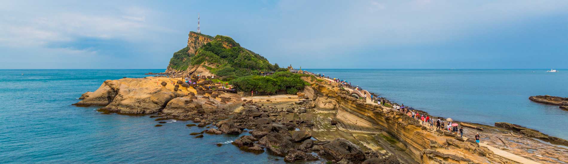
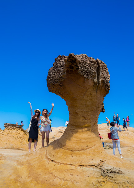
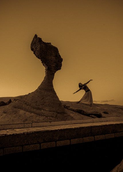
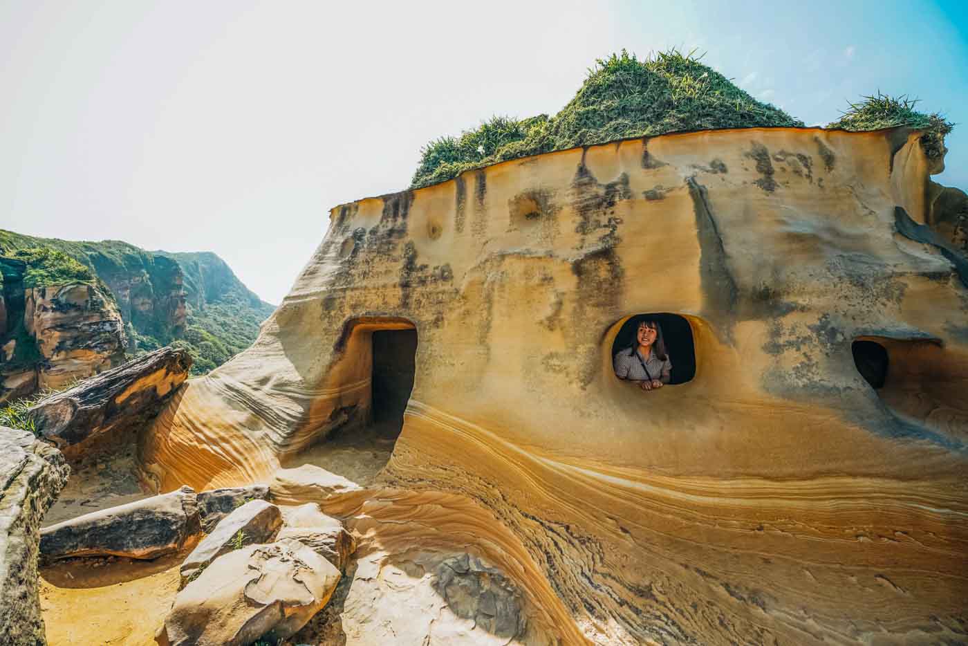
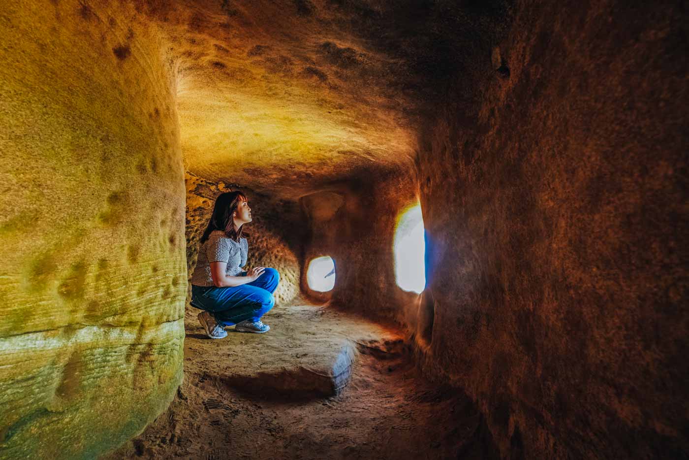
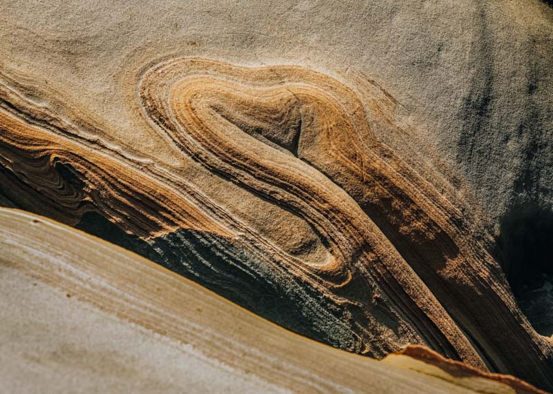
Yehliu Geopark takes up a long, thin spit of land that extends about 1.7km out into the sea from the edge of the cape. From ground level this headland sliver resembles an upside-down crooked finger; if you happen to see it from on high, possible if you walk the trail up to the cape’s high point overlooking the village/park, it resembles a giant turtle submerging into the sea. Bizarre sandstone formations on the rocky promontory have been carved by Mother Nature the artist, using wave and wind as her tools, the gallery of works including a formation that some people say resembles a bust of the Egyptian Queen Nefertiti, Cinderella’s lost slipper, burning candles (to my mind, by far the most beautiful), and petrified eggs left to hatch by ancient sea monsters.
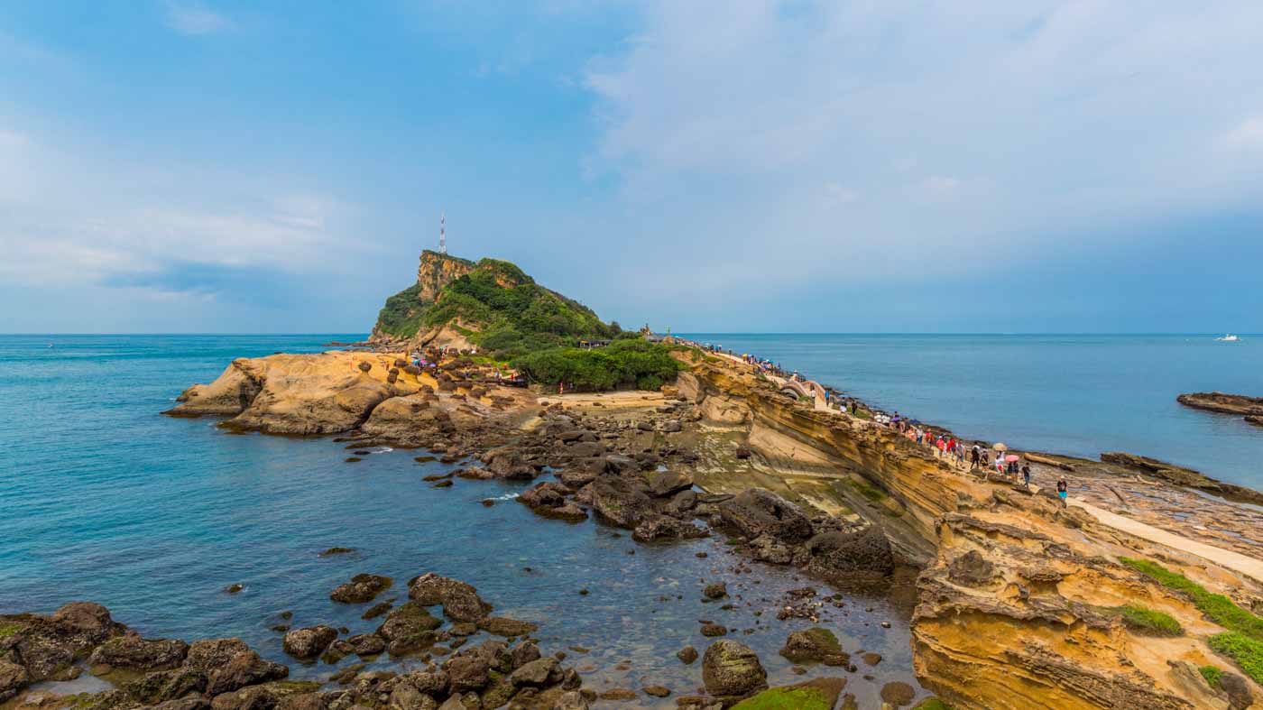
The sculptures are found toward the village end of the promontory. Recommended is the easy 2.2km loop trail that takes you out along higher ground to the promontory’s tip and back, highest elevation a bit over 100m, which presents superlative views back along the coast and good birding. Comparatively few park visitors venture far along the trail. One of the highlights along the way is the striking Yeliu Light Beacon, which possesses a shape clearly resembling the geopark’s famed Candle Rocks, a tall pure-white tower topped with a beacon casing shaped like a candle flame appropriately painted rich flame-red.
Yehliu Geopark (野柳地質公園)
Tel: (02) 2492-2016
Add: No. 167-1, Gangdong Rd., Yeliu Borough, Wanli District, New Taipei City
(新北市萬里區野柳里港東路167-1號)
Website: ylgeopark.org.tw
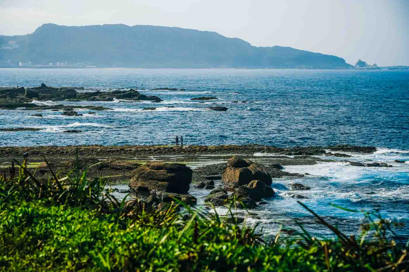
Guoshengpu Beach is tucked into the space where mainland meets cape on the latter’s west side. Above the beach, right beside the coastal highway, is a small park with a lookout providing clear views down to the beach and of the Jinshan Cape to Yeliu Cape sweep, including the Twin Candlestick Islets. The waters of the bay here, generally calm, have made this beach a popular SUP launch-point.
Another key Yeliu Cape photo-backdrop is Wanli Camel Rock, just east of the miniscule Dong’ao Fishing Harbor. This is right on the shore, not bobbing up and down out in the water, and accessible on foot. The large sedimentary-rock formation is said to look like a giant camel resting, its face oriented toward the village; the best viewing spots to prove this is so are along the Yehliu Geopark trail.
Wanli Fist Rock is further southeast along the coast, in a location where the height of the shoreline cliffs starts to rise dramatically and the narrow hill-bracketed entrance of the deep, natural Keelung Harbor can be seen in the distance. The rock sculpture has the look of an immortal’s clenched fist risen from the Neptunean depths. Good downward views of the artwork are enjoyed from atop a cliff at a small highway-side park. A moderately sloping paved pathway also leads down to the rugged rocky shore from here.
Tamsui and Bali
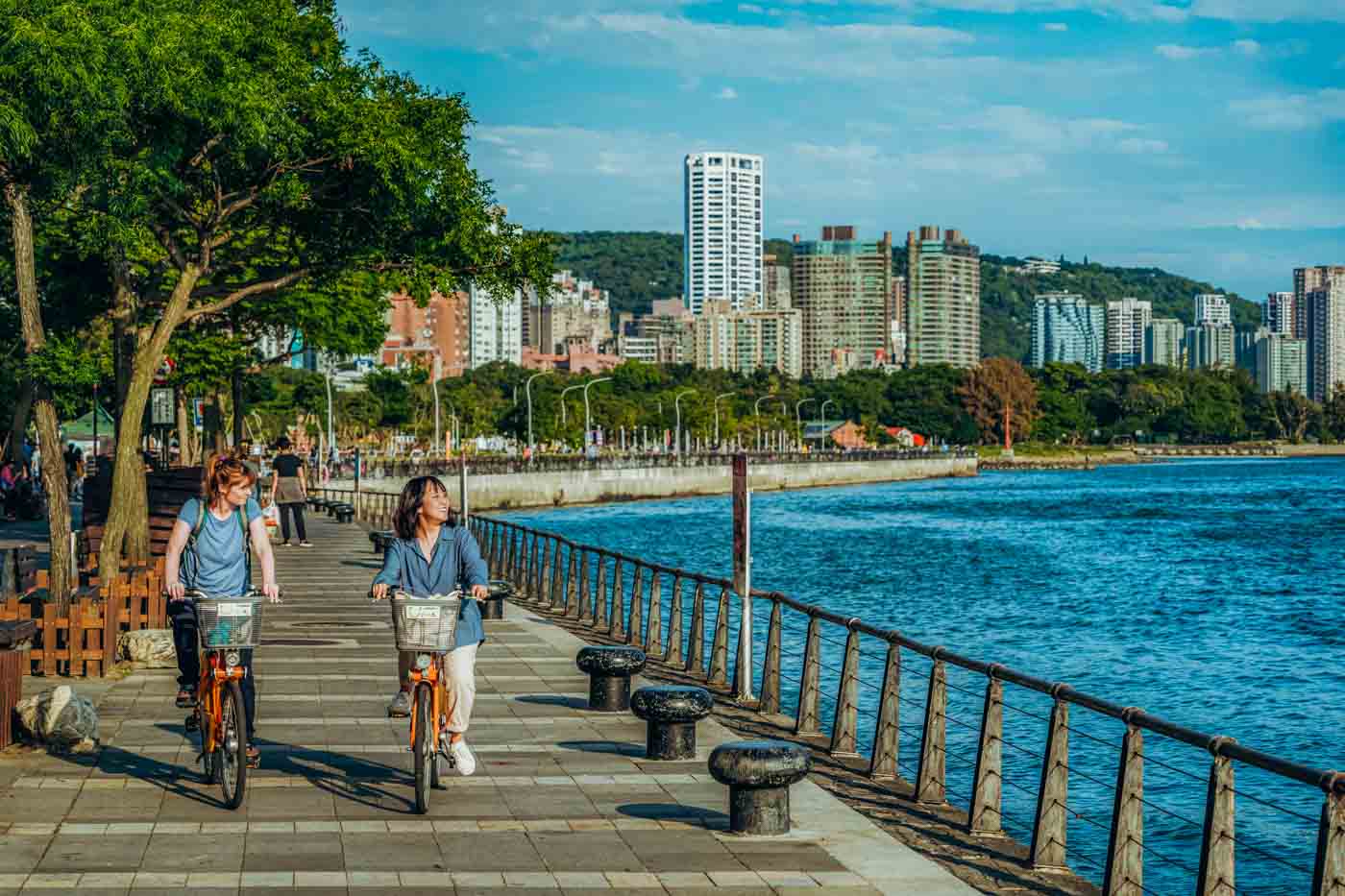
In this last section we swing back to the North Coast’s far west, the land areas on either side of the mouth of the Tamsui River, which drains the just-above-sea-level Taipei Basin, the city of Taipei’s mountain-walled nest. The port town of Tamsui is on the river’s right bank just inside its mouth, the town of Bali on its left. Each sports a history-rich Old Street by their respective waterfront. The Old Street areas are connected by regular ferry service, and Tamsui’s is just steps from the Taipei Metro’s Tamsui Station. Bikeways line both riverbanks, and cycle rentals are available in both Old Street areas.
The “Golden Riverside Bikeway” is a 15km route that runs north along the right-bank side of the Tamsui River from Guandu Park, near the famed Guandu Temple, up past the river’s mouth and along the North Coast, ending at Danhai New Town. Guandu Temple is north Taiwan’s oldest Mazu (Goddess of the Sea) temple. The paved, flat cycleway brings you past/along such attractions as the Tamsui River Mangrove Conservation Area, Tamsui Old Street, Tamsui Riverside Landscape Trail, and Tamsui Fisherman’s Wharf. All along the river section the backdrop over on the Bali side is Guanyinshan (Mt. Guanyin), said to resemble – and indeed very much doing so – Guanyin, or the Goddess of Mercy, reclining and gazing at the heavens. This is our destination in our final two entries.
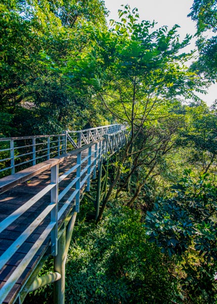
The Linshao Trail (you’ll see “Treetop Trail” on the trailside direction signs) starts beside the Guanyinshan Visitor Center complex. Stretching 800m around an elevation of 380m, it is mostly raised boardwalk whisking you along a mountain slope at forest-canopy level. The only steep section is a single staircase structure. Along the way you’ll have a good chance to espy such hovering and darting raptors as the Chinese sparrowhawk, gray-faced buzzard, collared scops owl, and eagles. The trail ends at the soothingly landscaped grounds of cliff-backed Lingyun Temple, Guanyinshan’s oldest; the temple features stone quarried right on the mountain, traditional red-tile roofing, and a distinctive asymmetrical “horseback” architectural design.

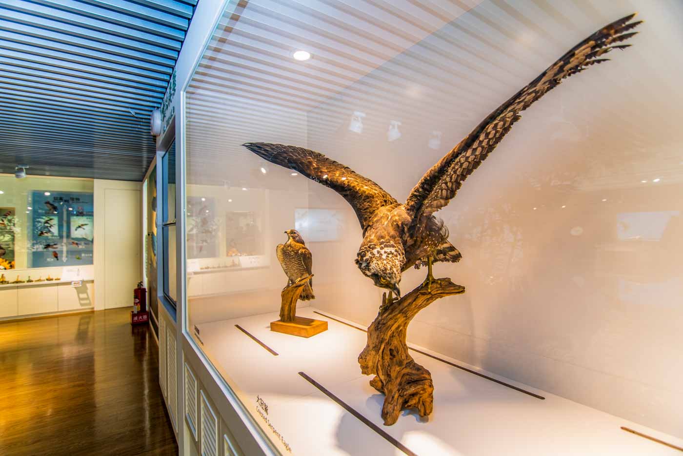
If interested in learning more about the local raptors, and about the local geology story as well, spend a spell at the Guanyinshan Raptor Exhibition Hall right beside the just-mentioned visitor center (free entry; limit of 50 visitors at a time). The first of its kind in north Taiwan, it was inaugurated in 2020. A lively approach is used for the presentation of information here, with especially stimulating interactive multimedia and VR facilities augmenting the pictures, texts, and models.
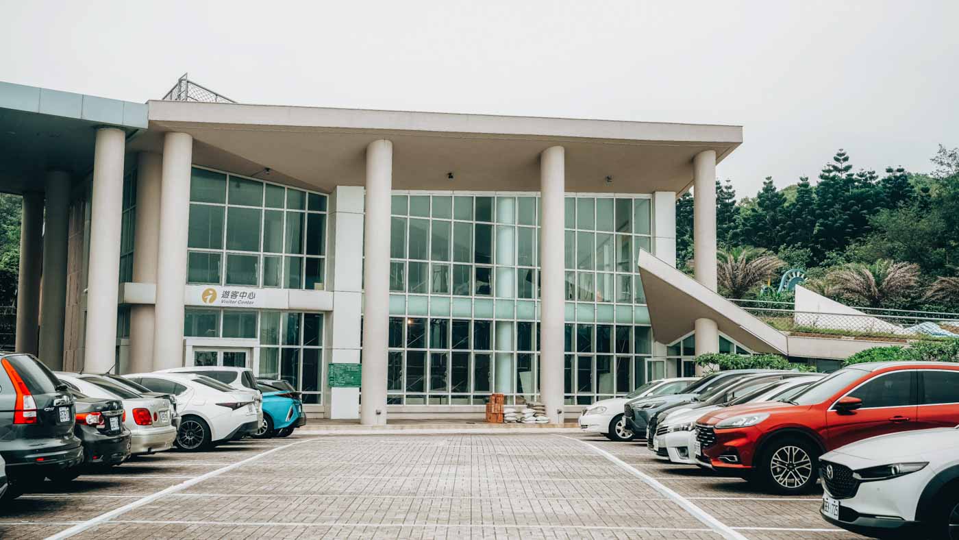
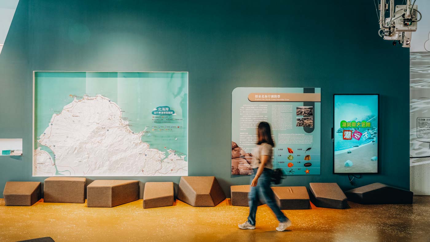
Note that the majority of the places visited here are within the North Coast & Guanyinshan National Scenic Area (northguan-nsa.gov.tw), which is overseen by the Taiwan Tourism Bureau (taiwan.net.tw). Its main visitor center is in Jinshan town, beside Shitoushan Park. Other centers are found around the NSA, a few mentioned in this article.
How to get there There are three main routes to get to the North Coast by public transport, via the port town of Tamsui, northwest of central Taipei (MRT Tamsui Line + Taiwan Tourist Shuttle bus no. 716); via the port city of Keelung, northeast of the city (local train/intercity bus + bus no. 862); or via Yangmingshan National Park, to the north (intercity bus no. 1717 + Taiwan Tourist Shuttle bus no. 716).
About the author

Rick Charette
A Canadian, Rick has been resident in Taiwan almost continually since 1988. His book, article, and other writings, on Asian and North American destinations and subjects—encompassing travel, culture, history, business/economics—have been published widely overseas and in Taiwan. He has worked with National Geographic, Michelin, APA Insight Guides, and other Western groups internationally, and with many local publishers and central/city/county government bodies in Taiwan. Rick also handles a wide range of editorial and translation (from Mandarin Chinese) projects.