The Matsu Islands are among the most fascinating places to visit in Taiwan. We recently explored the islands of Dongyin, Dongju, and Nangan on a whirlwind 3-day trip.
Text: Rick Charette, Photos: Chen Cheng-kuo
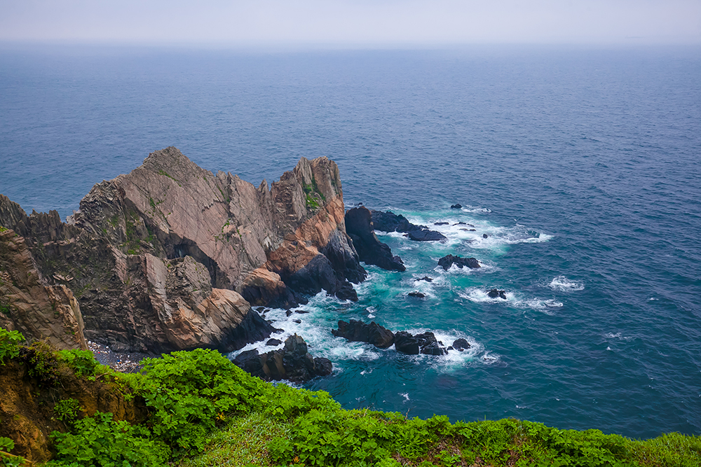
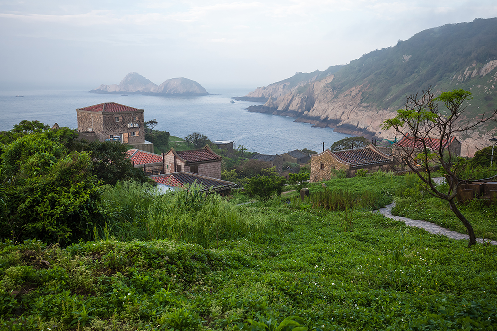
Three colored-cliffs on Dongyin Island
T main “themes” in the remote Matsu Islands, all falling within the Taiwan Tourism Bureau’s Matsu National Scenic Area, are: PRC/ROC Cold War military history and ubiquitous military fortifications (many now tourist sites); geological spectacle, especially in the form of dramatic seascapes; traditional East Fujian stone-residence and temple architecture and cuisine, dramatically different from “mainstream” Taiwan; ferry-ride island-hopping; and teeming, swirling migratory-bird colonies.he Matsu Islands, far to Taiwan proper’s northwest and the Republic of China’s northernmost possessions, are among my favorite Taiwan-travel destinations, accompanying Alishan, Taroko Gorge, and the East Rift Valley. Michelin is also much taken with them, bestowing many star-ratings in its Michelin Green Guide: Taiwan. I’ve visited three times, and though the mountainous mainland China coast is clearly visible from many Matsu locations, on the approach from mainland Taiwan I’m each time reminded of the island-approach scene in the first Jurassic Park film – I’m about to land in a place a world unto itself, unlike anywhere else in Taiwan. Or anywhere else I’ve ever been.
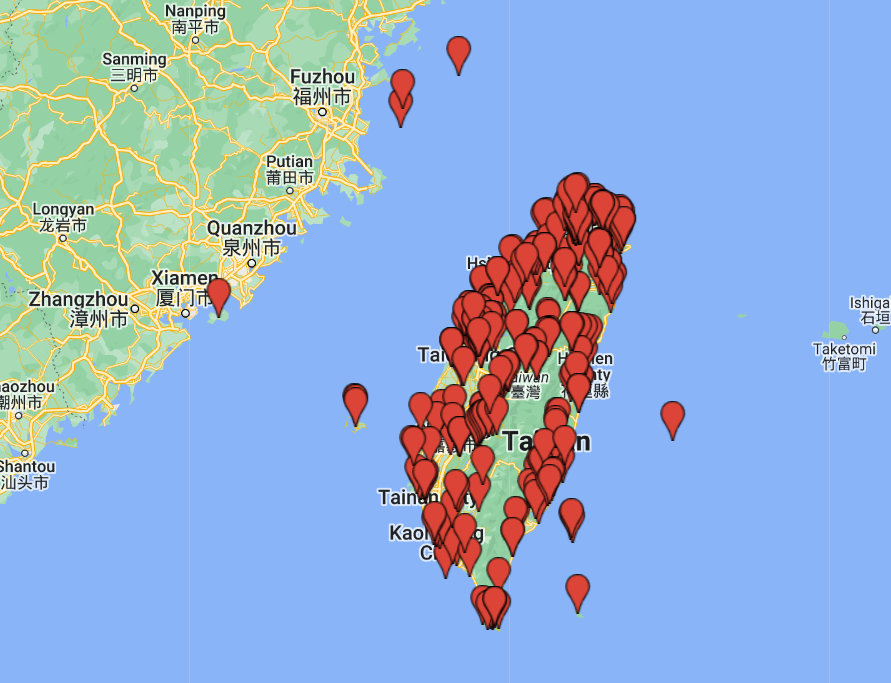
The sparsely populated islands can be described as massive granite (primarily) outcrops rising abruptly from the sea. Flat land is precious, and the wildly indented coastlines, geologically twisted and tortured, are dominated by soaring cliffs with only a few good harbor inlets and bays. There are five main islands: Beigan, Nangan, Dongyin, Dongju, and Xiju. The first two, close to each other, are the largest and most heavily populated. Travel in Taiwan recently visited Nangan, Dongyin, and Dongju, spending a single day in each.
Dongyin
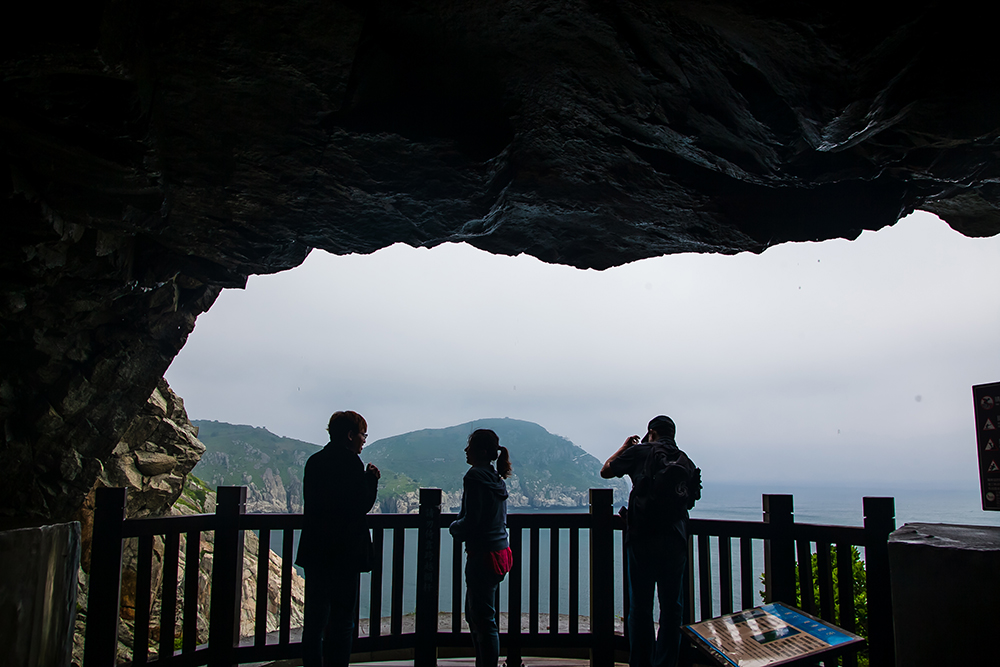
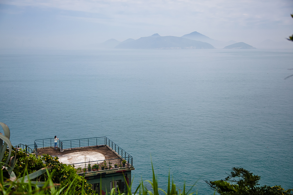
Dongyin is actually two islands, joined by a causeway. Two hours from Nangan by ferry, this is Taiwan’s northernmost point, a windswept outpost of tremendous natural beauty, with Matsu’s most thrilling scenery, a place of lofty granite cliffs and rocky spurs projecting out into the teal-green sea.
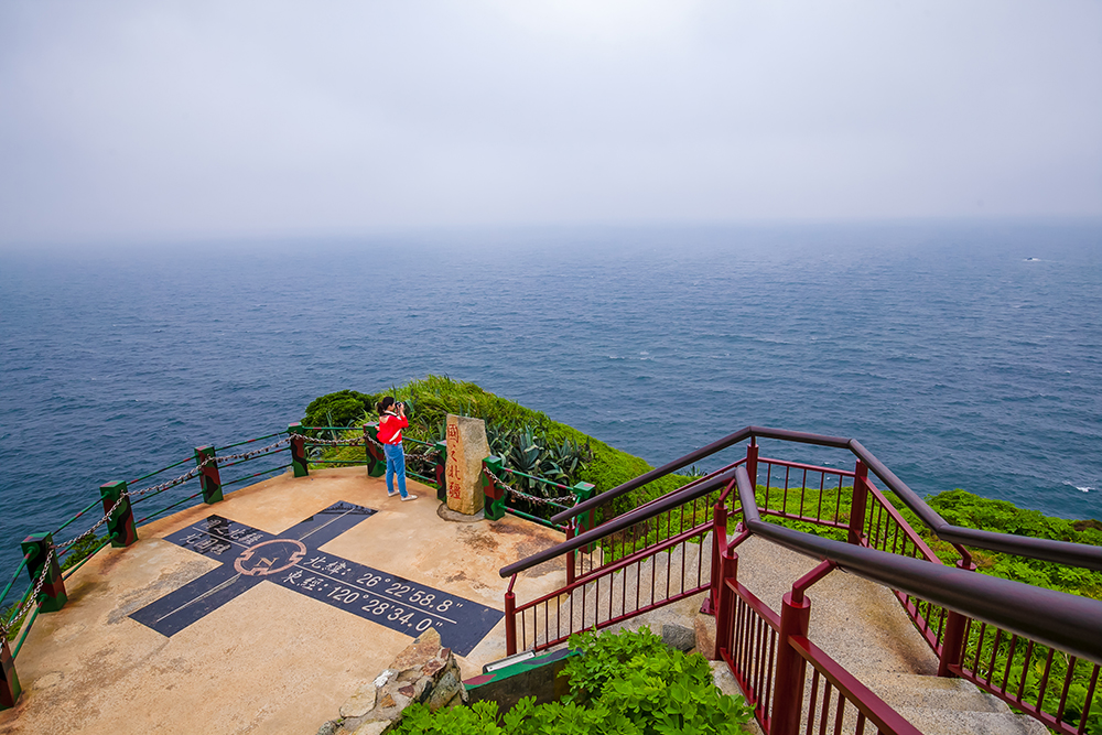
Northernmost Frontier
At the Northernmost Frontier, on the western island, Xiyin, a grassy trail leads from a parking lot past sentries at a lonely military command post, and past bunkers and other abandoned facilities, to the island’s windy northern edge. On clear days the China mainland can be seen. Below the cape’s tip is the Luohan (“Arhats”) Flats, sea-eroded pillars and platforms said to resemble Buddhism’s 18 arhats. Note, however, that though you stand at the Northernmost Frontier tourist attraction, the true frontier is in fact ;tiny, rocky Beigu Islet, just off the coast, which struggles to keep its head above the waves.
Northernmost Frontier
Stronghold No. 33
The cape-tip is at the northern end of a peninsula called the Reclining Alligator – the resemblance is indeed striking – and atop the alligator’s well-defined snout, at the peninsula’s southern tip, is Stronghold No. 33. The highlight of this abandoned facility is the decommissioned US-made twin-barrel M1 40mm anti-aircraft gun on display, which a signboard tells you “weighs 51,350 pounds, has a range of 11,000 meters, (and can fire) 160 rounds per minute.” Good English-language information signage is provided here, as well as at tourist sites throughout Matsu. Archipelago strongholds, invariably dug into the edge-tops of steep-cliff promontories, often have majestic edge-of-the-world views.
Cliffs at Stronghold No. 33
Andong Tunnel
The Andong Tunnel, on the east side of Dongyin Island, is a superlative work of engineering, shooting right through a small mountain and exiting far down below at sea level. The area outside the entrance is protected habitat for the Black-tailed Gull and Black-naped Tern. Inside the tunnel are now-unused barracks, bathrooms, a kitchen, a meeting hall … even a pigsty. Side tunnels lead to openings on sheer cliffsides, formerly used for gun emplacements, looking over cliffs on which Black-tailed Gulls nest in great number in summer, crashing surf far below, the birds obliging with fly-by entertainment just meters away. A large platform right above the sea awaits at the bottom, with tern nests all about on the rocky cliffs.
Andong Tunnel lookout
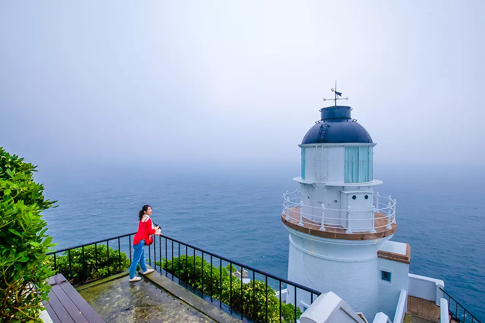
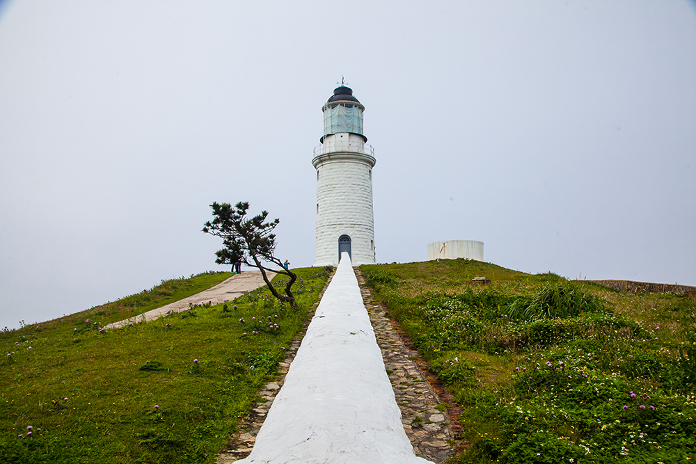
Dongyong Lighthouse
Located at the easternmost tip of Dongyin Island, the brilliant-white Dongyong Lighthouse’s physical setting – stark, lonely beauty. The lighthouse is perched, at first glance seemingly quite precariously, on the precipitous-angle flank of a mountain, the great sea looming before, nothing in view. The mountain’s upper half looms behind and above, nothing of human creation in view. On the dizzyingly steep complex walkways, you look straight down into the sea at your feet. Completed in 1877, designed by an Englishman in 18th-century British style, this lighthouse is Taiwan’s northernmost national heritage site.
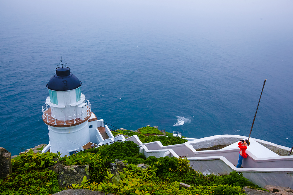
Dongyong Lighthouse
Suicide Cliff
A stone-step trail behind the lighthouse leads to the Suicide Cliff, where ocean waves have cut deep into a mountainside, sculpting a vertical 100-meter-high wall on one side. The site is so-named because, according to island lore, pirates infested the local waters during much of the imperial Qing dynasty, and during one attack a Dongyin woman, her husband killed, chose to leap from the cliff rather than surrender her chastity. The Chinese name translates directly as “Chaste Woman’s Pit.”
Suicide Cliff
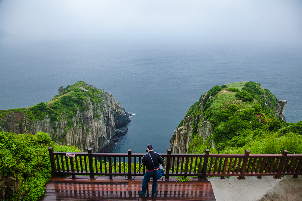
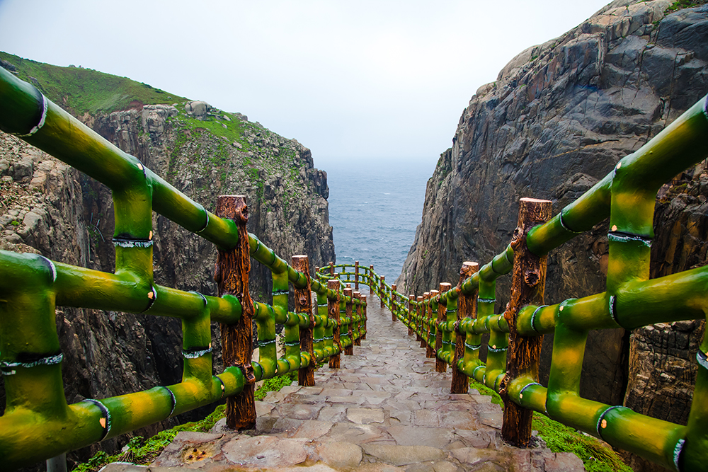
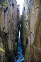
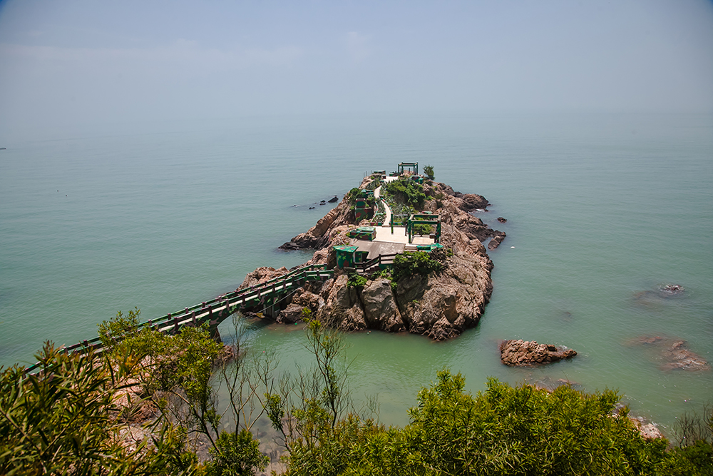
A Thread of Sky
A Thread of Sky, a deep and exceedingly narrow sea-erosion trench, splices two giant blocks of granite, towering rock walls facing each other just meters apart. The outer block is being cut from the mainland like a slice of birthday cake. Fallen slabs high up actually connect the cliffs in places. From the bottom only a thin, bright-blue ribbon of sky is seen. The foaming-white sea waters rush in with the sound of a freight train. From the viewing deck, more busy military rock-burrowing is seen – a tunnel entrance and short cliff-connecting concrete bridge beyond, seeming to hang in mid-air.
A Thread of Sky
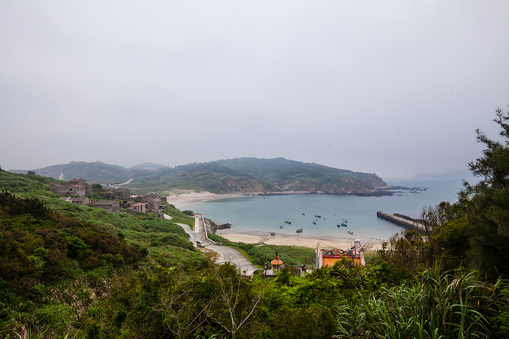
Dongju
Forty minutes from Nangan by ferry, sleepy and sparsely populated Dongju and its partner to the west, Xiju, are Matsu’s most southerly islands.
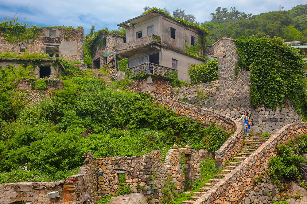
Dapu Village
Matsu’s double-story stone-residence architecture, so medieval European in look, is a world apart from the traditional south Fujian wood frame/brick wall/stucco courtyard residences seen elsewhere throughout Taiwan. During the Cold War era many old fishing villages emptied. Today, tourism is leading to revivification. Lovely, tiny Dapu Village is a prime example. The village was for a time abandoned, but with the help of an artist-in-residence program supported by the Matsu National Scenic Area Administration, homestay and other enterprises are now taking root – the first two homestays opened within the past year.
Dapu Village
Dongquan Lighthouse
Dongquan Lighthouse, atop a cape in Dongju’s northeast corner, is informally called the “Red-Hair Lighthouse.” The term “red-hair” was commonly used for Westerners during China’s imperial days after the Dutch appeared in regional waters. Like Dongyin’s lighthouse, the tall British-built facility, finished in 1872, guided foreign vessels into the nearby China mainland’s Min River after Fuzhou city was opened to trade following the Second Opium War. Britain built numerous lighthouses in the region – China had none – after losing many vessels. The highlight at the cape-tip stronghold below the lighthouse, beyond the stupendous seagull-angle views, is a massive gun poking from a camouflaged emplacement.
Dongquan Lighthouse
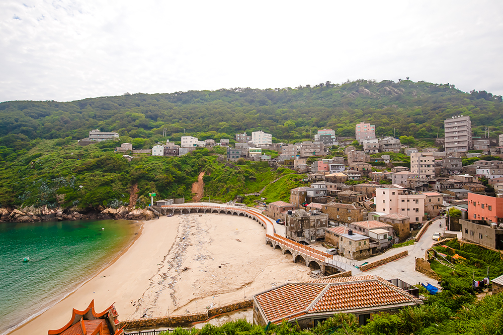
Fuzheng Village
Fuzheng Village, significantly larger than Dapu, is another old fishing village just recently launched along the road to revivification. If you are a photography buff you might feel here like a kid in a candy shop, a photo opp at every turn with possibilities seemingly endless, with scores of tiered old residences, harbor-moored fishing craft, beached hulks, the lighthouse atop its backdrop hill, a flaming-orange-red temple and display tanks at its base.
Fuzheng Village
Take your time savoring the architecture up close. Most structures are two-storied, the second floor providing sea views, cooling breezes, and relief from ground-level dampness. Windows tend to be small and higher up, facilitating defense (way back when) against pirate attack.
Nangan
Matsu’s largest island, Nangan is its cultural and political/administrative hub, and a very busy place compared to the rest of the archipelago.
Niujiao Village
Niujiao Village in Nangan’s northeast, once again flourishing, was one of the first to undergo a renaissance. Note how the homes’ granite blocks are in two shades, yellow and blue. The yellow are from Matsu, blue from Fujian; as a rough rule, blue meant you were more prosperous.
Niujiao Village
Wulinggong Temple
Wulinggong Temple, above Niujiao’s harbor, has the bright orange-red exterior seen on many local temples. The color symbolizes flames; since already “on fire,” why would real fire need to visit? As with many homes, exaggerated vertical eaves are also supposed to help block sparks from nearby fires.
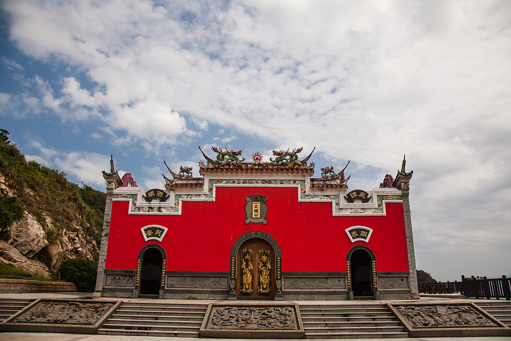
Wulinggong Temple
Stronghold No. 12
A 10-minute walk along the pathway that starts behind the temple takes you to the tip of the cape here, which is occupied by Stronghold No. 12 – not quite abandoned, for its two-floor command post/quarters has been “occupied” by “Thornbirds Book & Café,” an indie enterprise of great character that serves up splendid views of hilly Beigan to the north. The building is attached to such a steep rock face that you feel you’re hovering over the water rather than beside it.
Stronghold No. 12
Picturesquely filling up a mountain-backed niche of flat land behind a sheltered cove, compact, narrow-laned Jinsha Village in Nangan’s southwest is another imperial-era settlement now breathing strongly again, with new homestays and shops opening. One example is funky Matsu 1st Hostel, where cheap, cubicle-style single- and double-person rooms are offered. Housed in a true Matsu rarity, one of its east Fujian-style courtyard residences, beautifully restored, it’s one of four Nangan/Beigan youth-oriented homestays run by local entrepreneur Eddy Chuang (www.matsuhostel.com; Chinese).
Jinsha Village
Iron Fort
The Iron Fort east of Jinsha Village, both on and inside a rocky outcrop in a small bay, once protected frogmen units. Narrow tunnels within lead to sniper slots, gun emplacements, quarters, and a kitchen. Outside, note the dog kennel. When tensions were high, PRC frogmen units staged night attacks, poisoning the guard dogs and taking human ears as trophies and proof of success. Many died in such lightning attacks over the years, here and elsewhere in Matsu.
Iron Fort
For more information on the sights and experiences showcased in this issue, as well as the many others that await you, visit the Matsu National Scenic Area website (www.matsu-nsa.gov.tw).
There are regular flights between Taipei and Matsu’s airports on Beigan and Nangan, and regular overnight ferry service from Keelung, near Taipei, to the islands. In the archipelago, regular service on smaller ferries is provided between the main islands. The islands are often fogged in, especially March-May, so check ahead before traveling. For detail on flights, ferry services, accommodations, taxi/van/scooter rental, visitor info centers, and more, visit the Matsu National Scenic Area website (www.matsu-nsa.gov.tw). Note that tickets can be hard to come by during the summer high season, so book well ahead.
Further reading on other sites
Foreigners in Taiwan: Daqiu Island 大坵島
Foreigners in Taiwan: Our Guide to the Matsu Islands 馬祖列島指南
About the author

Rick Charette
A Canadian, Rick has been resident in Taiwan almost continually since 1988. His book, article, and other writings, on Asian and North American destinations and subjects—encompassing travel, culture, history, business/economics—have been published widely overseas and in Taiwan. He has worked with National Geographic, Michelin, APA Insight Guides, and other Western groups internationally, and with many local publishers and central/city/county government bodies in Taiwan. Rick also handles a wide range of editorial and translation (from Mandarin Chinese) projects.