Where Taiwan Is Not Quite Itself
Text | Rick Charette
Photos | Chen Cheng-Kuo
Riddle: What’s the farthest away you can get from Taiwan while still in Taiwan?
Answer: sdnalsI ustaM (hold up to mirror)
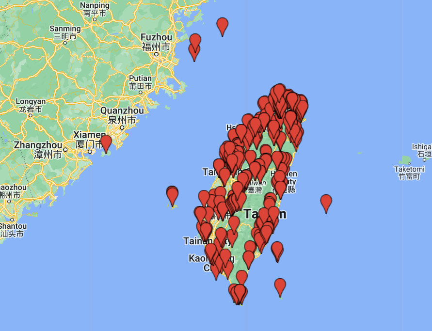
The answer, yes, is the Matsu Islands. “Taiwan” is of course the name of a great big island, but in the modern political sense “Taiwan” is also a collection of this great big island and scores of smaller ones. Among the latter, two – Kinmen and Matsu – are archipelagoes so close to mainland China you can see the red stars on People’s Liberation Army caps on the opposite side.
Well, maybe only with a telescope, but you get the point. Pretty darn close. Over the years countless soldiers have made faces at each other across the waters, and mouthed nasty things about each other’s mothers and political systems – though over the past two-plus decades things have quieted down markedly and front-line troop numbers have dramatically dropped.
Kinmen is across from Fujian Province’s south, where the ancestors of most of Taiwan’s people came from. Taiwan proper is far behind, across the Taiwan Strait. Matsu is far to the north, Taiwan’s northernmost possession, across from a north Fujian area called east Fujian in recognition of its distinctive dialect and cultural traditions. This is where the ancestors of Matsu’s permanent population came from. So you see how a Matsu visit takes you as far away from Taiwan as possible physically – and culturally – while still standing on Taiwan soil.
I had the great fortune to visit the Matsu islands for a second time just recently, with a Travel in Taiwan team. My first trip was 10 years ago. Military control of Matsu was lifted in 1992 (martial law was in effect in Taiwan from the late 1940s until 1987), the Matsu National Scenic Area was officially launched in 1999, and since my last visit there has been striking progress in the tourism facilities and the overall tourist experience.
You’ll find your key Matsu impressions will be about the ubiquitous military fortifications (many now tourist sites), dramatic seascapes, unique architecture and food, island-hopping, and birds, birds, birds. We savor the food in our accompanying “Eat” and “Buy” articles, and get busy with binoculars in a special birding piece.
Keelung to Matsu
Most visitors explore Beigan and Nangan, the two main islands, whose shapes give them a map appearance resembling two oracle blocks cast upon the sea. If time allows, many take in remote Dongyin, the northernmost island, which offers Matsu’s most spectacular seascapes. It’s about two hours from Nangan by ferry. (In an informal poll this visit among Matsu National Scenic Area personnel, Dongyin was the almost universal favorite.) Inter-island travel is by ferry; there’s also a helicopter service.
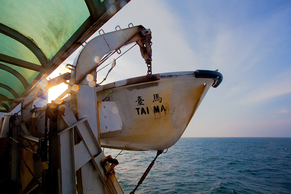
The quintessential Matsu travel experience includes an overnight Tai-Ma Ferry ride from Keelung, north of Taipei, to Dongyin and Nangan. The trip takes about 10 hours, arrival at the second port about 8 am. It’s eye-opening, and quite fun. You’re accompanied by hundreds – conscript soldiers, Matsu locals, tourists. The Keelung Harbor exit is thrilling, famous mountainside Jiufen town twinkling far off, fishing boats with lights ablaze gliding by, the galaxy of stars and shooting stars wonderful. On-board amenities are basic; most bring their own munchies. (Note: I flew back to Taipei both trips, just 50 minutes.)
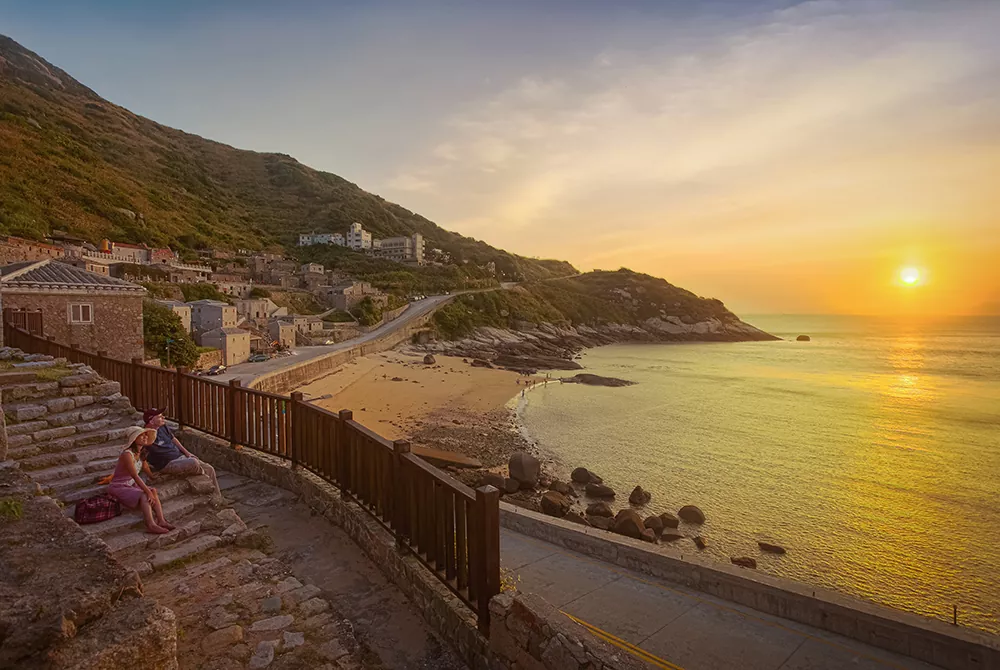
Qinbi Village
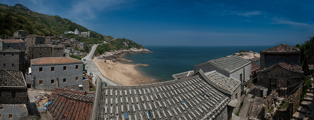
Matsu is a better showcase of traditional east Fujian culture than east Fujian itself is, where the infamous attacks on all “feudal olds” during Mao Zedong’s reign created turmoil and destruction. The most visually distinctive cultural expression is the stone houses. Four old villages are now protected, and stone houses are ubiquitous elsewhere. Beigan’s Qinbi and Nangan’s Niujiao are the most popular stone-house villages. Snuggled up between beach and mountain, Qinbi reminds you of old tiered, hill-clinging European villages by the Mediterranean. The granite blocks used in walls have rough, curved surfaces; those used in traditional south Fujian architecture are cut flat. The red-tiled roofs are covered with large rocks for protection from the big, booming winds that often come howling in, holding the tiles down. The houses are said to “breathe,” for no mortar is used to fasten the tiles, facilitating ventilation. This also enables easy roof repair. There are no overhanging eaves, avoiding upward wind pressure on roofs.
Locals say Qinbi houses are particularly well-built because this was once a pirate village, among the islands’ wealthiest. You’ll notice blocks in two shades, yellow and blue. The yellow is from Matsu, blue from the China mainland; as a rough rule, blue meant you were more prosperous. As elsewhere, most structures are two-storied, the second floor providing views, allowing breeze access, and bringing relief from damp at ground level. Interior walls and beams are of wood. Windows tend to be small and higher up, for defense against attack.
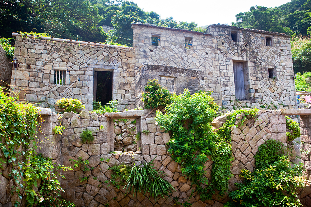
You’ll see bright-blue strips high up on what are called “fire-sealing walls.” The blue symbolizes water, dousing wannabe fires. Some are also topped with exaggerated vertical eaves that help block sparks from nearby fires.
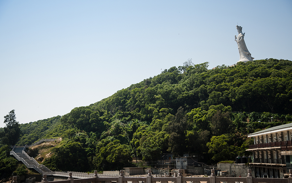
Magang Mazu Temple
Matsu folk have traditionally been seafaring people. Mazu, Goddess of the Sea, is unsurprisingly very popular, as is a deity not known so well elsewhere in Taiwan, the White Horse God, who also protects ocean sojourners. The harborfront Magang Mazu Temple is Matsu’s key place of worship. The goddess was born human over 1,000 years ago on the island of Meizhou to the north. She performed many miracles, and according to local Matsu Islands lore her body floated into this harbor after famously saving her fisherman father from drowning – all this, though very real, happening in the girl’s fitful dreams while she lay at home sleeping. Matsu folk sent her body home, but buried her sacred garments here and, later, built this temple.
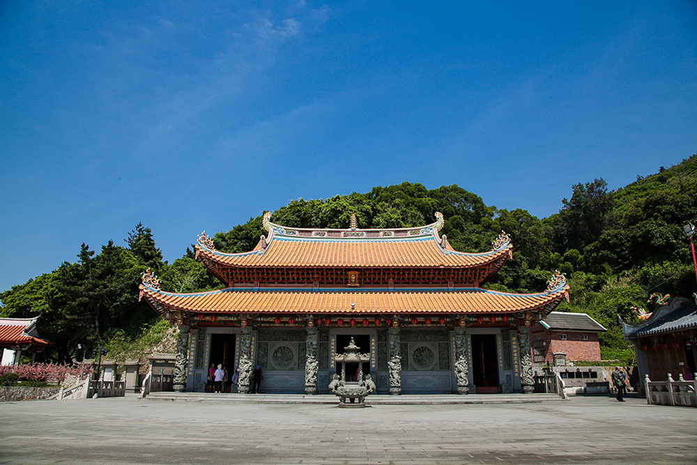
You’ll notice the bright-orange walls on many local temples. These are a fire-sealing wall variation. The color symbolizes flames. Since the temples are already on fire, why would real fire need to visit?
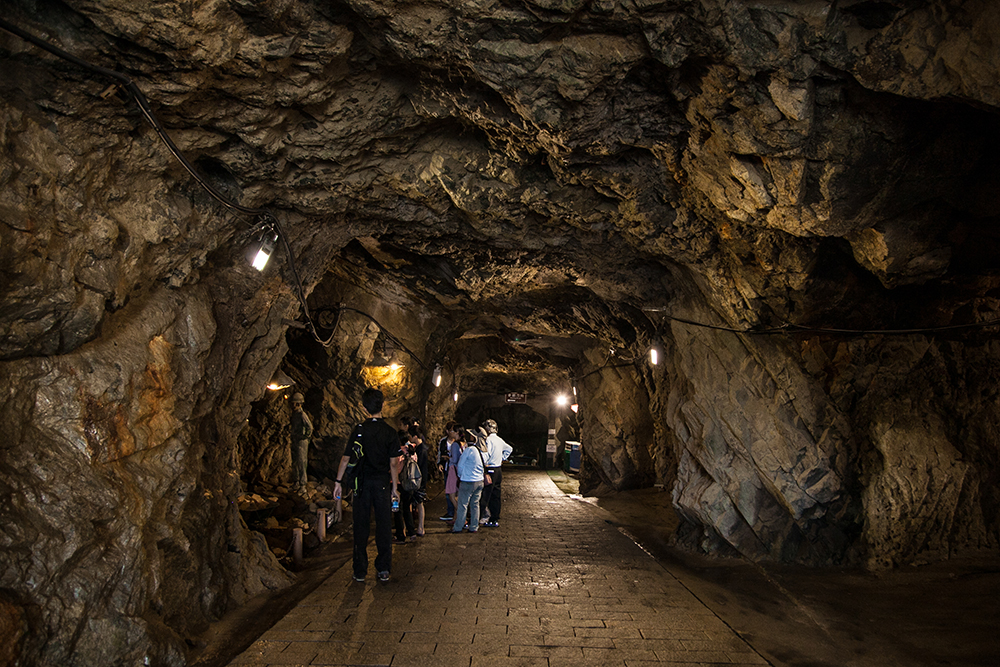
Military Tunnels
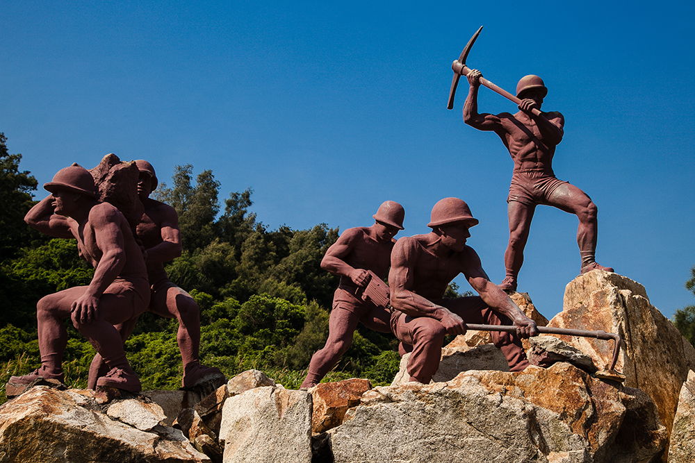
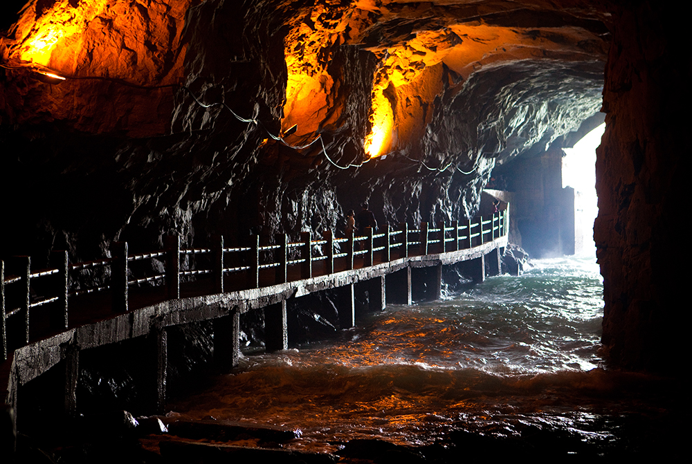
When the ROC military was pushed off the China mainland in the late 1940s, units dug in – literally – on many islands just off the coast. Matsu and Kinmen are those still held. You’ll see cliff-side pillboxes, strongholds, and other facilities everywhere, many now abandoned, many now tourist sites. Matsu, it’s said, has the world’s highest density of military tunnels and strongholds. The Beihai Tunnel on Nangan is an extraordinary tunnel complex, a hidden port hewn from solid granite, hacked out by conscripts in the 1960s armed with not much more than picks and tremendous willpower. Many forfeited their lives in the effort. Gouged out of a mountainside, it fit 120 smaller-sized vessels.
The Andong Tunnel on Dongyin and Wusha Beihai Tunnel on Beigan also engender powerful emotions. The gates at the latter are gone, and the sea comes pounding in at both ends. Yes, it’s perfectly safe.
Iron Fort
Close to Nangan’s Beihai Tunnel, the Iron Fort is both on and in a rocky outcrop in a small bay. It once protected frogmen units. Narrow tunnels within lead to sniper slots, gun emplacements, sleeping quarters, and a kitchen. Outside, note the dog kennels. When tensions were high, PRC frogmen units staged night attacks, poisoning the guard dogs and taking human ears as trophies and proof of success. Many died this way over the years, here and elsewhere in Matsu.
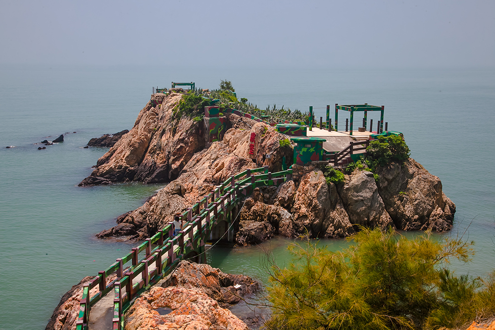
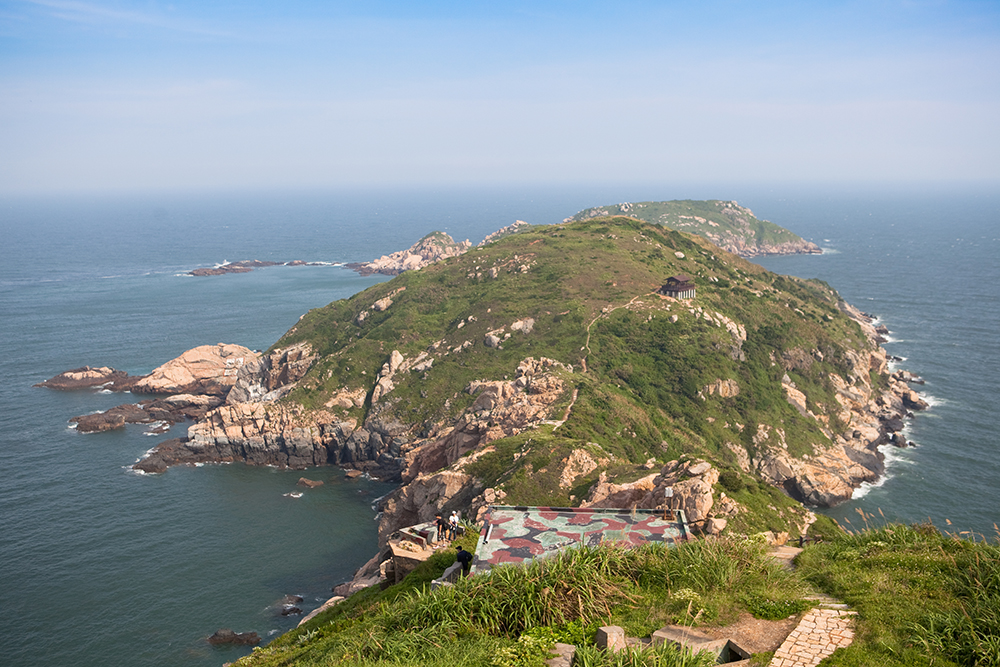
Luoshan Peninsula
The Matsu Islands are just tiny little specks in the ocean, small granite outcrops. The stark beauty of these sharp-cut rock-hills bursting skyward from the ocean’s depths is often breathtaking. The National Scenic Area administration has been systematically developing a network of inviting walking trails, most following old inter-village routes over mountain or high up on coast-side slopes, generally well-shaded.
On my recent trip I was especially taken with the Luoshan Nature Trail, which doesn’t fit the inter-village mold. In the area behind Beigan Airport, it starts on a small mountain and ends far down on a narrow bare-rock promontory, ocean pounding rock below your feet on both sides. This is an old dead-end trail used by local oyster gatherers and fishermen. Along the way, visit abandoned Stronghold No. 12 and the attractive War and Peace Memorial Park Exhibition Center (good English), with informative displays on Matsu’s modern military history.
Practical Info
The islands are often fogged in, especially March-May, so check ahead before traveling. For detail on flights to/from Taiwan proper, ferry service to/from Keelung, accommodations, taxi/van/scooter rental, visitor info centers, and more, visit the Tourism Bureau website and the Matsu National Scenic Area site (www.matsu-nsa.gov.tw).
Find Matsu hotels on booking.com or agoda.com!


About the author

Rick Charette
A Canadian, Rick has been resident in Taiwan almost continually since 1988. His book, article, and other writings, on Asian and North American destinations and subjects—encompassing travel, culture, history, business/economics—have been published widely overseas and in Taiwan. He has worked with National Geographic, Michelin, APA Insight Guides, and other Western groups internationally, and with many local publishers and central/city/county government bodies in Taiwan. Rick also handles a wide range of editorial and translation (from Mandarin Chinese) projects.