Taiwan’s Wilder Side — Three Days in Naturally Blessed Hualien County
Text: Rick Charette; Photos: Chen Cheng-kuo
All roads leading to Hualien County are spectacular ones. And there are but few. A thick series of north-south high-mountain ranges stand between Hualien (and its sister county to the south, Taitung) and the dense population of urban agglomerations in the north and along the west side of Taiwan. The result for the flatlands region called the East Coast is low population density and a comparatively quiet tourist business. This isolation, and the protection of the natural environment it has afforded, engendered the region’s “Taiwan’s backyard garden” brand long before tourism branding became a thing.
The roads to Hualien from the north and the west are as follows: First, the Central Cross-Island Highway, which brings you twisting down from the cloud-level heights of the central mountains, and in its last stage slices along the base of mighty Taroko Gorge’s sky-climbing cliffs before spilling you out coast-side at the gorge’s mouth.
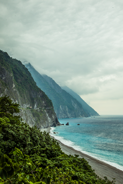
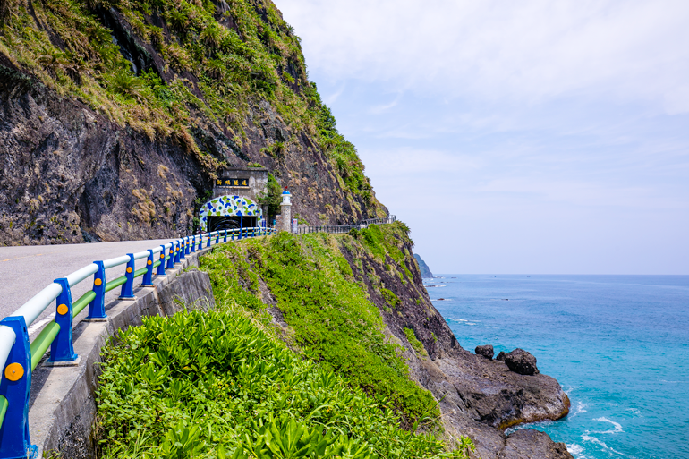
The second road is the inexpressibly impressive Suhua Highway, which is etched along cliffs high above the pounding Pacific breakers between the port town of Su’ao in Yilan County and coastal Hualien City, just south of Taroko Gorge. The most dramatic section traverses the face of the 1,000m-high Qingshui Cliff for 20-plus kilometers, the cliff dropping almost vertically down into the sea.
And there is a third, a “railway road.” Your train powers across the green Yilan Plain and plunges into the mountains heading south, popping in and out of tunnels and shooting across a series of gorges and valleys, taking you “behind” the colossal Qingshui Cliff. You then burst forth right on the coast for the last-leg chug to always-at-ease Hualien City, passing the yawning Taroko Gorge mouth and foot-of-the-mountain indigenous villages.
Travelers concerned about time (and who don’t want to take a domestic flight) choose the railroad – as we did on a recent Travel in Taiwan circuit. After picking up a rental car at one of the numerous operations right outside Hualien Railway Station, we hit the road for a 3-day ramble through the three main tourist regions in the county’s north: Taroko Gorge, East Rift Valley, and Pacific Coast.
TAROKO GORGE
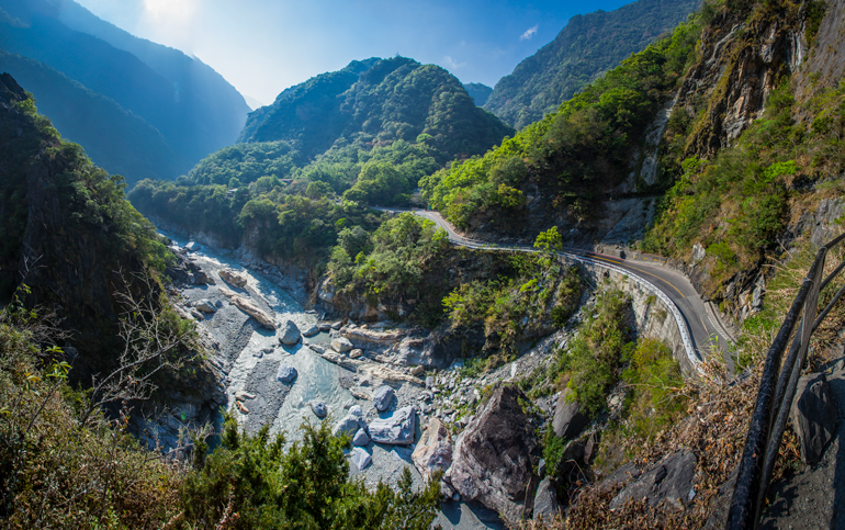
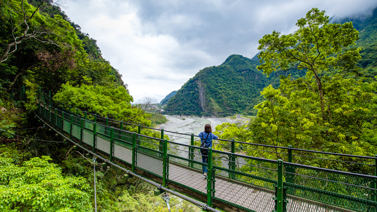
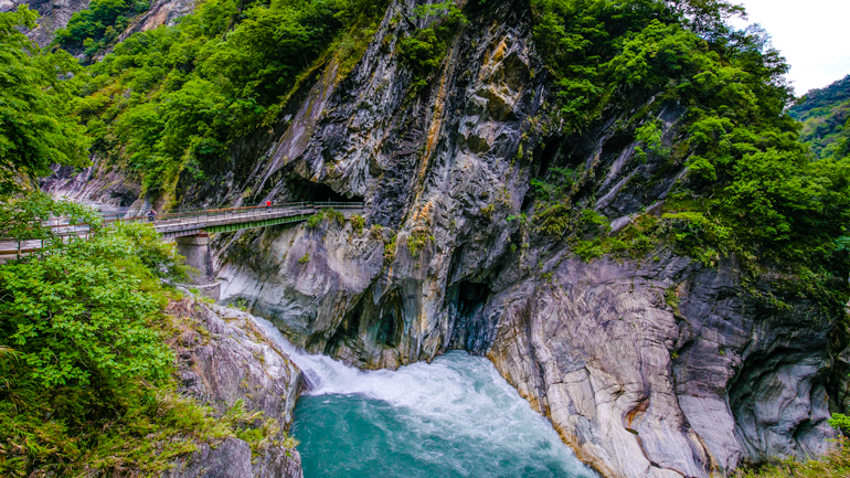
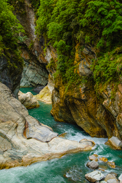
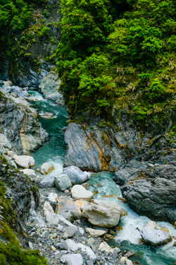
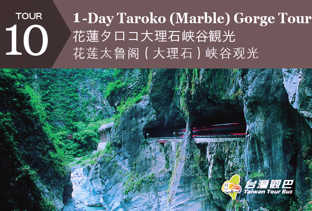
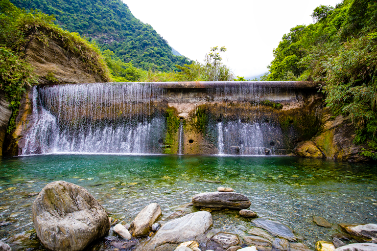
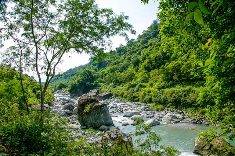
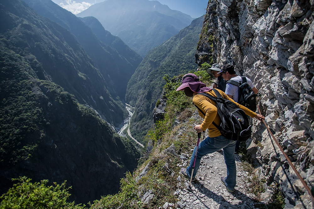
Taroko Gorge, though smaller in scale than the Grand Canyon, in my humble estimation rivals it in grandeur. The centerpiece of Taroko National Park, it is a magisterial river-cut slice right through solid mountain that starts far inland and opens directly onto the Pacific – 19km of unremitting wonder. Visitors moving along the Central Cross-Island Highway and along trails in the main gorge and tributary gorges marvel at the towering cliffs thickly laced with marble.
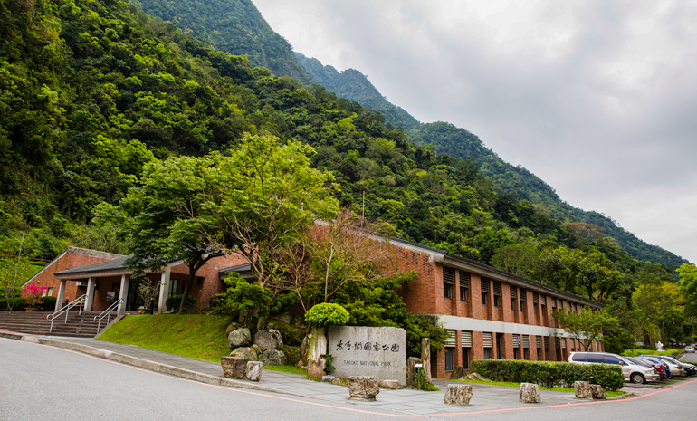
Taroko National Park Visitor Center
Upon entering the gorge at its east end, first check out the Taroko National Park Visitor Center – turn right and cross the bridge after passing the Central Cross-Island Highway gate. The facility has first-rate exhibit areas and video presentations (English available with a little advance notice). A special treat is dining alfresco at the snack bar/restaurant, while looking out over an artwork-bedecked grassy lawn and beyond into the gorge. Choose from among a range of savory set meals, including Korean-style spicy pork, curry chicken, and vegetarian tofu. As your drink selection, try the cold Oolong tea laced with local honey.
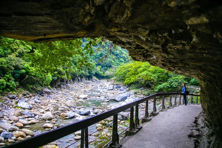
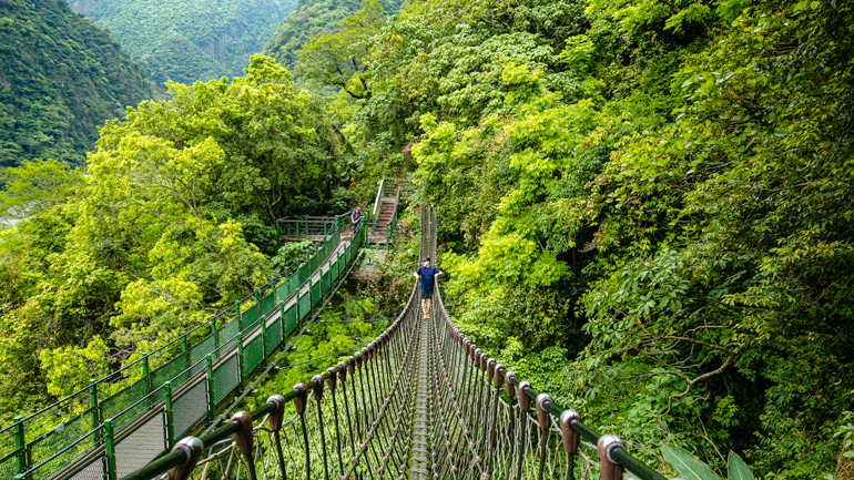
Little Zhuilu Trail
The Little Zhuilu Trail starts with a flourish, accessed from a pedestrian walkway inside Shakadang Tunnel, a highway tunnel near the visitor center. A short side tunnel, the east-end ventilation tunnel, takes you to the trailhead.
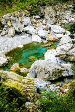
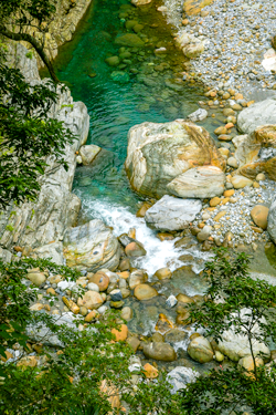
The short trail (650m) hugs the mountainside most of its length, and you overlook the gorge-sculpting Liwu River’s lower reaches from about 60m up much of the time. Pacific views are granted at the lookout spots. There are a few moderately steep stepped sections, requiring a modicum of fitness. After the views, the main trail highlight is its rope bridge spanning a creek-bed. Those less daring can cross via a wood-plank suspension bridge.
Shakadang Trail
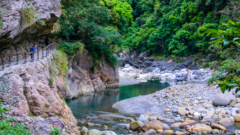
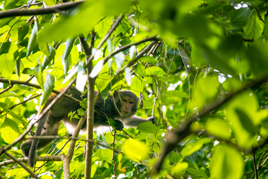
Where this pathway ends, the Shakadang Trail begins. This easy-grade trail along the tributary Shakadang River, with sections cut right out of the cliffside (low overhangs, watch your head!), began life as a narrow track blazed by the Japanese during the 1895-1945 Japanese colonial period to facilitate hydropower-project work. The walls here feature some of the area’s most impressive evidence of geological folding, in places looking like works of abstract art by immortals. You pass two now-abandoned settlements of the Truku tribe (the local indigenous people), called 5D Cabin and 3D Cabin, and a Japanese-built dam and aqueduct. At the 5D Cabin are Truku-run sales stands; the site’s old red-brick police station and small houses are used for storage. Try the locally grown bananas and delicious figs harvested from Ficus trees along the river. Macaques and colorful birds feed on the fruit early mornings and evenings.
Baiyang Trail
The gem experience of this Taroko visit was a morning spent on another trail, the Baiyang Trail, which starts at a roadside just above Tianxiang, a river-terrace recreational and service area at the upper end of the Taroko inner gorge. Beyond the scenery, Tianxiang’s draws include a few small eateries, a 7-Eleven, and the Silks Place Taroko.
Note: The length from coast-side mouth to Tianxiang is known as the “inner gorge,” while the stretch from Tianxiang further on toward the high mountains is referred to as the “outer gorge.” The difference? The outer is impressive, the inner magnificent, drawing most tourist interest.
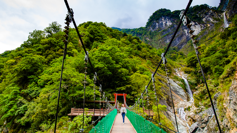
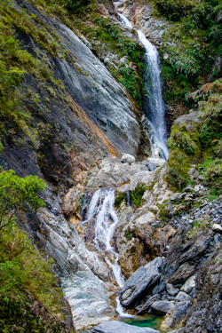
The Baiyang Trail begins with a dramatic human-engineering flourish. You dive directly from the roadside into a straight-as-an-arrow 380m-long tunnel (bring a flashlight!) that pierces a mountain from the main gorge to a secondary gorge. At the end of the even-grade 2km section of the trail is a golden prize, which bursts into view upon exiting a tunnel. At a footbridge leaping a deep-cut cleft carved by a waterway seemingly too modest for the task, a lofty twin cataract plunges ethereally downward from vertigo-inducing heights. The trail was constructed as a narrow cliff-hugging road by the Taiwan Power Company in 1984 for use in a later-cancelled hydropower project. There is in fact a further section beyond the present trail, currently closed for safety reasons.
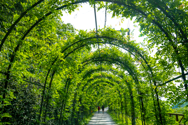
Buluowan Recreation Area
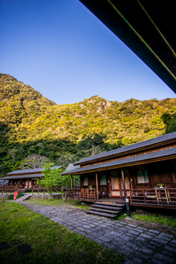
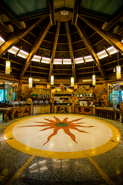
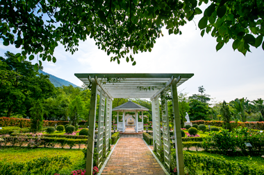
The Buluowan Recreation Area is spread over an upper and lower terrace at roughly the inner-gorge midway point, about 160m above the Liwu. It is reached via a short side road. “Buluowan” is the Truku name of a former tribal settlement here, and most recreation-area staff are tribe members. The word means “echo” – little wonder, considering the area is surrounded by soaring cliffs on three sides. The site has trails, a sophisticated multimedia tribal-culture intro, a circular theater where traditional dancing is staged, a museum explicating traditional arts and crafts, arts/crafts demos, a gift shop, and nightly song-and-dance performances at the Taroko Village Hotel (www.tarokovillage.com). The latter has indigenous-style wooden cabins with modern interiors spread out in village style around a grassy square and a restaurant serving up indigenous dishes and stupendous views.
Spending a half or full day in Taroko Gorge, as most visitors do, does not do it justice, especially for those with a taste for trail trekking. Here we’ve focused on the array of trail forays available, but of course you must leave time for its other big draws: the Eternal Spring Shrine, the Tunnel of Nine Turns, and the Swallow Grotto.
[wp-svg-icons icon=”cool” wrap=”i”]
Edison Travel Service
1-Day Tour
(Departure every day)
Pick-up: AM 06:00-06:30
At: Hotel lobby
Adult’s fare: NT$4,200; child’s fare: NT$3,300
Itinerary
Pick up from hotel → transfer to Taipei Railway Station → train to Hualien → bus to Taroko Gorge Gateway → Shakadang Trail → Swallow Grotto → Marble Bridge → Tianxiang → Changchun Temple → Marble Factory → Qixing Lake → Hualien Stone Sculptural Park → train to Taipei → transfer to Hotel
More information at www.edison.com.tw.
Also read:
Foreigners in Taiwan: Zhuilu Old Trail 錐麓古道
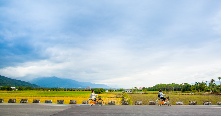
EAST RIFT VALLEY
The farm-carpeted, brightly colored East Rift Valley starts immediately below Hualien City. With the Coastal Mountain Range on one side and the Central Mountain Range on the other. It runs almost all the way down to Taitung City. Provincial Highway 9 connects the two cities through the north-south valley, meandering side to side.
Liyu (Carp) Lake
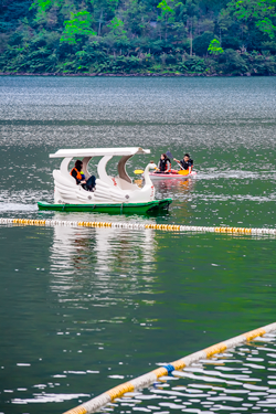
Liyu (Carp) Lake is in the central-mountain foothills southwest of Hualien City, on Highway 9C. About 104 hectares in area, this is the largest lake in eastern Taiwan. Among the plethora of tourist facilities and recreation options at the lake are a visitor center, pedal-boats, canoes, motorboats, and bicycle rentals. It has a 4km ring road that offers pleasant walking/cycling routes, camping/picnic areas, easy-challenge trails into the hills, and open-air local-style restaurants at which lake shrimp is the favored delicacy. On non-holiday weekdays, the birds find it quiet enough to come out and sing for you.
Feicui (Emerald) Valley
North of Liyu Lake, a short riverside road heads inland off Renshou Bridge that crosses the wonderfully monikered Mugua (Papaya) River. At the road-ending T-intersection is a trailhead. The pathway is less than 1km long and takes you upriver along the Mugua, through an old tunnel with dozing ceiling-clinging bats, and along an up-and-down au naturel exposed-root section to a tributary-stream waterfall with a wadeable rock pool at its base. This is the bottom of the narrow Feicui (Emerald) Valley, increasingly popular with river tracers.
Fenglin
Dotted along Highway 9 as it flows through the East Rift Valley are small farm towns well worth a little of your time. South of Liyu Lake we poked around two, Fenglin and Guangfu. Fenglin was Taiwan’s first locality recognized as a “Slow City” by Cittaslow International (www.cittaslow.org), an Italy-based association which promotes slow-paced sustainable living and provides support for natural, eco-friendly food production.
Read more about Fenglin at taiwaneverything.cc/2018/05/10/fenglin-hualien/
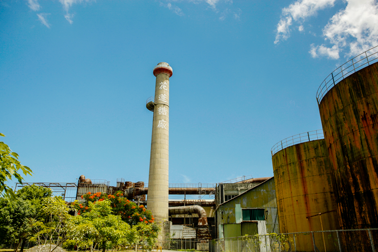
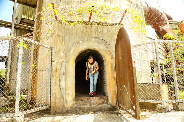
Guangfu
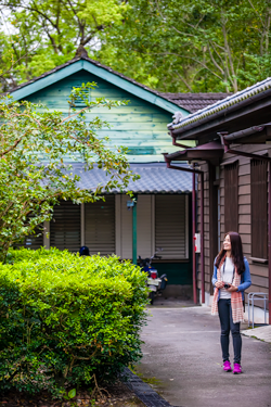
Guangfu is best-known as home of the Guangfu Sugar Factory, a sprawling complex constructed during the Japanese colonial era. Sugarcane was long a leading regional cash crop. Today, tourists come to view the heritage Japanese-style bungalows, worker bathhouse, and other nostalgia-inducing facilities.
Lintian Mountain Forestry Center
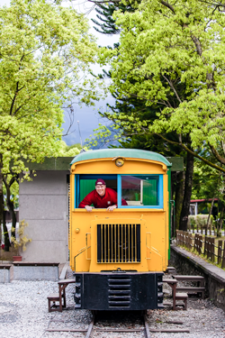
The Wanli River exits the central mountains into the valley between the two towns. Just inside the mouth of the mountain valley is a place popular with history buffs, the Lintian Mountain Forestry Center. This is a former timber industry village established by the Japanese. It was once Taiwan’s fourth-largest logging operation, with 2,000 residents at its height. Many buildings, built with native Chinese cypress, have been beautifully restored. It also hosts a history center, remnants of the extensive rail and cable systems that ran into the hills, and displays featuring trains and machinery.
Jilitan (Jili Pond)
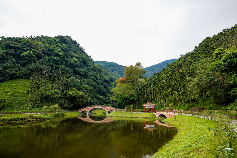
Directly on the other side of the mountain on which the center is built is another mountain valley, carved by the Ma’an River. This was also logged by the Japanese. Up a tributary stream just inside the mouth you’ll find the placid Jilitan (Jili Pond). It was created by the Japanese as a log pond, and is now cleared. It’s the centerpiece of a new breeze-brushed park with walking paths, Chinese imperial-style arch bridges, and foot-soak facilities.
Butterfly Valley Resort
The Fuyuan National Forest Recreation Area is in yet another central-range valley. The park is between the towns of Guangfu and Ruisui. The latter is best-known as a starting point for whitewater rafting outings to the coast. The focus here is eco-tourism. The Butterfly Valley Resort (www.bvr.com.tw) is managed by a commissioned private enterprise, and most of its amenities are just inside the park entrance. This is near Fuyuan Stream’s lower reaches, where the terrain is less steep. The resort’s amenities include a small upscale hotel, landscaped gardens, a butterfly museum, and an outdoor hot-spring spa. Guided eco-tours are available. These last 1.5 hours and take you through the gardens, along lower-area trails, and into the more rugged upper area. The upper area offers misty waterfalls, suspension bridges, and a broad camphor-tree stand. A fee is charged for non-hotel guests.

Jinlai Huilan B&B
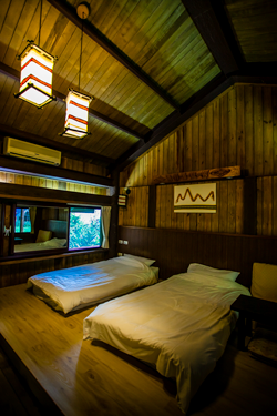
Located north of Ruisui town on Highway 9, the Jinlai Huilan B&B is run by a delightfully warm and young husband/wife team who not long ago decided to opt out of big-city living. Its layout is motel-like. Meals are taken in the main entrance area, and the five simple, tastefully appointed rooms, in the rear and along one side, are entered directly from outside (parking is in front). The tableau seen from the rooms is blissfully quaint – across valley-floor farms into the Butterfly Valley (see main text), trains drumming along with percussion-like rhythm in the distance. The meals are another soothing satisfaction. The husband has international-cuisine culinary-arts training, and clearly studied well. (Rooms start at NT$2,200)


Add: No. 226, Sec. 3, Zhongzheng N. Rd., Ruisui Township, Hualien County
(花蓮縣瑞穗鄉中正北路三段226號)
Tel: 0960-667-286
Website: comein-bnb.com (Chinese)
PACIFIC COAST
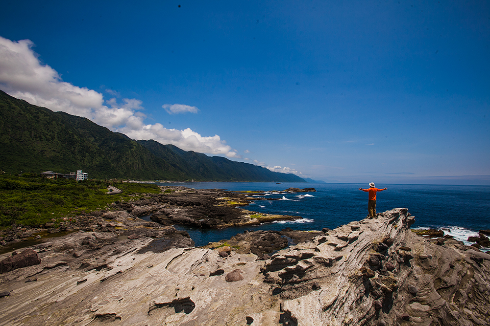
The long coastal strip between Hualien City and Taitung City is framed by the coastal range on one side, with slopes that are sometimes gentle and sometimes steep, and the brilliant-blue ocean on the other. The coast offers a medley of arriving waves (breakers great for surfing in some places), unique rock formations in other locales, and narrow bands of arable.
The curvaceous Provincial Highway 11A takes you from Guangfu up and over the low-peak coastal range. It serves up splendid hawk-eye views of the rift valley and central mountains when ascending, and of the coast and ocean on its descent. The descent drops you into Fengbin, a languid mixed Amis/Kavalan indigenous village above a river that melds with Pacific. Highway 11, which traverses the coastline and takes you back north up to Hualien City, is joined here.
Xinshe
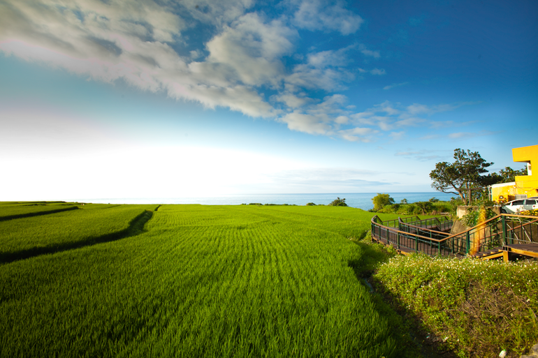
The village of Xinshe, with a sharp-slope mountainside serving as its “back wall,” is perched atop a large flat-topped headland which is espied from many kilometers away while motoring along Highway 11. This is a tribal community, Taiwan’s largest Kavalan settlement. The Kavalan motherland is Yilan County, but most members moved down along the Hualien/Taitung coast in the 1800s to escape Chinese-settler pressure. The headland is beautifully contoured, with sun-reflecting rice paddies fitting perfectly together. The blue of the ocean, green of the paddies, and colorful scarecrows combine into a photographer’s dream come true.
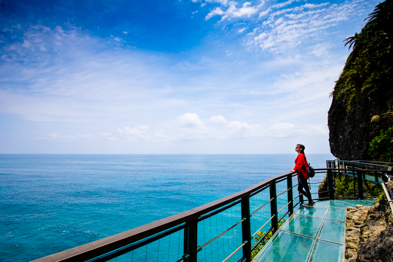
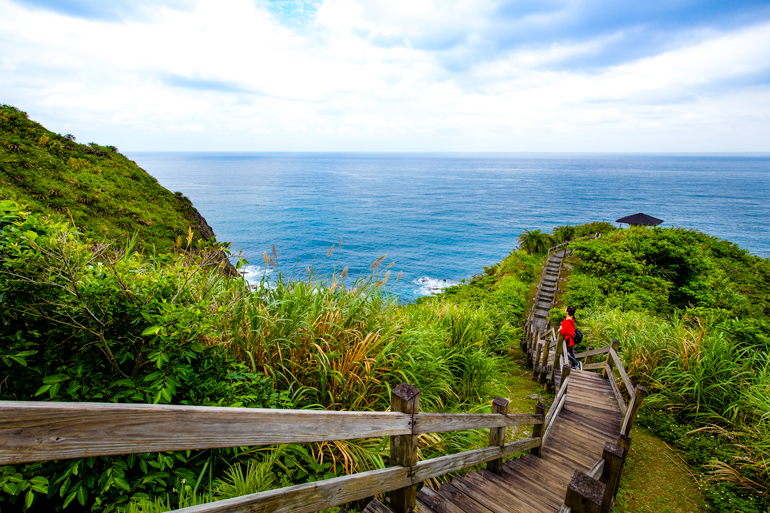
Hualien Fengbin Sky Trail
The new Hualien Fengbin Sky Trail is a double-thrill attraction. The “sky trail” is a 150m cliff-clinging skywalk that hangs you right out over the ocean, breakers and shore fishermen at your feet. A 20m section is transparent. The trail follows a narrow old path hacked from the cliff face, which connected local villages during the Japanese period. The second thrill is that your access walk is along a retired cliff-edge section of Highway 11. Your skywalk return is through an old highway tunnel, today filled with gift and snack stands.

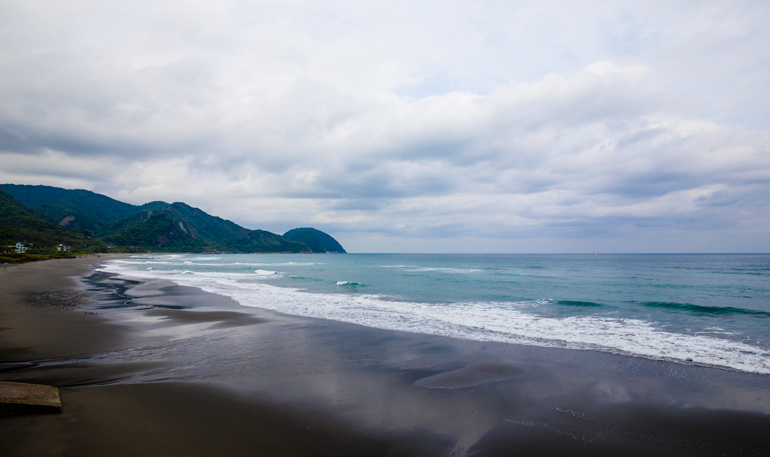
Jiqi Beach
Jiqi Beach offers 3km of soft sandy shoreline in a shallow bay surrounded by mountain on three sides. This is the first good swimming beach south of Hualien City. On the south end is a resort with water- and beach-fun equipment, a snack shop, a retail/gift shop, and a camping area with covered wooden platforms.
Dashibi Hill Trail
The hill on the south side of Jiqi Beach is easily ascended. It juts out into the sea, and the highway curves around it inland. The wood-stair pathway to the top, the Dashibi Hill Trail, starts at a highway-side parking lot and takes about 15 easy minutes to conquer. Your reward is splendid views of the rugged coastline north and south, local fishing craft out at sea, and the highway-side indigenous village inland.
There is regular train service to Hualien City from points around Taiwan’s perimeter on the round-island railway loop. The fastest trains from Taipei take under 2.5 hours. On this trip we rented a mid-sized vehicle from one of the licensed enterprises outside of the Hualien Railway Station (there are also scooter-rental outlets). If you have any questions, staff at the tourism information center outside the station can help. A mid-sized vehicle costs around NT$1,500 per day. For non-self-drive options, check out the ultra-convenient Taiwan Tourist Shuttle and Taiwan Tour Bus services (www.taiwantrip.com.tw / www.taiwantourbus.com.tw).
For much more detail on the three major areas covered here, visit the following websites: Taroko National Park (www.taroko.gov.tw), East Rift Valley National Scenic Area (www.erv-nsa.gov.tw), and East Coast National Scenic Area (www.eastcoast-nsa.gov.tw).
Along the Amazing Pacific Coast of HUALIEN
taiwaneverything.cc/2016/05/15/hualien-coast/
TAROKO GORGE: A Truly Scenic Wonder
Further reading on other sites:
Sengkang Babies: 4D3N Taiwan East Coast cycling itinerary
DOWN TO EXPLORE: SUP Along the Qingshui Cliffs of Hualien
About the author

Rick Charette
A Canadian, Rick has been resident in Taiwan almost continually since 1988. His book, article, and other writings, on Asian and North American destinations and subjects—encompassing travel, culture, history, business/economics—have been published widely overseas and in Taiwan. He has worked with National Geographic, Michelin, APA Insight Guides, and other Western groups internationally, and with many local publishers and central/city/county government bodies in Taiwan. Rick also handles a wide range of editorial and translation (from Mandarin Chinese) projects.